2018 Appalachian Trail Thru-hike

15
Oct
2018

Harper’s Ferry to Swift Run Gap

Day 91: 8.6 miles 
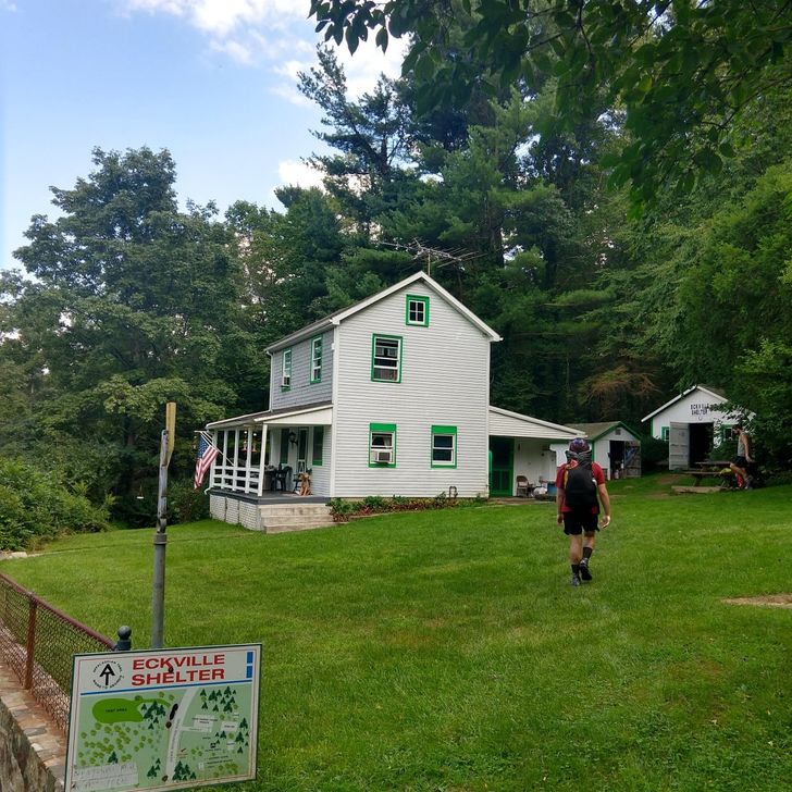
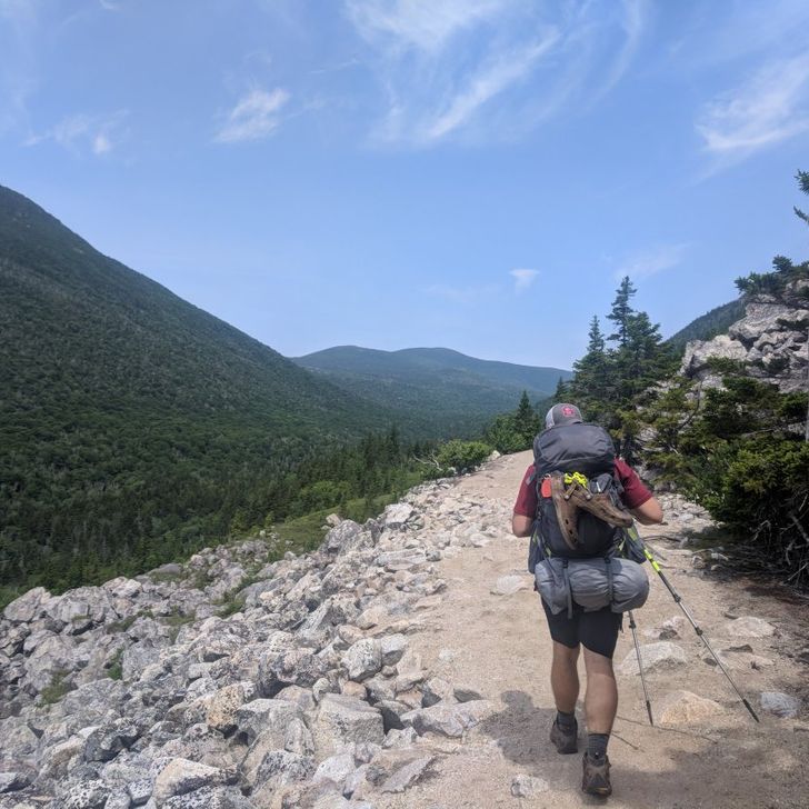
ATC HQ to David Lesser Memorial Shelter 
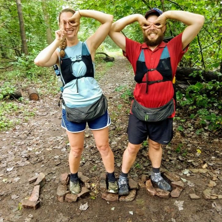
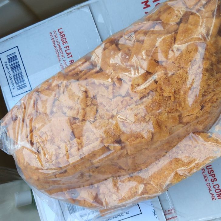
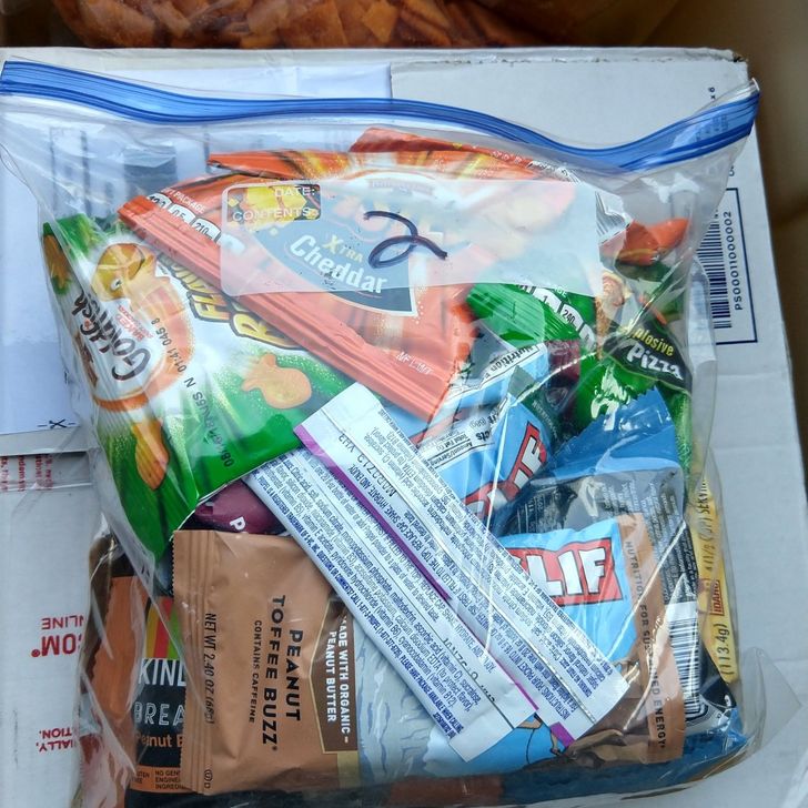
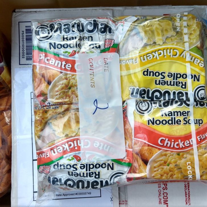
Our night in the hotel was luxurious and we slept in just a bit longer than usual. Pappy and Pat had helped us restock our food supplies (Trail mix, MnMs, Cheese crackers!), so we only needed a quick Walmart stop to get the rest. We headed from Walmart to the Country Cafe where we had plans to rendezvous with the entire trail family. The cafe had delicious breakfast choices, including homemade doughnuts. Toots, Paw Paw, and Crazy Mountain Mama joined us first, and we caught up with them over coffee and bacon. (And home fries. And sausage. And eggs. And toast. And, of course, doughnuts). 
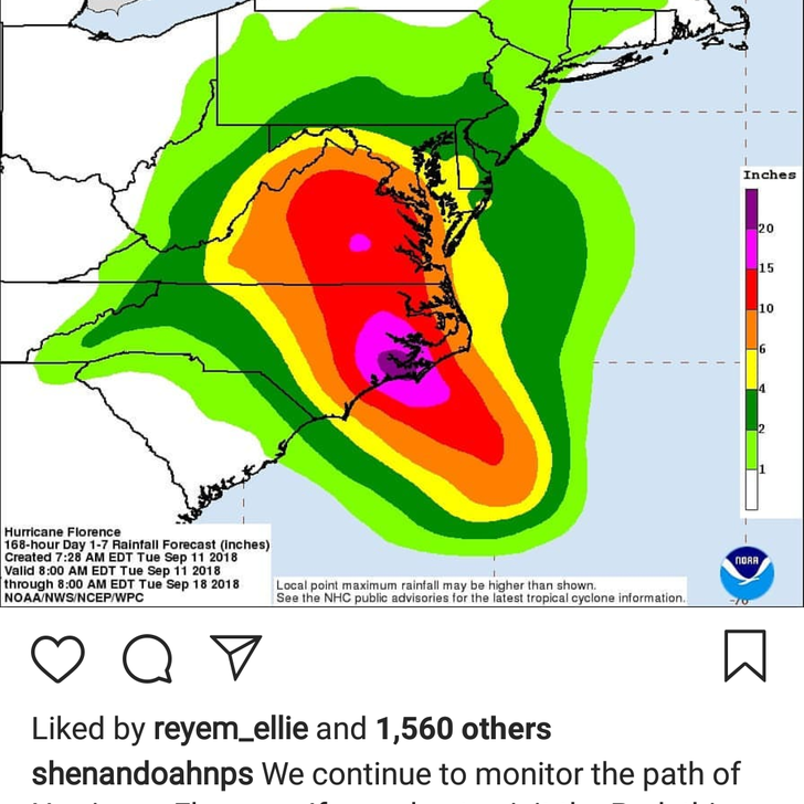
Soon MnM, Redline, Still Kelly, and Mr. D arrived. It had been awhile since we had seen them and there were plenty of tales to tell. Unfortunately, there was also an impending storm of doom pressing on our agenda. Hurricane Florence was on course to devastate NC and VA, which could not only result in rainy hiking, but potential flooding and blow-downs. None of us knew what to do. We spent awhile at the cafe, and then Mr.D and co decided to hit the trail. The rest of us headed back to the ATC, hoping for more information on the storm and access to a computer in their hiker lounge for blogging. We spent a little more time together, and then Pappy and Pat headed back to Pittsburgh. It was so much fun getting to share this exciting time with family. While we sat in the ATC hiker lounge and typed weeks worth of blog posts, quite a few visitors came through to chat. Some were former hikers, some current hikers, some just stopping in for a visit. Most asked us what our plans were for the hurricane, and at that point we still had no idea. And then Shenandoah National Park announced it would close on Thursday. Whelp. Guess we’d be zeroing in Front Royal! If we could get there–all State parks would also be closing and Sky Meadows State Park would be on the way. Fortunately, the folks at the ATC were extremely helpful and friendly. We got confirmation that the AT corridor would remain open, and Levi exchanged numbers with an employee there so that they could keep one another in the loop about closings and trail conditions. Based on current weather information, we booked a hotel from Thursday-Tuesday in Front Royal. It was frustrating to take that much time off, but the park would close Thursday and the storm was due to hit Saturday. They were expecting 8-12 inches of rain across Central VA, and that was in addition to the rain which had already saturated the ground. 
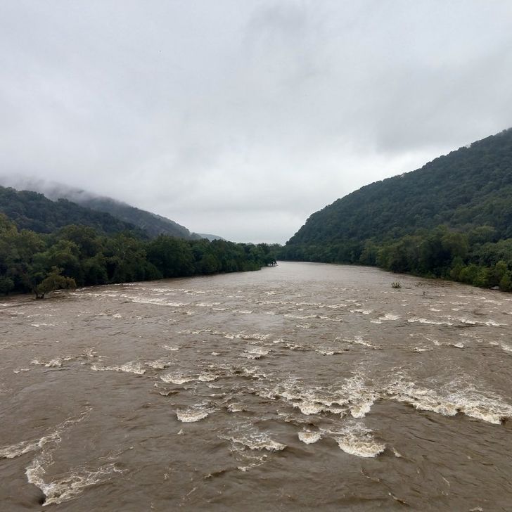
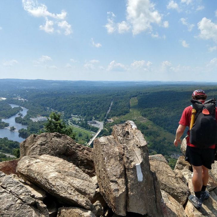
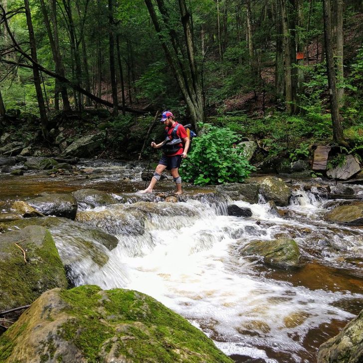
Around 2:30, we finally headed to the trail. We crossed over the Shenandoah River and hiked up to a ridge. It was rocky, but there weren’t many trees blocking our path. Rain misted, but we got to the shelter relatively dry. The shelter was very nice and looked new. It had a deck and painted floors, plus a bear-hang pole for our food bags. We made dinner and settled in for the night. Day 92: 21.1 miles David Lesser Memorial Shelter to Rod Hollow Shelter 
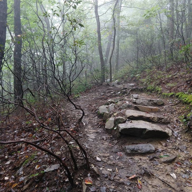
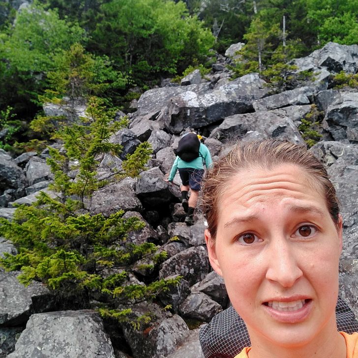
We awoke to more mist and cool weather, but still no rain. Given our current weather predicament (imminent hurricane conditions), this cool misting was a pretty good scenario for the Roller Coaster. The Roller Coaster is a 12.5-mile section of trail which “consists of over 3500 vertical feet of steep up and down hills, mostly 300-400 foot climbs and descents“(Alltrails.com). Basically, every hiker’s pet peeve. 
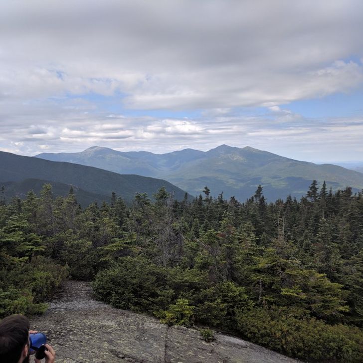
There might’ve been a few good views on a clear day to mitigate the annoying terrain, but we weren’t so lucky. On the plus side, there were ample water sources in every valley! We made it to camp as it was beginning to get dark. Redline and MnM were sitting at the picnic table with two other hikers who were NOT Mr.D and Still Kelly. Uh oh. Turns out, Mr.D had recovered from a 103* temperature, but still felt sick and needed to seek medical treatment. (Spoiler: He was fine, but learned an important lesson about always treating water before drinking). We chose to sleep in our tents (the shelter smelled like urine), but the sounds of tree branches falling in the woods around us resulted in fitful sleep for everyone. Day 93: 15.4 miles Rod Hollow Shelter to VA Rt. 55 By the morning, the path of the hurricane had changed quite a bit. Shenandoah was still closed, but VA would not receive nearly as much rain as anticipated. 
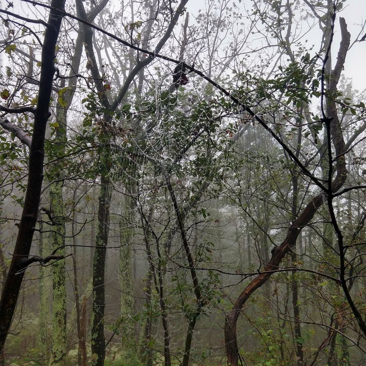
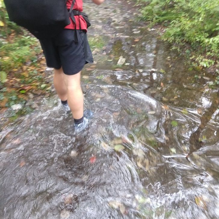
Although we had a hotel on our horizon, it was a looooong day of hiking. Without day hikers to do so, Redline and Levi struggled to clear spiderwebs along the trail as we hiked by. You’d think rain would deter the spiders, but that’s wishful thinking. The rain DID make the webs more visible though. We met one section hiker (who had thru hiked in 2016) when we stopped to fill water, but she hadn’t come far. She did inform us of Pinworms in the water source. If you need something else to worry about on our behalf, feel free to Google “Pinworms”. Good thing we always filter! We made it to VA Rt. 55 just after a decent bit of rain. Not wet enough to validate wearing raingear, but wet enough that our soggy bodies couldn’t get a hitch into town. So we called an Uber. The four of us had to cram into the back of the driver’s Kia Soul and sit with our packs on our laps. But we made it to the hotel! While Levi showered, Kristen headed to the gas station for shampoo and beer and Redline picked up Arby’s for everyone (except MnM, she was holding out for pizza). We got clean, set our shoes outside to dry, and gorged ourselves on curly fries, roast beef sandwiches, gyros, mozzarella sticks, and jamocha shakes. We sat in out beds until it was dinner time, then ordered Pizza Hut. A dog barked incessantly next door, but wasn’t much louder than Still Kelly’s snores, so we slept just fine. Day 94: Zero in Front Royal, VA The Motel 6 didn’t have breakfast, but it did have hot coffee and comfortable couches from which we could watch media coverage of the hurricane. At this point, the storm was downgraded to a category 2 and wouldn’t be truly hitting us for a few days. Or perhaps not at all. Or it could rain gummy bears. The newscasters couldn’t convince us of much, but Shenandoah was still closed so we weren’t going anywhere. We started some laundry and then left MnM in charge of it while Redline, Levi and Kristen went to Popeyes for lunch. The rest of our trail family happened to hit Rt. 55 and catch a ride around the same time and joined us there. A new guy, Porcupole (his hiking pole handles once made a midnight snack for some porcupines) was with them. We spent a pretty relaxed day in Front Royal watching movies, doing laundry, making a Wal-Mart run, and Lysol-ing sleeping quilts. Day 95: Zero in Front Royal, VA We began our day together again in the lobby sipping coffee and watching more hurricane coverage. The park would be opening today, but we wanted to continue monitoring the weather and catch some college football. Everyone did their own thing, but most of us ended up at a coffee shop downtown for lunch. We had delicious sandwiches and some of the best peppermint hot chocolate known to mankind. Seriously. 
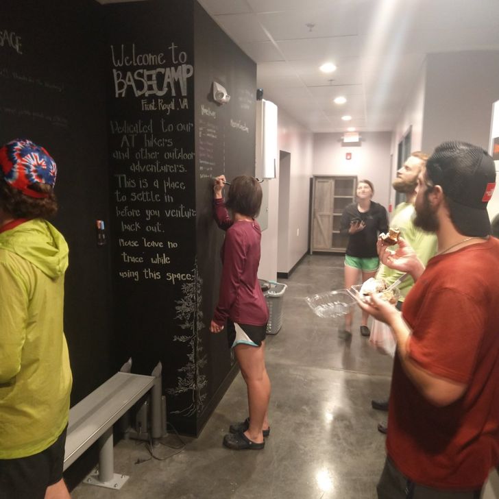
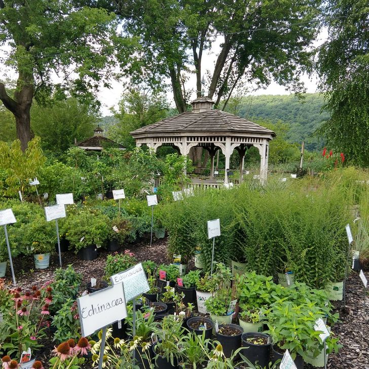
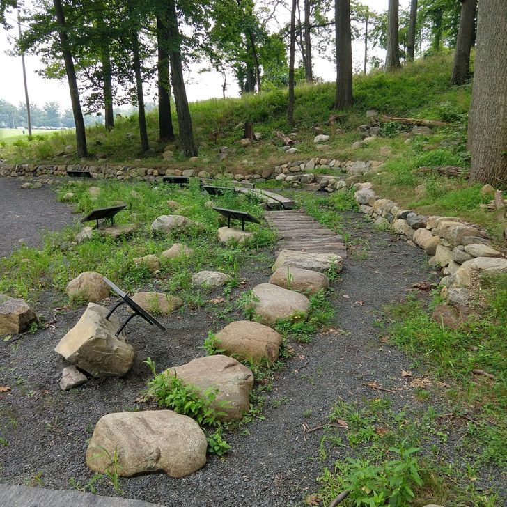
After killing some time editing photos, working on the blog, checking facebook, etc. we decided to explore town a bit. It was there that we hit thru-hiker GOLD. Our first stop was an outfitter with lots of great gear, clothing, and resupply food (basically a tiny REI). We then went next door to an adorable bakery where Levi and Redline bought cinnamon rolls the size of their faces. As we headed to the brewery, a chalk-wall reading “Basecamp” caught our eyes. We opened the door next to the wall and found a space specially designed for thru hikers. Basecamp is an alcove between the outfitter, bakery, and brewery with storage lockers, a washer/dryer unit, shower, and boot dryer. It was so clean, inviting, and thoughtful! We signed our names on the walls with the provided chalk markers and wrote in the log book. Thank you Front Royal!!! Levi and Kristen headed to the brewery and watched football while enjoying some local brews, fabulous charcuterie board, and beer-cheese pretzel. We were joined for dinner by the rest of the tramily and then cabbed back to the hotel. While in the cab (which cost all of $3 to bring us across town) we asked the driver about the possibility of getting picked up from inside Shenandoah park the next day. She said cab drivers could enter the park without paying the park fee. Hmm..We couldn’t get out of our hotel booking, so we decided to hike out the next day but get a lift back to the hotel for the night. Day 96: 21.6 miles Front Royal to Gravel Springs Hut The morning started off well enough. We (including Toots and Paw Paw) left most of our food and clothes at the hotel since we would be returning for the evening. It was good to be hiking all together again, the weather was ominous but currently fine, and we had a few big uphills but nothing too crazy. We hadn’t booked our taxi ride back to the hotel, but figured we could do that from the trail. Levi called to make a reservation and ask for a ballpark cost. The guy said he would need to get back to us, but we thought it couldn’t be too bad since a ride across town was $3. Turns out we were wrong. We got a call back about 2 miles past a road crossing that the cab fee to pick us up from Shenandoah and bring us back to the hotel would be $140. For one way. Crap. The four of us ended up walking to the next road, cabbing from there to the hotel, packing up our stuff, and then picking up Popeyes since we’d be getting to the shelter late and probably wouldn’t want to make dinner in the dark. All together it took about 2 hours, but we made it back to the trail with enough daylight to catch up to the group. The remaining trail for the day was a never-ending course of switchbacks up to the Shenandoah backcountry park entrance. We filled out our form (names, contact info, plans for camping during our stay) and entered the park. It got steadily darker and the light drizzle began to come down as real raindrops. By the time we reached the shelter we were using flashlights and ponchos. The 10-man shelter already contained the 5 members of our trail family, plus 3 other flip-floppers (thru hikers who start in the middle of the trail) named Bean, Meltdown, and Hard Hat. If you did that math in your head, you’ve realized the problem. We managed to squeeze 3 more people into the shelter, and Kristen volunteered to sleep at the foot of the shelter which was still under the roof. Levi slept in a corner of the shelter that smelled like animal urine. We had each chosen our personal lesser of the two evils. 
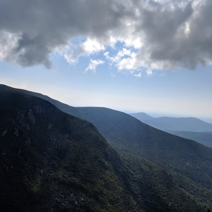
Hurricane Flo’s remnants progressively escalated overnight. The rain beat down on the roof. Strong wind blew humid air all around. Tree limbs fell off in the distance. It was a fitful night of sleep for all of us. Day 97: 5.7 miles – Gravel Springs Hut to Elkwallow Wayside 
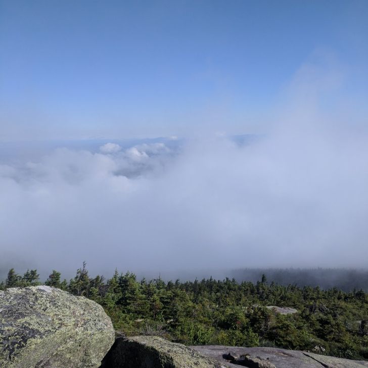
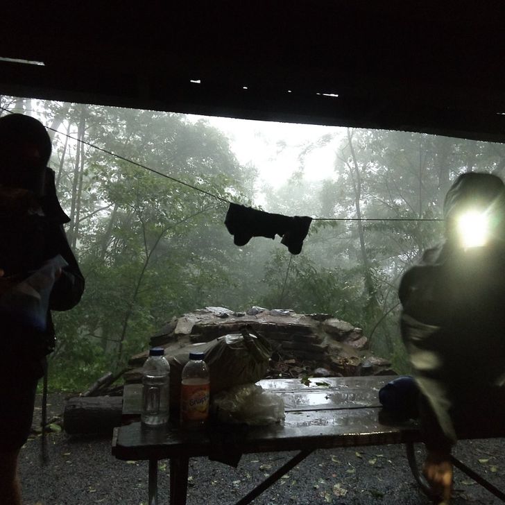
That morning we all awoke to steady rain and wind. We hiked through thick fog, trying to keep eyes on both the slick rocky trail below and precariously swaying branches above. It was exhausting physical and mentally. Around 11am we arrived at the Elkwallow Wayside, a spot to stop with a bathroom, gift shop, and concession. The smell of something warm and delicious wafted towards us from the side of the building, but there wasn’t a person or car in sight. As we came around to the entrance, we learned why. A small typed sign taped to the door read, “Closed due to hurricane.” Much to our dismay, even the bathrooms were locked. Having no cell service whatsoever, we (Kristen, Levi, Toots and Pawpaw) decided to wait a bit under a pavilion and generate a plan. Soon, a ranger pulled up and notified us that the park had closed once again. The backcountry (trails, shelters, etc) would remain open, but the frontcountry (roads, waysides, visitors centers) would close. All personnel would be leaving the park. Basically we were permitted to stay and hike, but if anything happened we would be SOL. Though frustrated, we decided to err on the side of caution (you’re welcome, moms). And we took the ranger up on his offer for a ride to Thornton Gap where we could get a ride into Luray, VA. At the Thornton Gap park entrance, we met a hostel owner who was returning two hikers to the trail. She was willing to give us a ride to town and recommended a hotel (understanding that sharing a room would be cheaper than staying at the hostel). We booked a room at the Quality Inn and went to Gennaro’s Restaurant to warm up and eat up before our check in time. Mr. D, Still Kelly, and MnM were all staying at a different hotel close by. They were at the wayside about 20 minutes before us, just as it was closing. Porcupole and Red Line were farther ahead, and ended up hiking all the way to Thornton’s Gap. They came to the restaurant soaking wet and thought it would be a good idea to split 50 hot wings (spoiler alert: it was not a good idea, but all wings were finished before we got back on trail). Our day in Luray was pretty chill. The weather in town was beautiful, but we could see dark clouds hovering over the mountains. We showered, walked across town to do laundry, watched the Office, and enjoyed more Gennaro’s for dinner. Day 98: 11.8 miles – Elkwallow Wayside to Byrd’s Nest #3 After many calls and text messages, we finally got in contact with a trail angel who shuttled us back to Thornton’s Gap. Here we took different routes. Porcupole and Redline had already hiked the ten miles between Elkwallow and Thornton’s Gap, but everyone else had gotten a ride from the park at Elkwallow. Everyone but Levi and Kristen pressed on south; others had intentions of coming back to hike that section later. We hiked north to Elkwallow since we had only 50 miles to go until meeting up with the Mortons. Once back at Elkwallow we chose to take the road back to Thornton’s Gap. We figured it would be gentler on our feet and there was a chance of getting a hitch. The first few cars passed by and waved, but finally an SUV pulled over. Out stepped a ranger. He ran our IDs (apparently that’s required for riding in a police vehicle), and we were allowed in the backseat. On to Thornton’s Gap! The rest of the day was smooth sailing. We found the Byrd’s Nest shelter empty though slightly damp. We checked the weather, set out our groundcloth inside the shelter, and tucked in for the night. Day 99: 14.4 miles – Byrd’s Nest #3 to Big Meadows This was one of the most relaxed days we had on the trail. Our morning was crisp and cool, but not raining. Early on we met a very sweet German couple who we talked with for half an hour. They wished us the best and we sauntered on. When we hit the Lodge we decided to stop for some food and phone charging. The restaurant wasn’t open yet, but there was a concession so we each ordered a sandwich and large coffee. The coffee came with free refills, which resulted in a much longer stay than originally planned. However, we were able to fully charge our phones, battery pack, and water purifier, plus talk with two other nice couples who sat for a spell. The afternoon was also pretty easy terrain-wise and the weather continued to hold out. We were thankful for dry shoes that stayed dry an entire day. Sometimes it’s the small things, like feet without a pruny texture or mildew smell, which make us happiest. 
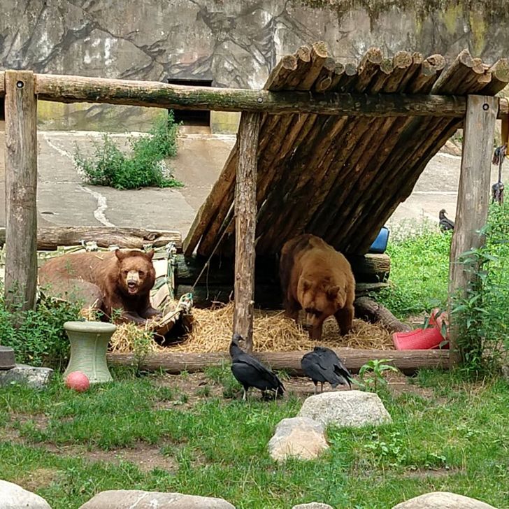
The first thing we saw at Big Meadows campground was a bear. Technically, we first saw the large crowd of people starting up at something, and THEN we saw the bear at the top of a tree. Either way, we had our first bear-not-at-the-zoo sighting. It was pretty impressive that the branches that high didn’t break under his weight. Although there was a fee to stay at that campground we chose to fork it out and set up camp nearby. Not having to hang a bear line (there were fortified bear boxes at every tentsite) and having easy access to the bathrooms were worth it. We set up our tent and walked to the nearby Lodge for dinner. There we had dinner, drank beer, and enjoyed a blackberry ice cream meringue pie. After a filling meal, we headed back to the tent for a full night’s rest. We’d be meeting up with the Mortons the next day! Whether it was the anticipation of a family reunion, the half gallon of coffee we’d consumed earlier in the day, or the sugar-laden pie scarfed down for dessert, something kept us awake late into the night. I think we finally drifted off around 2am. Day 100: 16.9 miles – Big Meadows to Swift Run Gap Entrance We woke up this morning desperately wanting to sleep in, but knowing we were on a schedule. We made fast work of our 17 miles and arrived at our rendezvous point about 15 minutes before Levi’s parents, Ellen and Dale. After lots of joyful hugging, we hopped in the backseat and took off. The Mortons handed us a giant bag of Garrett’s popcorn (a mix of carmel and cheddar cheese) which we messily scarfed down. We headed to the airport to pick up Jeremy, Levi’s brother. We made a quick stop at Chick-fil-A, just beating the dinner rush. We arrived at the airport and Jeremy joined us, then we headed to Front Royal for our Air BnB. We had an interesting encounter with the owners, but found the property to put liking. We showered off, had a nightcap, and enjoyed a much easier time falling asleep. Day 101: Zero in Front Royal Despite being hundreds of miles from Bull Valley, IL this morning felt like a typical Morton family morning at home. Dale grabbed some coffee from a local coffee shop (fortunately sans the Cincinnati Bengals mug always reserved for Kristen) while Ellen made sure we ate fruit, bagels, and mandel bread, and Jeremy sat working on the crossword. Levi opened his birthday gifts and we called some family members while all together. Since it was a beautiful day, we went for a walk in the center of town. Naturally, our walk led us straight back to the outdoors store, bakery, hiker center, and brewery. While in the presence of a large washer/dryer unit we decided to wash our down jackets and Levi’s sleeping bag. As the laundry cycled, we went nextdoor for some lunch at the brewery. Everything was as delectable as we remembered, plus we got dessert this time! Following lunch, we hit up a few antique stores on the walk back to the Air BnB. Kristen and Levi went back to the hiker center to wait on laundry, while the remaining Mortons headed back for a ‘toes up.’ 
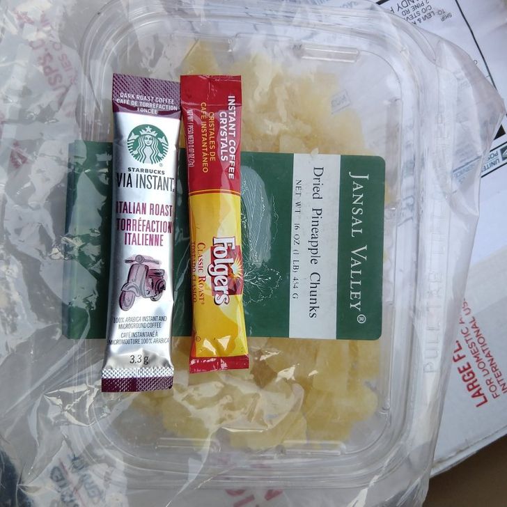
It took awhile for the quilt to dry, but in the meantime Kristen walked to the post office to grab the resupply box. Some other hikers showed up at Basecamp and we enjoyed catching up with them over hurricane survival stories. Once we were done, we went back to the house to get ready for dinner. Still rather early in the evening, it was decided that the birthday boy needed a trip to the Virginia Beer Museum. The museum is an old house which has been remodeled with exhibits and a bar for touring purposes. A gentleman on the front porch welcomed us to the museum, and his demeanor quickly answered the question we’d all been wondering: “Is there beer actually served here?” Why yes, yes of course. Another gentleman came through and ushered us inside to the bar, where we ordered from a large array of the numbered options. This gentleman gave us the tour, which he claimed was much improved by the #9 beer in his hand. The tour did get better as that #9 kicked in. It was actually quite interesting to learn about our founding fathers’ associations with beer, about the role of pubs in colonial America, about prohibition and the blah years of boring beer which followed, and finally about the recent Renaissance of craft beer making. After a second round in the bar, we danced over to a nearby restaurant for dinner. It had been recommended to us by a number of folks in town, and did not disappoint. We’d talk more about it, but the meal was a blur of incredible food and good company. The specials were especially scrumptious and we left feeling warm and maybe a bit tipsy. We headed back to the house and played a round of games before sleeping one more time under one roof.

Day photo preview 1
Day photo preview 2
Day photo preview 3
Day photo preview 4
Day photo preview 5
Day photo preview 6
+4
10
Sep
2018

Delaware Water Gap to Harper’s Ferry

Day 76: 6.4 miles Delaware Water Gap to Kirkland Shelter At last, it was time to return to the trail. Our resupply box and tent pole had FINALLY arrived at the post office and two of our tramily members were due to arrive around lunch time. We got our post office business taken care of and then walked down to the pizzeria to wait on our friends, the Hope Hikers (Toots and Paw Paw). When they arrived (YAY!!!) they had another hiker with them. Rabbit is a hiker from South Korea, and will soon be the third hiker from his country to “Triple Crown,” or hike the AT, PCT, and CDT. We all spent some time catching up on recent adventures. We hadn’t seen the Hope Hikers since Levi took on the boulder with his forehead. A whole pizza, giant sandwich, and gyro later, we were back on the trail. We’ll, all except Rabbit. He was taking a zero day and would catch up later. It was a scorcher and Levi and Kristen hadn’t used their trail legs in three days. We had a very rocky climb out for the valley and stopped frequently for water. We had hoped to go a bit farther, but the Kirkland shelter was nice and had a water pump easily accessible so we chose to spend the night. Day 77: 19.7 miles Kirkland Shelter to Tentsite We successfully hit the trail before 8 am. Rocksylvania is real, folks. We started out going over a section called Wolf Rocks, but the rocks didn’t end there. They just didn’t have cool names. Snake rocks might’ve been appropriate for the remainder of the day. Or maybe drought rocks. We had been lucky during most of the proceeding trail with water access, but now with the heat wave we had to carry water since streams and springs had dried up. We took a break around two. While everyone was off getting water, Levi watched a real live animal planet episode back at the shelter. A rat snake flushed a toad out of a bush, but mid-pursuit the toad just froze and the snake lost track due to poor vision. Nature is pretty cool, eh? We hiked along a ridgeline for the rest of the day. The tentsite had good water access and Rabbit caught us by dinnertime. Day 78: 17.5 miles Tentsite to Bake Oven Knob Shelter We hiked on ridgeline to the infamous Lehigh Gap–a precipitous and rocky descent into Palmerton, Pa. The rocks were hot to the touch after baking all morning, and we kept a sharp eye out for snakes (which we later learned was unnecessary, phew!). We stopped for lunch at a local pub, while chores were run at the nearby post office and gas station. We enjoyed Yuengling and perogies, and were happy to get back on trail. Our hike was pretty uneventful for the rest of the day. Around 5, we were a few miles out from a shelter and Kristen suddenly needed access to a privy. There’s a 2 mi/hr pace, a 3 mi/hr pace, and a Kristen-really-needs-the-privy pace. She set off with dust at her heels towards the shelter. An overwhelming majority of shelters have privys nearby, and we assumed our destination shelter would as well. She arrived to the shelter, found the side trail, and sprinted down it. About 100 yards down, the grass was overgrown, massive spiderwebs cris-crossed the trail, and it became apparent that no one had come this way in a while. The side trail was for springs, NOT a privy. She hiked back up the hill to the shelter where the rest of the group was arriving, muttered a few profanities, and set off to a secluded spot to dig a cathole. (Which is not very easy to do in Rocksylvania) We filled up at the spring, then ended up finding a tent site nearby and settled in for the night. Day 79: 26.5 miles Bake Oven Knob Shelter to Windsor Furnace shelter We made fast work of the miles in the morning, trying to maximize our time hiking before the heat could really set in. In honor of Paw Paw’s birthday, we threw out the crazy idea of hiking 31 miles for his 31st birthday. At our morning pace, it would be possible. After lunch, we made a stop at Eckville shelter. This shelter is slightly off-trail and maintained by a caretaker. It had a shower and a flushing toilet. We ran into Good Time Gumby, who we had seen back at the beach. It was valiant effort, but we only made it 26.1 miles to a shelter. However, it was a monumental day for a few other reasons: it was our first night hike and Toots and Paw Paw saw their first rattlesnake. The shelter was very nice, and we enjoyed some Mountain House Meal Apple Crisp for Paw Paw’s birthday. Day 80: 20 miles Windsor Furnace shelter to Rock N Sole Hostel After our epic day prior, we slept in a bit and got a slow start. There were plenty of rocks to make our day interesting, and late morning rain made the going slow. Luckily, we were able to make it to our road rendezvous point by 5, and were picked up by the owners of the Rock ‘n Sole Hostel. The Rock ‘n Sole Hostel is a cute and cozy out-building and comes complete with an outdoor shower, privy, and many warm comforts of home. Dinner on the front porch consisted of burgers, potatoes, mixed veggies and an ice cream and warm cookie dessert. Levi went out for a resupply at a very well-stocked Dollar General while Kristen drank tea and chilled. Day 81: 13.4 miles Rock N Sole Hostel to William Penn Shelter Breakfast consisted of coffee, fruit, OJ, egg casserole, coffee cake, and warm bagels. After taking in as many calories as was offered to us, we packed up and got back on the trail. The day was pretty easy, but the trail was flooded and still rocky. We stopped at the 501 shelter for lunch and to watch videos we had been talking up during the morning. While there, the caretaker of the shelter stopped by and said hi. He was very kind and handed out Gatorade to each of us. After that, we hiked 4 more miles to the 1000 mile marker. We had queued up a playlist and timed everything to culminate at the 1000 mile mark, but it turns out the marker was placed 0.2 miles later at the shelter. Oh well. The shelter we stayed at was a cool, two-story shelter with room for 8. We chowed down on dinner while watching more videos and passed out at sundown. Day 82: 18 miles William Penn Shelter to Yellow Spring tentsite. The beginning of the day was eventful as Kristen fell down stairs of shelter. After we determined that she was okay, we moved on to walking flooded trails and wet rocks. Hiking was extremely dreary and chilly, so we stopped under an overpass for a break. We walked a bit farther and crossed 1890s bridge where we ran into Allen and Nancy setting up for a Trail Magic lunch. If we hadn’t taken that break at the overpass, we would have missed them. As we sat, Allen and Nancy brought us homemade ham sandwiches, potato salad, watermelon, chips, and local chocolate milk/Gatorade. As we started to hike on, we ran into lots of overgrown trail. We did frequent tick checks. We then walked through a section of trail flooded by a burst beaver dam. The water was disgusting, but was so widespread that we had no choice but to walk straight through the gunky water. We then stopped at a shelter with a spring in order to wash out our footwear, and take a privy and snack break. Kristen had what appeared to be blisters on the tops of her toes. Luckily this went away by the next morning. We ended the day by hiking four miles to a buggy tentsite. Day 83: 20.1 miles Yellow Spring Tentsite to Clarks Ferry Shelter Levi got to start the day off right chowing down on his breakfast a few feet from a spook-free deer. The day was full of wildlife as we saw two rat snakes, one of which was on trail. The weather got humid early, and Kristen was struggling and kicking rocks. We took a break at Mt. Peter’s shelter to get water and found out that water was a loooong way down. 300 steps down. We had nice views of the Susquehanna river from both sides of the ridge we were walking. We pulled up to Clarks Ferry Shelter and proceeded to make a large fire to keep bugs away. It worked on things that fly, but not so much on things that crawl – Paw Paw and Toots found a few fishing spiders on their side of the lean-to and decided to set their tent up on the inside. Day 84: 15.6 miles Clarks Ferry Shelter to Darlington Shelter We got up and hiked four miles to town. We crossed a bridge into Duncannon (the rails were home to a million spiders) and were a little worried by the strip club and gun smith right as we entered town. As we made our way further into town, things got nicer. We stopped by the post office and took advantage of the great hiker box by filling our snack bags with granola bars. We stopped at a breakfast place called Goodies for an early lunch, and then the historic Doyle for beer. Kristen resupplied at a gas station and met a local named Steve who offered to take us to his pool/ a real grocery store. She politely declined. We stopped early at a shelter for much needed privy use (disruptive town food) and water fill. We then hiked some uneventful miles down to a stream, then across fields. We went up and over a hill, and the rocks began getting slightly better. We marched up a long hill to the shelter, just as the sun was beginning to set. There, we met a section hiker and his adorable black lab, Liberty. As it got dark we made dinner and then headed to our tent. As we were laying down, we got text from Toots about a snake in the privy. (To clarify, the snake was not emerging from the toilet itself, but lurking down from a rafter.) Just what you want to think about as you’re laying down to go to sleep. Day 85: 19.5 miles Darlington Shelter to stealth site near Whiskey Spring Road. Today’s terrain was the easiest we have seen so far. We hiked 3mi/hr downhill and then across fields, roads, and along streams. We stopped at the Hiker place for water and to use the portapotty. Kristen got to spend a few minutes exploring a cool old graveyard with graves dating back to the early 1800s. We continued on into the town of Boiling Springs. For lunch, we went to a local pizzeria and ate most of 2 large pizzas. To digest, we stopped at bench by shallow pond and sat in the shade for a spell. Finally, we got up the inertia to hike 4 miles uphill to the shelter. In order to save ourselves a few miles the following day, we decided to press on to a tent site. We ate leftover pizza for dinner and hit the hay. Day 86: 23.9 miles Stealth site to Birch Run Shelter We hiked a pretty easy (though hot and humid)14 miles into Pine Grove Furnace State Park. The trail wasn’t too challenging, but we did run into a couple slithery fauna. Toots and Paw Paw saw a rattle snake just off trail in the leaves and Kristen walked over what she thought was a root, but was actually a rat snake. As we entered the state park, we saw a lakeside beach and filled up on water at the rest area. Next, we went to the general store–the home of the half gallon ice cream challenge. The store was supposed to close after labor day, but was in fact open with limited hours. After much consideration of flavor choice, Levi and Kristen both did the half gallon challenge. (Levi ate 1.5 quarts of vanilla/chocolate and .5 of Moose Tracks; Kristen had 1.5 quarts of black cherry and .5 of chocolate). At the general store, we met Snicker Bear, another hiker who did the challenge and would be completing her thru-hike in Harper’s Ferry. She was nursing an infected shoulder wound, a broken toe, and a full belly of ice cream–but there’s not much that can stop a hiker when they’re so close to the finish line. This day was a SCORCHER. The heat index was around 105 and we had passed more than one person who told us it was too hot to be hiking. After eating our ice cream, Levi hung out at the general store while Kristen, Toots, and Paw Paw went to the AT museum. There was lots of cool information and artifacts about trail construction, some of the earliest hikers, and trail components. Finally, we got back on the trail. Clouds lurked in distance, but the wind was welcome. There were some sprinkles, but we never needed rain gear. It was the perfect amount of rain. We hit the old halfway point, then Dead Woman Hollow Rd (halfway according to AWOL guide), and then official halfway marker. Paw Paw’s parents met us on trail and hiked with us to a parking lot. They all left for a hotel, while we went on to Birch Run Shelter. Day 87: 14.7 miles Birch Run Shelter to Rocky Mtn. Rd This was a quick and rainy day, with some surprise rocks at the tail end. Luckily we were able to get picked up by Kristen’s high school friend, Leah Stefanski Hanson (she just got married). At her house, we got our first shower in a week and quickly began a load of laundry. We had also sent four boxes to her house, and had fun opening the resupply box, box of snacks from Aunt Dana, Kristen’s new shoes, and a new water purifier. Her cat, Pickles, really loved all of the new boxes! Leah’s husband came home a few hours later with two large pizzas and we chowed down happily. A few episodes of Parks and Rec later, we were ready for bed. Day 88: 22.9 miles Rocky Mtn. Rd to Ensign Cowall Shelter We ate an awesome breakfast of leftover Panera pastries (from the wedding) and fruit. We reluctantly got packed up and and got back on the trail around 9:30. By about 10:30, Kristen’s shoes weren’t looking so new anymore. It was rainy and muddy for most of the day. In the afternoon, we crossed the Mason-Dixon line and began the Maryland section of the trail. We met up with Toots and Paw Paw (and Paw Paw’s mom, Crazy Mountain Mama) for a bit, as they cruised through while Slack Packing. An hour or so later, we had to crossed crazily flowing stream. There weren’t supposed to be any serious water crossings in MD, but the rocks to hike across were completely submerged due to the amount of rain. We made it to shelter just before dark. To our surprise, the shelter was crowded with two groups of section hikers. We slept next to a guy named Stewart who had warned us he “snored” and usually slept in his tent. Thank goodness for ear plugs is all we’ll say on that matter. Day 89: 28.1 miles Ensign Cowall Shelter to Canal Towpath (Hostelling International-Harper’s Ferry) Anyone who knows Kristen well knows she does not like to get up and out of bed in the morning. This morning was particularly difficult, and Levi almost had to break his wedding vows and deflate Kristen’s sleeping pad. Around 7 am we had put on wet socks and shoes, packed damp packs, and draped ourselves in our ponchos. It was going to be a long day. The rain didn’t stop. At all. We trudged up and down stairs-turned-waterfalls, through ponds, and over never-ending partially cobbled paths. It was exhausting and unrelenting. Our final descent was actually rather dangerous (sorry Moms and Dads) due to the wet rocks and early loss of daylight due to cloud cover. We got out our flashlights and made it down the mountain without incident. After a short flat stretch we road-hiked to a hostel for a hot shower, warm bed, and access to pizza. Day 90: 3.7 miles Canal Towpath to ATC (Appalachian Trail Conservancy) Head Quarters At the hostel we had a nice breakfast and did our laundry. We headed out around 10 am and had a smooth flat walk into town. The Potomac River was running WILD. The river was muddy and extremely high. It came about 6 ft. from the trail! We hit the bridge to cross and were in awe of the large tree parts floating downstream. Our walk through historic Harper’s Ferry was beautiful–hopefully we can come back here some day to appreciate it fully. When we finally made it to the ATC HQ, we spent some time talking to the folks working here about our travels and the impending rain. We learned that the bridge would be closing around 4pm due to the flooding, and we texted Paw Paw and Toots who were behind us. Hurricane Florence is going to be pretty serious business. About half an hour after we arrived, Kristen’s grandparents (Pappy Fries and Pat) walked up the ATC! After such a rough few days of hiking, it was so comforting to be greeted by family. They had been following our journey on their AAA maps and knew quite a lot about milestones on the trail and AT culture. We got our official picture taken for the register, bought some postcards, explored the headquarters, and headed off to lunch. We had delicious fare at Almost Heaven, then drove to the hotel. Pappy and Pat surprised us with a cooler of beer and some beignets from Cracker Barrel. We took a nap, then hung out in the hotel room for awhile showing off our gear. Pat even gave the sleeping pad a try! We had dinner at a diner and went to sleep shortly afterwards.

Day photo preview 1
Day photo preview 2
Day photo preview 3
Day photo preview 4
Day photo preview 5
Day photo preview 6
+14
27
Aug
2018

Great Barrington, MA to Delaware Water Gap, PA

Day 59: 17.6 miles Great Barrington to Riga Shelter Since we were in town we had to hit up the McDonald’s one last time. A kind trail angel in a Casper van gave us a ride to the trailhead and we were off! Shortly after starting, we had to pause and lather up in bug spray. The mosquito onslaught continued the entire day, but the Picaradin seemed to work. The elevation profile on our app had us worried, but the trail over Mt Everett was largely gradual. We stopped for water at a shelter and continued over Mt Race. The Northern section into the ravine skirted the mountain and we hiked with a beautiful view off to one side. Once down in the ravine, we crossed the state line into Connecticut. The trail meandered alongside a brook for almost 2 miles, which combined with a steady stream of weekend hikers made it extremely difficult for Kristen to empty her bladder. Bear Mountain (CT), the highest elevation we will see for weeks, was a challenging but enjoyable climb. There was a fair amount of rock scrambling towards the peak. We loved the flat hike between the peak and Riga shelter, making it to the shelter earlier than anticipated. The view from the shelter was beautiful and we had an unusually good night’s sleep Day 60: 18.7 miles Riga Shelter to Pine Swamp Brook Shelter The day started off with an easy downhill into Salisbury, CT. We went up and over a few small mountains and then down into Falls Village where we had lunch (pastrami Rubens) at Toymaker’s Cafe. Afterwards we climbed up and over Mt. Easter and choose to spend the night at Pine Swamp Shelter. The tramily pressed on to a campsite four miles beyond, but we needed to stop. Choosing between a wet tent to carry and bug-bitten appendages, we opted to tent. The rain began about 30 seconds after we finished eating dinner. Day 61: 17 miles Pine Swamp Shelter to Kent The morning started off well enough. The rain had ceased and despite the humidity it was relatively cool. We hiked up and down on squishy pine-straw trails and eventually descended into a valley with a wide, rushing brook. Because of recent rain the brook was running higher than usual. It looked like it could be a dangerous crossing, especially since it lacked any rope hold or partial foot bridge. Kristen, being slightly more confident on rock crossings, took out a trekking pole, changed into camp shoes, and journeyed across. Easier than expected! Levi followed more carefully and without issue (and without shoes at all). Following a few more up and downs, we descended and came to a flat rocky path alongside a river. Although the trail was flat, our bodies were tired and our feet were especially achy. What should’ve been a brisk 4 miles turned into a crawl and we took a much needed break at the south parking lot. Tight Achilles. Bruised balls of the feet. Feeling tired despite good sleep. Itchy from mosquito bites. Not knowing when we would next stop in town to shower and do laundry. Carrying a wet tent. Running low on snacks. Dreading the next uphill. Knowing the rain was returning at any moment. Sometimes there are rough days on the trail, and this was one of them. We had only zeroed in town two days prior, but if possible, we needed another stop into civilization. At the top of the next climb (which was a doozy–if we thought rock scrambling ended in New Hampshire we were sorely mistaken) we made some calls to locales in Kent, CT and found an opening at The Fife n Drum. With the promise of town, our spirits lifted and we did the final 4 miles of the day easily. 4.8 actually…it was a bit of a road walk from the trail to the Inn. We were rewarded for our efforts though–this stop was the closest we’d come to most people’s idea of a honeymoon. The town of Kent is picturesque with clean, orderly buildings and high end boutique shops. We entered to the restaurant and were welcomed to the bar despite our ragged appearance and undeniable stench. We had a delicious dinner and then made our way up to our room, a beautiful king suite with a lofted ceiling. After showering and rinsing out our clothes, we promptly collapsed into bed. A wonderful ending to a terrible, horrible, no good, very bad day. Day 62: 12.8 miles Kent to Wiley Shelter We successfully avoided hiking until 12:30. Kent had a wonderful Coffee & Chocolate shop which we stopped by for breakfast. We needed to buy some more snacks so Kristen shopped at IGA while Levi charged phones and checked out the Kent Welcome Center. There just happened to be an ice cream shop on the way back to the trail head, so that necessitated another stop, complete with a milkshake and a close game of checkers. At last, we were on our way. There was about an hour of dry hiking before the rain moved in. We threw on our rain gear and continued slowly, especially on Levi’s least favorite downhill terrain–large granite slabs. At some point we crossed the border into New York, but there weren’t any fun signs to mark this momentous occasion. At .1 miles from the campsite, we stopped at a water pump and filled up. On our last bottle, we heard a group moving up the path. It was our tramily! We found the shelter completely empty and all set up inside. During a break in the rain we hung our bear bags and encountered a large owl sitting on a tree branch. Hoo! Hoo! Day 63: 8.8 miles Wiley Shelter to Telephone Pioneer Shelter In the morning we hiked about 5 miles to Native Landscaping Inc, a garden store along the trail which is friendly to hikers. We took a break at their gazebo, bought some ginger ale, and asked about the best way to get into the nearby town of Pawling. Unfortunately for us, hitchhiking is illegal in New York state and Pawling didn’t have any Lyfts or Ubers available. We ended up walking the three miles into town to pick up our resupply boxes from the post office. Once all four boxes were in-hand, we found a pub to eat nearby where we could also sort all of our goods. Like Kent, Pawling had a welcome center with public restrooms and power outlets. We charged up, repacked our bags, and made one last stop (CVS for new insoles) before taking a cab back to the trailhead. Our bags were heavy and we were worn out by walking to and through town in the heat of the day. Exhausted, we paused at a shelter 3 miles from town and looked at our maps. Either we could continue on another 7 miles and have to choose between a 14 and a 28 mile day the following day, OR we could throw in the towel and pull two 20-mile days to get into our target town. We threw in the towel. It was a mostly great night of sleep (some rowdy NOBOs arrived and were loud until around 9) and we were ready for big miles the next morning. Day 64: 21.7 miles Telephone Pioneer Shelter to Canopus Beach We headed out bright and early, managing almost 8 miles before 10am. Around 11:30 we took a half mile detour to our first NY deli. There was a pizzeria connected to it, so naturally we stopped there as well. All in all we had three slices of pizza, a chicken club, three drinks, and ice cream. It was a great lunch and we were ready for more hiking. Around 3:30 we stopped at RPH shelter– a fully enclosed sleeping building with a patio, flower garden, and newish privy with toilet paper. We only stopped long enough to snack, use the privy, and look at the rest of the day’s terrain on the app. The final five miles flew by. Around 6pm we hit the side trail for the beach! Some SOBOs we had met back in New Hampshire greeted us, and they just happened to have grilled leftovers which they shared happily. Day 65: 20.2 miles Canopus Beach to Ft. Montgomery We got up and out early, heading around the lake to get back to the trail. The terrain was a jumble of ups, downs, and road crossings. It got hot, humid, and sticky early on. There were lots of stone walls, one of which formed a ledge we walked along. Around 14 miles into the day we came to a road crossing which had a deli at it’s junction. The Appalachian Market did not disappoint. We downed two large Gatorades and a Ginger Ale, ate a deli sandwich apiece, and talked for awhile with a New Yorker. Bellies full, we continued on slowly. At the peak of Anthony’s nose, the mosquitoes finally abated and we made our descent towards Ft. Montgomery. The trail converged with a road which led us to the Bear Mountain Bridge and across the Hudson River. Once across, we stopped in a shady park to call for a shuttle to the motel and to talk to some other hikers. They were a mother and son doing a section hike and were very curious about gear and taking time off life to do a thru hike. Our shuttle arrived, driven by “Grandpa,” the owner of the Bear Mountain Bridge Motel. He got us checked into our room and gave us the low-down on laundry, restaurants, and his grandchildren (one of whom we met the next day). Our attempt to have a lazy night in was thwarted by the pizza place which doesn’t deliver on Thursday nights. Fortunately there was a BBQ joint across the street, so we hobbled there for dinner. Our attempt to watch the Steelers-Packers preseason game was ruined by the NY Jets hogging tube time. It was probably for the best. Day 66: 15.5 miles Ft. Montgomery to Fingerboard shelter We started our day with a trip to the Bagel Cafe and had a semi-surprising visit from one of our extended tramily members. We knew he had plans to stay at the Motel the same night we were there, but he hadn’t arrived by the time we went to bed. He ended up using the late night and 100* heat index as rationale to take a zero day. We marched on. We first got back on trail near the bridge and soon after hit our lowest point so far. Literally. The trail makes its way through Bear Mountain Zoo, and the bear exhibit is at 124 ft. of elevation. We saw two adorable sun-bleached black bears from the safety of their enclosure. Next we climbed Bear Mountain, which seemed to be a very popular weekend hiking destination. It was hot and humid, but there were stone stairs nearly the entire way up. We hiked for a bit with a girl named Rachel who was doing a section of the AT before starting a new job. We climbed up and down West Mountain and Black Mountain before the terrain leveled out a little bit. At one point, Kristen was leading and saw some movement off to the left. It was a rocky section of trail and she slowly approached. A snake, about 4 ft long, was spanning half of the trail. It’s tail was in the path and it’s head was hidden in the brush and presumably down a hole. Upon closer inspection as we tiptoed around it, there was a rattle on the end of it’s tail. Our first rattlesnake sighting! Ambling on more cautiously now, we made our way to Fingerboard Shelter. It was a hot, rainy, buggy night. Day 67: 21 miles Fingerboard Shelter to stealth site By 5:55am we had had enough of the mosquitoes and prepared to hit the trail. We used the last of our bug spray as Levi ran back to the shelter from retrieving the Bear bag, a swarm of blood suckers on his tail. Sadly, the bug spray can only do so much and we continued to be eaten alive. The first fun event of the day was the Lemon Squeezer: a section of massive boulders with a human-sized gap between them. We both managed to make our way through without even having to remove our packs! Somehow our day managed to get even buggier. We received countless compliments and jealous comments from day hikers about our head nets. One of our tramily members (Red Line) caught up to us for a bit and we hiked with him until we came upon a couple more day hikers…or so we thought. It was MnM’s parents surprising her with a visit! She was obviously overjoyed and their visit couldn’t have come at a better time. She was the most bit-up of all of us, had a small fall earlier in the day, and was struggling with the heat. Parents to the rescue! Although the McMenemys invited us along to town, we had to get in place for our own rendez-vous the following day. So we walked on. Shortly after the parking lot, we came across some trail maintainers who were weed whacking and clearing the brush around the trail. We thanked them for their work and said we hoped the cleared brush might help deter some of the mosquitoes. They asked if we had enough spray, and when we said we ran out but would pick up some the next day, one of them ran to their car to give us their can. Talk about Trail Magic! We were aware of a pending rainstorm (and both in need of the privy) so we picked up the pace making it to a nearby shelter a few miles away by 3 pm. According to our weather app, the chance of storms had decreased and we seemed to be in the clear for the rest of the afternoon and evening. We left the shelter and soon found ourselves hiking along a granite ridgeline. The sky looked ominous, but we figured the storm was passing over us and would clear shortly. Thunder rumbled, wind blew, and we put on our ponchos minutes before the rain began pounding down on us. At the first sign of lightning we returned to the cover of trees and chose to wait out the storm from the relative safety of the forest. When the storm cleared, we walked a few more miles to a road where we hoped to stop for hot dogs and ice cream. To our great disappointment, the hot dog stand was closed. The Bellvale creamery was open though, so we continued down the road. After one giant ice cream and milkshake we we’re still hungry. We knew we were heading to a stealth site (not a shelter), which would likely be buggy and provide no cover for cooking dinner. Logically, it made sense to order another round of ice cream and shakes for dinner! After filling our bellies with Bellvale Bog chocolate, Calf Trax, and The Great White Way, we got back on trail and hiked until sunset. We found a flat spot, set up our tent, and got ready for bed. Day 68: 16.9 miles Stealth Spot to Pochuck shelter The bugs were awful, so we started walking fast. We were only a mile from the New Jersey state line, and stopped briefly on the ridgetop to savor the moment. After a fast ridgeline walk, we hiked down what locals like to call the ‘Stairway to Heaven.’ It was a weekend, and therefore extremely crowded with locals. When we got to the bottom we were greeted by Michael Freeman, a former colleague of Levi’s father. Michael was extremely accommodating and took us to grab bagels, gigantic sub sandwiches, groceries, and some trail beers. We were extremely thankful and had a wonderful time. After departing, we hiked a long, smooth boardwalk through a beautiful marsh. At the end of the boardwalk, we stopped to filter water and Kristen’s trail beer tumbled out of her pack and busted on a rock. It was a sad moment. We got to the shelter, cracked open our only remaining cold one, and phoned home only to realize we were a mere 14.1 miles from the New Jersey High Point, and therefore a short drive from family friends Stu and Sheerie Berjansky. Thankfully, they were going to be available the next evening and welcomed us to stay with them. Day 69: 14.1 Miles Pochuck Shelter to High Point State Park HQ Occasionally we think a tent spot is flat, only to wake up with our pads slid in one direction or another. This morning we awoke with our feet pressed against the foot end of the tent. Whoops. Our walk to High Point was rather uneventful. We got there right as Stu pulled up in the parking lot. The park office was handing out free sodas to thru hikers so we stopped in, fueled up, and hopped in the car. Once at the house, we caught up with Stu and Sheerie and met their three loving doggos. They filled us up with pretzels, chips, guac, chicken, steak, corn, potatos, beer, and cider. It was a relaxing evening and we went to bed with full hearts and full bellies. Day 70: 14.3 miles High Point HQ to Branchville We slept in until almost 8! A one-dog wake up party (Wrigley) came to energetically escort us downstairs towards the smell of coffee and blueberry pancakes. As we ate and discussed the day’s agenda, Stu decided to join us for our 14.5 miles to Branchville. Sheerie dropped us off at the High Point HQ and we hiked a very quick and uneventful 14.5 to Branchville. In the evening after dinner, we were left to our own devices while the Berjanskys went out. So we Netflixed and chilled. (The new Dimitri Martin sketch is great!) Around 8:00 we got a phone call from Levi’s dad asking us if we were still awake. Yes! Dale was on a business trip in the area, and was able to stop by for a few minutes. We hugged and discussed the finer points of having such an immense beard. It was a great reunion. Day 71: 7.7 miles Branchville to tent site In the morning we went into the town of Milford and stopped at an amazing bagel place for breakfast. This NY/NJ/PA corridor sure knows how to make bagels! We went to see Sheerie’s studio, stopped at a grocery store to grab snacks, and then drove to the Hawks Nest- a winding section of road running along the Delaware river. We stopped back at the house to have lunch and to grab our freshly laundered clothing. It was difficult to say goodbye, but hike on we must. After Wrigley, Brynn, Stu and Grace said their heartfelt and slobbery goodbyes we got in the car. Stu and Sheerie dropped us off at the trailhead in Branchville and we hiked a quick 7 miles to the tentsite. Day 72: 20.7 miles from tent site to Delaware Water Gap Seeing as we are hiking the Appalachian Trail, we deemed it fitting that we should spend a night camping. It drizzled overnight, but overall it wasn’t a bad experience. We should try it more often. But alas, there was more family to be seen. We hiked a level but rocky 20.7 down to the Pennsylvania border, where we were abducted by the Greenbergs and shuttled to far away Kendall Park, NJ for three days of R&R. Day 73: Zero in Kendall Park, NJ After a blissful night’s rest, we awoke to French press coffee and fresh bagels. Cousin Danny gave Levi a lesson on proper bagel cutting technique after Levi ‘nearly sliced his hand off’. Turns out, bagel-related injuries are the most common cause of visits to the local ER. We spent some time catching up with Caryl and Kira, began a load of laundry (yes, our clothes smelled after only 35 miles), and avoided working on this blog. Following laundry, we borrowed the car and headed to a local REI to get a new filter and non-deet bug repellant. As all of our trips to REI usually go, we spent an exorbitant amount of time debating products. In the end, we got a new filter which uses UV light to stop microorganisms from reproducing in water. We also got new socks, a collapsible cup, and bug repellant. For dinner, Danny picked up hoagies and we all headed to Old York Cellars winery. The weather was perfect for walking in the vineyard, listening to music, playing Scrabble, and of course, drinking wine. Day 74: Zero in Kendall Park, NJ Day 74 was a relaxing one. We were slow to rise, and only did so when we remembered that there were bagels waiting for us. We treated our clothes with bug repellant and lounged outside writing our previous blog post while waiting for our clothes to line dry. We had dinner at a wonderful pho place, and then paid a visit to an incredibly ornate BAPS temple to experience one of their open Hindi services. The day was capped with a trip to the Bent Spoon, a gourmet ice cream shop right outside of Princeton’s campus. Day 75: Zero in Delaware Water Gap, PA We started our day with a hearty breakfast of peanut butter cup pancakes and watermelon. After breakfast, we began packing, and departed for Delaware Water Gap shortly after lunchtime. We stayed at the Deer Head Inn, a spot famous for weekend jazz performances. Instead of staying for the evenings performance, we made our way around town. We stopped for more fuel at a local outdoors shop, got some drinks and super glue at the gas station, and ended up eating Stromboli and chicken fingers at the pizzeria. We had a relaxed night back at the inn, excited to meet up with tramily members Toots and Pawpaw (formerly known as Story, Country Kitchen, DB, and Jukebox… Sometimes trail names are hard) the next day.

Day photo preview 1
Day photo preview 2
Day photo preview 3
Day photo preview 4
Day photo preview 5
Day photo preview 6
+3
9
Aug
2018

Gorham to Hanover

Day 30: 15.2 miles Gorham, US rt. 2 to Carter Notch Hut. Our first day in the Whites took us through the Carter peaks in the Wildcat range. The climbs were long, but not as difficult as the Northbounders had been claiming. What was supposed to be a ten mile day turned into a 15 mile day complete with our first Hut encounter. In the Whites, a series of huts were constructed by the Appalachian Mountain Club (AMC, also known as the Appalachian Money Club) as a means for tourists to see the rough ranges in relative comfort. They come complete with bunk rooms, a mess hall, indoor composting toilets, and caretaker quarters for the staff. For a mere $120-$160 a night, one can have dinner, a sound night’s sleep, and breakfast, all with a view. Most of those pennies go towards the logistical nightmare that is the caretaking staff literally carrying all supplies to the hut on their backs. There are no roads up there. Thankfully, the AMC has designed a few alternatives for the frugal thru-hiker. They are as follows: Work-for-stay. Huts will employ 2-8 thru-hikers during the breakfast or dinner hours in exchange for a spot on the mess hall floor and leftovers. Stealth camp. If the forecast isn’t life threatening, staffers are happy to point out the nearest tenting spot, usually located outside a .25 mile radius around the hut for environmental impact reasons. Armageddon. If the weather forecast shows truly unsafe conditions, huts will accept as many thru-hikers as will fit on their floors. Some members of our tramily were lucky enough to secure a work for stay this night, but we were directed to a stealth camp for the evening. Day 31: 10.7 miles Carter Notch to Osgood Tent Site We started off the day with a bit of a miscommunication with the tramily. Because some tramily members did a work for stay, we assumed they would be staying late to eat breakfast leftover. Turns out, they were on dinner duty and left early. Some of us staying at the stealth site missed the memo and had a late start to the day. We climbed out of the notch and summited Wildcat before descending to Pinkham Notch visitors center for a food resupply. We had lunch there with two section-hikers who are currently studying Philosophy at…Pitt! H2P! A short hike to Osgood tentsite placed us right at the base of Mt Madison, our gateway to the spectacular Presidential Range. Day 32: 10.1 miles Osgood Tent Site to Lakes of the Clouds Hut In hopes of beating out a storm, our day began early with a sunrise ascent of Mt. Madison. It was a very rocky climb, more boulder scrambling than trail hiking as we neared the peak… Or what we thought was the peak – Mt. Madison had a number of false peaks leading up to the final summit. This turned out to be the only view we saw from a peak in the Presidential Range due to heavy fog and light rain. After hitting the top, we carefully made our way down to the Madison hut. Many people at the hut were only just leaving for the day, but we were already 3 miles in and over a mountain by 8 am. Our tramily had split into its two regular hiking parties. As we filled water bottles in the hut, some members of the advance team managed to take the wrong side trails right after the hut and had to turn around to get back on trail. We had a front row seat to the confusion and got to watch them reroute from the warm comfort of the hut. The Presidentials are decently marked with sign posts and Cairns, but due to the alpine environment, the trails scarcely have white blazes. As we got farther up Mt. Washington, those cairns became harder and harder to see through the thick cloud covering the mountain. We had few instances of navigational uncertainty but fortunately we managed to stick to the trail (unlike our amigos who got lost again). After what felt like an eternity, a man standing about 20 ft. ahead of us bellowed, “Congratulations! You made it!” ‘Made it where?’ we thought, looking around confused. Five steps later we saw a building through the fog: we had arrived at the peak of Mt. Washington, the second highest point on the trail! Slowly we wandered around the top, following our noses to the building containing concessions. Many chili dogs, warm beverages, and moments of rest later, we pushed on to Lakes of the Clouds hut. At Lakes of the Clouds, Levi and I did our first work-for-stay. After all of the paying guests finished dinner, the “croo” (mostly college aged kids who work at the hut) showed us to delicious leftovers and our work assignment: dishes. Following work, we laid out our sleeping pads on the mess hall floor. Unfortunately for us, several guests were still in the middle of a card game during ‘lights out’ and they continued to play loudly and with much headlamped commotion. We didn’t get to sleep until 11 pm. Day 33: 11.1 miles Lakes of the Clouds Hut to Dry River Campsite As we picked at leftovers and waited for friends to finish work for stay, we met a former thru-hiker named Neon who had hiked to the hut with the intention of delivering trail magic to hungry hikers. Score! We stayed at the hut for awhile talking to him and another hiker named Jet about our trail adventures while eating Neon’s apples and homemade pizzas. Neon hiked with us for awhile and we stopped for a bit at Mizpah hut. On our way around Mt Eisenhower, Rerun, a member of our tramily, had the misfortune of twisting his ankle on the flattest terrain of the trail. His ankle ended up being the size of a grapefruit by evening. A difficult climb down from the range (including an actual descent of a rock face) left us exhausted. Luckily, we were able to hitch to a campground with showers and laundry. The night was capped off when a very nice camper whose sons had thru-hiked the PCT purchased us trail magic beers. Day 34: 14.7 miles Dry River Campsite to Galehead Hut The morning started off with a long incline, but we enjoyed unobstructed terrain. Magically, the incline flattened out and we relished in smooth flat trail. Around every corner we thought it might take a steep turn uphill, but the red carpet trail lasted almost five miles. It was glorious and we were making excellent time. After a steep climb up a cascade we arrived at Zealand hut and had an early lunch there. One of the volunteers at the hut asked us about our plans for camping that night given an impending hailstorm. We had mentioned a lean-to, but the caretaker urged us to push a few miles past it to the shelter of an enclosed hut. She stated that hut personnel know to take in hikers given dangerous weather conditions, and suggested requesting a work-for-sleep deal. Great climbs and views led to our eventual arrival at the Galehead hut. Unfortunately, the caretaking team was made up of volunteers while the usuals were out for a required caretaker banquet. These volunteers were not up to speed on safety protocol for thru-hikers and were adamant that no more could stay at the hut. Furthermore, they alleged that hikers should be able to proceed an additional three miles over dangerous terrain even in the impending conditions. The caretakers were rude, loud, and even resorted to using profanity in their misguided frustration. Multiple members of our group cried. It was after much discussion that the caretaker yielded and we spent the night. Day 35: 2.8 miles Galehead Hut to Garfield Ridge Campsite The storms held off until morning, so we decided to book it away from the formidable volunteer caretakers towards the Garfield Ridge Campsite lean-to. The trail was steep, rocky, and included scaling the face of a waterfall. Once in camp, we wrapped up and waited out the storms. Day 36: 10.2 miles Garfield Ridge Campsite to Lincoln, NH to stay at The Notch Hostel The storms died down, but fog haunted us on our ascent of Mt Garfield. We were very fearful that we wouldn’t have any views on one of the most scenic ridgelines in the world, Franconia Ridge. As we ascended Mt Lafayette, however, the mist parted and revealed 360 degree views of spectacular mountain ranges. The ridgeline was exhaustingly beautiful, and the wind was downright tenacious. We were very thankful for our rain gear as the wind was so strong that we could walk straight while leaning 20 degrees to the right. Once down from the ridge, we hitched to town and gorged ourselves on McDonalds and pub fare. That night we stayed at the Notch Hostel, a wonderfully organized place run by a woman named Bookie. Day 37: 16.2 miles The Notch Hostel to…Lebanon! Bookie dropped us off at Flume Visitor Center and we took the .9 mile bike trail back to the AT. Maybe it was the coffee at our final hut, but the penultimate peaks of the Whites went by like a breeze. The Kinsmans were rocky, beautiful, and we felt good hiking them. All went swimmingly until we hit the base of Mt Wolf. Levi tripped on a root and landed face first on a boulder. The initial bleeding was intense as forehead wounds usually are, but subsided after 10 or so minutes. Levi was able to brace for the fall and did not exhibit any concussion symptoms. We were able to reach out to Keith and Delaina, college friends of Kristen who live in nearby(ish) Hanover. Thankfully, they chose to drive over an hour to pick us up at a trailhead and drive us to a clinic. After some initial cleaning of the wounds, the doctor determined that no stitches were needed. This was cause for celebration in the form of beer and buffalo chicken pizza. Day 38: Zero in Hanover Doctor’s Orders. Day 39: 18.5 miles Back on the trail to Jeffers Brook Shelter Taking a zero day really paid off, despite the circumstances. Our day started off on our escape route (Reel Brook Trail) and took us by the scene of the incident just before Mt. Wolf. Mt. Wolf was more technical than expected, and made us glad we had gone back the way we did two days prior. After a quick mile of smooth trail, we ascended Mt. Moosilauke. The jury is still out as to whether that’s pronounced moose-ill-lock or moose-ill-lock-ee, even among locals. All we can say for sure is that the first 1.5 miles of climbing were pretty close to 1.5 miles of actual climbing. While it wasn’t something we weren’t used to, it was a fitting final 4k climb in the Whites. Given an impending early morning rainstorm, we decided to push an additional 6.9 miles over the peak and down to a shelter at the base of the mountain. The peak included an alpine zone with unusually long grass and 360 views. It was relieving to be able to compare the intimidating terrain we had come from to the more welcoming terrain ahead. Day 40: 15.7 miles Jeffers Brook Shelter to Hexacuba Shelter The early morning showers held off until about 10 am, which allowed us to take advantage of the smooth terrain. Mt. Mist was a relative breeze, and a 3 mph pace came naturally to us. Unfortunately, heavier rains came through just as we started Mt. Cube, a granite capped peak not unlike many we saw in Maine. Slick surfaces and leftover fatigue from the previous day slowed us considerably. While we had our sights set on a 21 mile day, we decided to play it safe, dry out, and recharge. Day 41: 17.7 miles Hexacuba Shelter to Moose Mountain Shelter The rain paused for a few hours giving us an opportunity to make some substantial miles, but then it came back with a vengeance. We trudged through one of the worst storms of the trip thus far, but managed to make it to leaky Moose Mountain Shelter with time to make dinner before nightfall. Day 42: 11 miles Moose Mountain to Hanover Still soaked through from the day before, we hiked down into the city of Hanover for some much needed showers, laundry, pizza, beer, and gelato.

Day photo preview 1
Day photo preview 2
Day photo preview 3
Day photo preview 4
Day photo preview 5
Day photo preview 6
+3
19
Jul
2018

What's in a Resupply Box?

First of all, “What IS a resupply box” might be on the minds of some folks reading this, so let’s respond to that first. A resupply box is a box of supplies that a thru-hiker arranges before the trail to be shipped by someone else while the hiker hikes. We pre-packed about 20 boxes before leaving and Kristen’s saintly parents are shipping them out upon request (roughly 10 day intervals). Not all hikers arrange resupply boxes and prefer to purchase all food and materials on-trail. We DO shop on-trail to supplement our boxes, but love getting a steady supply of certain goods and the ability to request additional items which are also stored at Mom and Dad Sawl’s place. For us, resupply boxes make sense because many of the items inside the box were registry gifts from our wedding. Yes, some friends and family members purchased the items below as wedding gifts. So, what comes in these mysterious “resupply” boxes? Lots of stuff… Most importantly–inspiration! But here are the contents of a typical box: * Some Ellendale honey (for mixing into tea, oatmeal, and peanut butter tortilla wraps). * Dehydrated Sriracha * 8 packages of Ramen. We typically buy Knorr sides and instant potatoes and mix Ramen in with those. * Powdered drink mixes like Gatorade and Propel and assorted snacks– Cliff bars, Oatmeal, Goldfish, Kind bars etc. * Carnation instant breakfast. We like a 3:1 ratio of breakfast packets to water bottles once per day. * Additional goodies: dried fruit, instant coffee, Cheezits, jerky * Non-edible supplies: wet wipes, sanitizer, toothpaste, and the paper AWOL guide pages for the next section of trail. Anything else? Yes! Sometimes we ask Mom for items on reserve. These are things that we either a) already own and feel silly buying and/or b) things that we don’t need a lot of, but you can’t buy in small quantities at grocery stores. * 2ft. pieces of aluminum foil to use as a wind-screen around the alcohol stove. * Cut pieces of window insulation film which we use as a ground sheet beneath our tent. * Travel sized toothpaste * Toothbrushes * Frog-toggs rain gear * Hair ties * Band-Aids/medicine * Ziplock bags * Clothing We like to ship the boxes to places we’ll be staying instead of post-offices, just in case we arrive in a town after business hours or on a Sunday. Most hostels will accept boxes for free if you stay there. Additionally, once per month Kristen’s Aunt Dana is sending us boxes of Georgia pecans and snacks. These are great by themselves on trail, but are especially tasty in peanut butter honey wraps or in oatmeal! I think that’s all for resupply boxes. Keep those questions coming!

Day photo preview 1
Day photo preview 2
Day photo preview 3
Day photo preview 4
Day photo preview 5
Day photo preview 6
+1
17
Jul
2018

Rangely to Gorham

Day 20: 4.8 miles to Little Swift River Pond campsite. Our stay at the Hiker Hut was blissful. We woke up to the sound of the rushing stream and enjoyed some tea with the owners of the Hut. Instead of hitting the trail early, we hitched back into town for some more food and a stop at the post office. We managed to catch a hitch into town with a local artist who owns an art gallery on the main road. After spending some time in the gallery, we cozied up in a coffee shop and did work online updating the blog, posting to Instagram, dowloading audio books, and calling some family members. Our early dinner was a highly anticipated serving of Pad Thai and veggie lo mein plus blueberry soda. We caught a hitch back to the Hiker Hut and hung out on the porch for our tramily (trail family) to arrive. We had been hoping to rejoin them and were excited they were so close behind. While waiting, Levi happened to find some shoes on the porch that had belonged to a former hiker–a hiker who decided the shoes weren’t for him and ‘hiker boxed’ them. Turns out, they fit Levi perfectly! In turn, he ‘hiker boxed’ the shoes he had picked up in Monson which weren’t in bad shape but fit poorly. Our first trail magic! Shortly after that, one of the Hut owners gifted us a leather-bound journal as a wedding gift. Sadly, by the time our tramily arrived the Hut was all booked up. They got a bit of trail magic themselves and ended up staying in the home of one of the business owners in town. We hit the trail in the late afternoon for a short hike in an effort to allow our tramily to catch us the next day. Day 21: 9.2 miles to Bemis Stream Campsite Levi and I made it to Sabbath Day pond lean-to 5 miles from where we started the day by about noon. The shelter was seated on a hill above a pond which hosted some playful water-dwelling salamanders (maybe?). We stretched out, ate some lunch, and were filtering water when our tramily arrived. Our tramily includes six others who also started the trail on June 13th. We call ourselves the 613s and we are probably the current largest south-bound “bubble” (grouping of thru-hikers). After lunch, we decided we had plenty left in the tank and continued on to the Bemis Stream Campsite. Day 22: 12.4 miles to South Arm Road We started our day with a climb to the peak of Bemis Mountain, hung out on the ridgeline for most of the day, then summited Old Blue in the afternoon. Old Blue may be our least favorite mountain so far. I don’t remember details (I think I’ve blocked them out), but the ascent was moderately rough and the descent was pure torture. It was a 2k descent over 2 miles, but the campsite wasn’t that far past the bottom. As we were soaking our limbs in the stream, we met Yukon, the owner of the newly minted Human Nature Hostel, and three time participant on the TV series Naked and Afraid. He was doing his daily runs in the area to transport hikers to his hostel, and while we weren’t planning on staying until the next evening, it was great to meet him. Day 23: 10.1 miles to East B Hill Rd to stay at Human Nature Hostel With a shower and laundry in our minds we hiked over Moody Mtn. and Wyman Mtn. Our stay at the Human Nature Hostel was great! It is a brand new geodesic dome hostel (Yukon did not want to be ‘boxed in’) with a bunkroom in the basement which maintains a 60-70* temperature year-round. We all took showers, did laundry, and got shuttled to all-you-can-eat Mexican dinner. Day 24: 4.5 miles to Frye Notch Lean-to. Although we had hoped to hit the trail in the morning, our AYCE Mexican replaced the evening Wal-Mart shuttle and most of us needed to hit Walmart in the morning. Walmart is a dangerous place after nearly a month without one. However, Kristen managed to not break the bank too badly. On our way we also met up with some other SOBOs who started the day before us. We crossed over Dunn Falls (only soaked one of four feet!) and the hike to the campsite wasn’t too bad. Despite a clear forecast the wind was howling all afternoon and through the night. Day 25: 12.8 miles to tentsite between Mahoosuc Arm and notch As we journeyed across the Baldpates, we came across a NOBO who appeared to be drowning in quicksand. He was actually just manuvering across an alpine bog, but without the help of a plank bridge. He was sunk down to his hip, but managed to make it through. We found another route around it. After tackling the Baldpates we went down into Grafton Notch, and then up over Old Speck (another 4k peak). The descent from Old Speck is know as the Mahoosuc Arm, a notoriously steep stretch with large granite faces leading up to the “hardest” or “funnest” mile on the AT, the Mahoosuc Notch. We took it slow and camped at a site close to Mahoosuc Notch with plans to traverse it in the morning. Day 26: 7.1 miles to Carlo Col Shelter The Notch was a BLAST! It was basically a boulder jungle gym. There wasn’t a set path through the Notch, just an occasional blaze of encouragement. Beneath some of the boulders there was still lingering snow and ice from the winter. We took off our packs a few times to squeeze through rock tunnels. The whole endeavor took just over 2 hours. The remainder of the day was spent summiting 4 peaks and traversing alpine bogs. We spent our first night in a double-decker shelter at the Carlo Col campsite. Day 27: 16.1 miles across the border to Gorham To Kristen’s delight, the boulder scrambling a là Mahoosuc Notch continued just after our campsite. I guess Maine wanted to welcome or bid adieu to its hikers in style. Less than .5 miles into our day we crossed the Maine- New Hampshire border! Aside from a short struggle up Mt. Success, New Hampshire showed us something that we hadn’t seen in awhile–easy terrain. It was a long day, but not a particularly challenging one. We found a tent site by the river right outside of Gorham and settled in for the night. Day 28: .9 miles to Gorham After hiking in the wilderness for a month it was strange to be walking on the shoulder of a road. We passed a broken dam, houses, buildings, street lamps, a short bridge, and a railroad track. Things so common in everyday life seemed so out of place. We arranged to be picked up at a gravel parking lot by the owners of the Barn, a hostel in Gorham. The owners showed up in a pair of old tanks; a White Cadillac with duct tape tail lights and blue-leather interior and a burgundy Mercury to match. Both trunks could fit at least three dead bodies, and they both squealed from the breaks, tires, and probably everything else. We had our own hiker-trash entourage. Day 29: Zero-day at The Barn The Barn is the longest-running hostel in New Hampshire. It is connected to Libby House BnB and is run by a great guy named Paul (whose cousin runs the BnB). The Barn has two floors: the first has a bathroom/shower, kitchen, laundry area, pool table, sitting area, and a bed; the second has what seemed like a hundred beds of varying sizes spread across the loft. We enjoyed all Gorham had to offer. Highlights include Dynasty Buffet (all you can eat for $10), fudge and an ice cream sandwich, access to Walmart, a cool sensory garden at the local park, lots of moose statues, and a post office to ship home 6 lbs. of unneeded gear. We sent home our leaking sleeping pads and bought new ones at a local gear shop. We also received some exciting items in the mail: a resupply box from Mom Sawl, a box of pecans and chex-mix from Aunt Dana, and Kristen’s new shoes and P-style from Amazon. It was a fabulous day of relaxing and ended with a homemade cake!

30
Jun
2018

End of the 100 Mile Wilderness to Rangeley

Day 10- 9 miles. We started our day off right with blueberry pancakes, eggs, bacon, and hash browns for breakfast at Shaw’s. It took us a while to get everything packed up and sorted, so we got a ride back to the trail from our good friend Pegleg. The trail to Horseshoe Canyon Lean-to was a very smooth 9 miles. In fact, the side trail up the hill to the lean-to was the most challenging part of the day! There were 11 of us at camp that night. Day 11: 13 miles. We left camp and headed back to the bottom of the hill to fill up water at a stream. We hiked alongside the Piscataquis river for a while and eventually had to ford it. We found a good place to cross with an island in the middle and continued on to Moxie Bald Mountain. After the peaks in the 100 MW this one wasn’t so bad to summit and still boasted beautiful views. We headed down the mountain to Bald Mountain Brook Lean-to and were joined by many from the night before, plus an international student group of some sort. The privy had a hornet’s nest inside, but the brook had easy access to cool clear water. Day 12: 14.7 miles. Pleasant Pond Mountain was a much bigger challenge than Moxie Bald. We had an early start on the day and made it into Caratunk by early afternoon. Stopping into town wasn’t originally part of our plan, but Levi’s sleeping pad had some leaks and he needed something to sleep on until Rangeley. Plus, the Kennebec River ferry only runs from 9-11am and we had missed it by a long shot. We stopped at the Caratunk house hoping for a room, but sadly it was a full house. We did however partake in milkshakes, a pulled pork sandwich, and resupply. Fortunately, the owner was a very kind three-time thru-hiker who let us hang out on his lawn and use the WiFi, then drove us to Northern Outdoors where we had some delicious food and beer with friends, then stayed the night in an A-frame canvas tent with the JKTrekkers and Happy. And we all got showers. Day 13: 4 miles. We got a shuttle from Northern Outdoors to the trailhead, then walked a short ways to the ferry. I use the term “ferry” loosely. It is actually a canoe rowed by a hiker and a sweet man who keeps SOBO hikers entertained while they wait with his golden retriever pup. After making it across, we hiked some pretty easy terrain to Pierce Pond stream falls. Kristen did the whole thing in her sandals because she had accidentally packed all of her socks and didn’t feel like re-packing. At the falls, we stopped for a bit with our companions the Gentleman Hikers and Happy, then pressed on towards Pierce Pond lean-to where we hoped to stop for lunch and continue on before the rain came. The aforementioned rain came ahead of schedule though, and we found ourselves crossing a giant dam in rather slick conditions. At the Pierce Pond Lean-to we decided to call it quits for the day and snuggled in our quilts for some relaxation time. Not a nap. No one is going to…zzzz. We woke from our midday naps when the Brothers (aka Double Up and ReRun) showed up to the lean-to. They told us of a mystical forest lodge serving huge pancake breakfasts and coffee. The Gentlemen Hikers headed away to follow the blue blazes and sign us up for breakfast. It was a chill evening, complete with a picturesque sunset over the pond framed by laundry drying on the lean-to Day 14: 17.7 miles. Started off the day with a short jaunt to Old Man Harrison’s where we enjoyed 12 pancakes apiece (apple, blueberry, and raspberry) and hot coffee. After breakfast, we hiked a brisk bit to West Carry Pond lean-to, but the trail was flat so we carried on to Little Bigelow Lean-to in order to get a leg up on the challenging Bigelow range. We had the campsite all to ourselves, and enjoyed a trip to “The Tubs” and the the use of our first dual privy. Day 15: 15.3 miles. The Bigelows were beautiful but incredibly challenging. Steep faces of the mountain were unconquerable by foot alone and often times our way up was a bare root hand-hold. What looked like smooth terrain on the saddle was instead a horizonal rockslide, and the fastest way through involved balancing on the sharp edges of splintered boulders. Once safely on top of Avery Peak, we had access to cell service (via US Cellular, of all carriers) and had a moment to call home. This brief contact with humanity also brought with it a flash flood alert, necessitating a push to the next town, Stratton, a mere five miles away. We arrived at the Stratton Motel that evening, and celebrated with our first zero day (a day with zero miles hiking) the following day. Day 16: 0 miles We slept, we ate, and we ate some more. Day 17: 13.5 miles Despite a late night catching up on Westworld, we awoke early and took the 6:30 shuttle back to the trail. A SOBO “tramily” (trail family) of mostly recent college grads started the day with us, but soon were left in our dust…they caught up to us later. The Crocker peaks were a blur, but Sugarloaf provided one of the craggiest climbs thus far, capped by a stunning valley view. An impending rain storm had us spooked, but the echoing thunder never turned to lightning. We passed the 200 mile marker without even noticing (the mark of true professionals). A quick climb over Spaulding peak led us to our campsite where we had a chance to dry out and rest. Day 18 (the best yet): 16.9 miles. We woke and climbed down deep into the Orbeton Valley. Once across the Orbeton Stream, we ascended into the Saddleback range, reaching the Poplar Ridge lean-to by lunchtime. Our next endeavor, Saddleback Jr. gave us a run for our money, but stunning views left us wanting more. We had a choice between camping nearby or pressing on over two 4k peaks to a lean-to only 1.8 miles from town. Pressed by an impending storm and drawn by a stacked resupply, we pushed on. This ended up being our best decision thus far. The Saddleback Range is justly named, as its two main peaks – The Horn and Saddleback – are formed and spaced much like their equestrian namesakes. To add to the stunning shape of the formation, the entire saddle boasts pristine alpine scenery, some of which is hundreds of feet lower than treeline on the outer faces of the peaks. We had a 360* view of surrounding valleys, lakes, rivers, and ponds as we clambered down the horn and back up Saddleback. Although the difficulty of terrain judged by rockiness and incline hadn’t changed much, we spent that section encircled by majestic views. Our day ended with a quick descent and a stay at the Cadillac of Maine AT shelters, Piazza Rock Lean-To. The shelter had skylights, and the two-seater privy had a cribbage board. What more could you ask for? Day 19: 1.8 miles Day 19 took us a short distance into the outskirts of Rangeley where we picked up a room at the Hiker Hut, a collection of small huts along a stream completely removed from the grid save a collection of solar panels and a generator. After a streamside outdoor shower, trip into town brought juuuust enough wifi to finally get this post out (though no luck with needed shoes).

27
Jun
2018

A Day in the Life

A trail update is on its way soon! Currently we are taking a Zero-Day in Stratton to wait out rain and let some friends to catch up. We’ve had a couple of people ask what a typical day on the trail is like, so here goes: 5:00 am- Sunrise. If a NOBO (Northbound hiker) stayed the night in the lean-to, they’re already gone. The one’s we’ve seen are the fastest of the fast. NOBOs may slow down as we reach the back of the pack. Around this time, people start rolling over and waking up. Not us, or at least not Kristen. 6:00-6:30ish Now we can start getting up (with Kristen’s permission). The higher the temperature, the easier this is. Typically we do any needed wardrobe changes under our sleeping quilts, then deflate the pads and pack our clothes. We smush clothes, quilts, and sleeping pads into our compactor bags inside the bottoms of our packs. If we feel like it, we heat up water to make oatmeal and coffee. There’s nothing quite like peacefully sitting surrounded by nature, sipping a pot full of steaming coffee (according to Kristen. This is slightly stressful for Levi as he wants to start moving). Otherwise, we pour Carnation Breakfast Essentials powder into a water bottle and divvy up snack food for the day before packing food bags into our packs. 6:30-7ish One last privy stop and water bottle fill before hitting the trail. Typically lean-to sites have wooden privy shacks (more on those in a later post) and water sources close by, though nowhere near one another. Gotta avoid Giardia! 7ish-12ish Hike. Stop frequently for breathers if traveling uphill because we still haven’t got our trail legs. The trail so far has been rocky and rooty so we go around 2 mi/hr. Occasionally we stop for water fills at streams/springs, make some Gatorade or Propel, and eat Cliff bars/Poptarts/Snickers. If we hit a good resting place like a lean-to or mountain top we may also make peanut butter and Nutella tortilla wraps. The more calories, the better! 2:30 Our typical rule is if we hit our mileage goals by this time, we reward ourselves with more hiking. In other words, if we arrive at our intended lean-to stop for the day we sign the trail register and move on to the next one. Sometime between 4:00-7:00 we hit our final campsite or lean-to for the day. Don’t worry moms, in Maine, it doesn’t get dark until almost 9. With our 3-person tent sometimes we are unsuccessful finding a tent site and choose to sleep in the lean-to. We have only slept ONCE by ourselves. Typically we have plenty of SOBO friends sharing the site (more on them later, too) and someone else gets a fire started to keep bugs away. We arrange our sleeping area (tent set up or pad/sleeping bag set out) and then begin filtering water and making dinner. Kristen makes Ramen or mashed potatoes (or some combo of the two), plus olive oil for dinner and Levi does the dishes. Basically he scrapes the pot, swishes it with water, and swigs what remains. Delightful. Sometimes there is evening cocoa, cider, or tea before bed. Then we sleep (usually before sundown).

21
Jun
2018

Baxter SP and the 100 Mile Wilderness

Day 1 – 5.2+5.2 miles, 8000+ ft in elevation change. Our first day started with us climbing 5.2 miles and 4000′ to Baxter Peak on Mount Katahdin in order to start our journey south. The climb was tough, and included multiple rock scrambles. Some locations included rebar hand and foot holds, but most had the climber depend on granite and friction to make their way up. Views above treeline were breathtaking, and the alpine ecosystem was packed with beautiful low-lying vegetation. Once we reached the northern terminus, we started the AT by turning around and going down the same way we came up. A seasonal spring near the top was dry, leaving many of our group without water on the first few miles of the difficult descent. The granite was rough enough to chew a rubber piece off the bottom of Levi’s shoe. Thankfully, the full group made it to the peak and back without issue, and set up camp at Katahdin Stream Campground. --- Day 2 – 17.8 miles Day 2 saw less elevation but more miles. Upon leaving the campsite, we hiked 9.1 miles to exit Baxter State Park. Right outside is Abol Bridge with wonderful views of Katahdin when the weather is clear. We weren’t so lucky. We had our first rainy day. Shortly thereafter, we entered the 100 mile wilderness. Entering from the north end means instant gloomy overgrown and mossy ancient forest. Roots and rocks coat the ground, and an incredible silence fills the air. After a few miles, we started an ascent to rainbow ledges, a granite capped hilltop with occasional views of the expansive wilderness. We ended our day by setting up a rainy camp next to Rainbow Lake, the only flat tent site for a few miles. Luckily, the rain stopped by evening, and despite dropping to 35 F the condensation on our tent was not bad. --- Day 3 – 15.2 miles Day 3 started slow as we were trying to dry out everything from the day before. The trail took us by some beautiful lakeside views as well as some mountaintop panoramas. We first started feeling the effects of food intake and got zonked at separate points. Camp at Wadleigh Stream Lean-to was particularly buggy. --- Day 4 – 13.5 miles Day 4 was limited in elevation but included very tricky terrain. We wanted to break 20 miles, but unexpected miles of swamp rock-hops and root scrambles encouraged us to leave some trail for the next day. We spent the night at the Antlers campsite, which was a beautiful lakeside site with (gasp) cell service. Good company was had, and we got word from a speedy section hiker regarding others who started the same day. Many are still on trail, but a few others have dropped out. --- Day 5 – 19.7 miles The return of the miles. We got an early start and a nice boost from smooth trails. 12 miles were down by lunch, which is when we picked up our paint bucket food resupply for the rest of the 100 mile wilderness. With full packs, we decided 7 more miles and 2800 feet of elevation gain was a no brainer. We ended our day at Logan Brook Lean-to halfway up Whitecap Mountain, the 100 Mile Wilderness’ highest peak. The camp site is a small tent city tucked next to a beautiful cascading ravine. Kristen almost caught the lean-to on fire while cooking in the wind, giving her the trail name Danaerys. --- Day 6 – 12.8 miles The day started off with a windy and foggy ascent of White Cap Mountain followed by a rough ramble through the White Cap range. The subsequent peaks allowed for great views and brief breathers before the next rocky descent. Rain and the looming Chairback range inspired us to stay the night at an unnamed campground. --- Day 7 – 11.1 miles Day 7 took us into the Chairback range, by far the toughest challenge yet. We tackled Chairback, Columbus, Third, and Fourth mountains and had enough. The mountains are so exhausting that they gave up naming them after the second one. We took a short side trail to beautiful Cloud Pond and spent a couple of hours drying out before taking an early bed time. --- Day 8 – 16.2 miles After a good night’s rest, we decided to get ourselves in good position to exit the 100 Mile Wilderness by the next day. Great views on Barren Mountain led to a long day of PUDS (pointless ups and downs) and some scenic stream crossings. We settled down at Leeman Brook Lean-to a few miles from the exit, ready to heal up and chow down the next day. --- Day 9 – 3.0 miles After an early start, we made it into Monson just in time for breakfast at Shaw’s Hiker Hostel. We were met by a few familiar faces and many more have since joined.

Day photo preview 1
10
Jun
2018

We’re in Maine!

We made it to Maine on Sunday evening after a long but picturesque drive through PA, NJ, NY, CT, MA, and NH. Fortunately, it only rained for an hour or so, and being able to belt out Frankie Valli and Me First and the Gimme Gimmes kept us trucking along. We’ve just boarded a bus that will take us to Medway, where we’ll catch a shuttle to Millinocket and the AT Lodge. We’ve already met a few potential thru-hikers who will be starting the trail over the next few days. The levels of preparedness vary quite a bit from hiker to hiker. As for us, we’ve been preparing for this for over a year both mentally and logistically. You could say we’ve been preparing physically, but that’s stretching the truth a little bit. (As they say, “The AT gets you in shape for the AT,” right?) We have gone through many iterations of backpacks, tested out sleep systems, and experimented with bug protection. We read numerous books, including a joint effort of Appalachian Trials by Zach Davis, a book about mentally preparing for the AT. If I had to recall, we also probably spent over half of our premarital counseling sessions talking about hiking and life on the trail. In addition to preparing gear, we’ve been able to prepare our responses to common questions. Will you carry a gun? How do you get food? Will you sleep in a hammock? What do you do about bugs? Bears? Ticks? Our answers have changed over time but currently stand at: No; via resupply boxes and stops in town; nope–we have a 3 person tent; and Permetherine/Picaradin and head nets, run and shout, and nightly tick checks in addition to bug protection. It was difficult to arrive at answers to some of those questions. It was comforting when we both blurted out the same answer (Will you be hunting squirrels on the trail? No! Are you trying to finish the whole thing? Yup!). But more often than not we had to do some further discussing (How many pairs of underwear will you take? Will Kristen sleep in a hammock?) The most memorable of these was probably last 4th of July when Levi surprised his family (and Kristen) when he declared, “We won’t even be carrying a cookstove!” Excuse me? “Yup. No cookstove. They’re heavy and we can just cold soak our meals.” (Whatever the heck that means). That changed. We ‘compromised’ with a 30-gram cookstove that burns both alcohol fuel (not the good kind, though) and esbit tabs. Kristen can have her coffee and Levi can have much more pleasant mornings. Sometimes it wasn’t about compromising, but about solidifying our reasoning. Yes, our backpacks are really really light and no, we aren’t carrying many items that some people think are entirely necessary for surviving for 6 months in the wilderness. If it weren’t for all of the supportive yet curious friends and family members, we might not be able to explain why, though. Anywho, here we are, prepared as we’ll ever be with many a thanks to all of you who’ve expressed interest in our journey!

Day photo preview 1
26
Jan
2018

Why We’re Hiking the Appalachian Trail

Hiking 2,200 miles… That’s an undertaking. You must be serious, stupid, or a little bit of both to try an adventure like that. Probably both. FOUR to SIX months, and you sleep in the woods the whole time? I could never do that. We’re not in the woods the whole time – sometimes we’re above treeline… Aren’t you scared of bears and spiders and snakes and lions and ticks and… Yeah, most of those things. Well, maybe not lions. There are plenty of reasons not to hike the Appalachian Trail. Ask all you want, some of those reasons just don’t shake us. We’ll try to dispel any concerns you have in future posts; for now, we’d like to explain our reasons for hitting the trail. We love the outdoors We both love camping, hiking, traveling, and experiencing nature. Backpacking the Appalachian Trail is the ultimate testament to all of the above. We value everything that the AT is, and everything it stands for. Now is the perfect time There’s no time like the present. We are both in situations where we can take breaks from the working world. We’re still young. We don’t have any toddlers to drag up Mt. Washington in 40 mph winds. Finally, we’re in sound physical condition. No one could pick a better time to do the AT. The Physical and mental challenge The Appalachian Trail has a 70% failure rate due to the environmental, psychological, and physiological challenges one faces between Georgia and Maine. We’ll be fighting through cramps, blisters, black flies, long days, rainy days, rainy weeks, interrupted sleep, heat waves, cold snaps, you name it. We’re excited by the challenge, and want to push ourselves to our limits in order to accomplish something as great as the Appalachian Trail. It makes for an epic start to our lives together Talk about trial by fire, right? If we can make it 2,200 miles together, we’ll probably be pretty well set for the rest of the road. Not to mention, we’ll create stories that we can tell and retell (and embellish) for the rest of our lives.

Day photo preview 1

About This Hike

Appalachian Trail
Total Distance— mi
Total Days
Journal Entries0
Avg Distance/Day— mi
Longest Day— mi
Waypoints0

Map

Explore the full hike map