
Want to document and share your hike with friends and family?
Our App is Available for iOS!
Download it now!
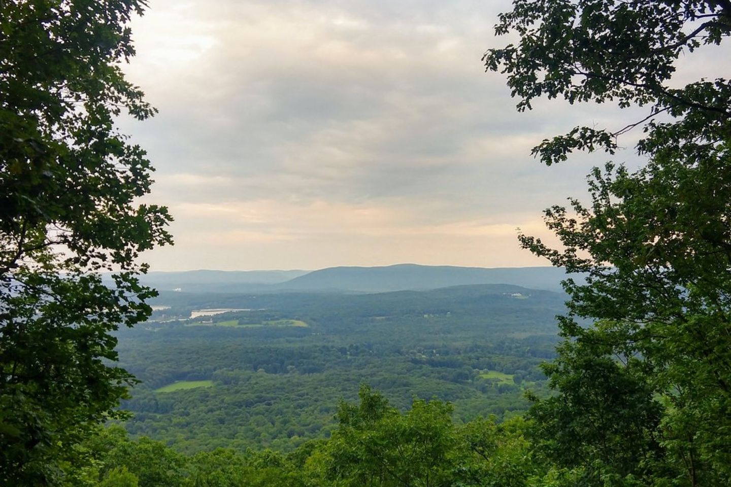
Great Barrington, MA to Delaware Water Gap, PA
Great Barrington, MA to Delaware Water Gap, PA
Bedhead Aug 28th, 2018
Day 59: 17.6 miles Great Barrington to Riga Shelter
Since we were in town we had to hit up the McDonald’s one last time. A kind trail angel in a Casper van gave us a ride to the trailhead and we were off!
Shortly after starting, we had to pause and lather up in bug spray. The mosquito onslaught continued the entire day, but the Picaradin seemed to work.
The elevation profile on our app had us worried, but the trail over Mt Everett was largely gradual. We stopped for water at a shelter and continued over Mt Race. The Northern section into the ravine skirted the mountain and we hiked with a beautiful view off to one side. Once down in the ravine, we crossed the state line into Connecticut. The trail meandered alongside a brook for almost 2 miles, which combined with a steady stream of weekend hikers made it extremely difficult for Kristen to empty her bladder.
Bear Mountain (CT), the highest elevation we will see for weeks, was a challenging but enjoyable climb. There was a fair amount of rock scrambling towards the peak. We loved the flat hike between the peak and Riga shelter, making it to the shelter earlier than anticipated. The view from the shelter was beautiful and we had an unusually good night’s sleep
Day 60: 18.7 miles
Riga Shelter to Pine Swamp Brook Shelter
The day started off with an easy downhill into Salisbury, CT. We went up and over a few small mountains and then down into Falls Village where we had lunch (pastrami Rubens) at Toymaker’s Cafe.
Afterwards we climbed up and over Mt. Easter and choose to spend the night at Pine Swamp Shelter. The tramily pressed on to a campsite four miles beyond, but we needed to stop. Choosing between a wet tent to carry and bug-bitten appendages, we opted to tent. The rain began about 30 seconds after we finished eating dinner.
Day 61: 17 miles Pine Swamp Shelter to Kent
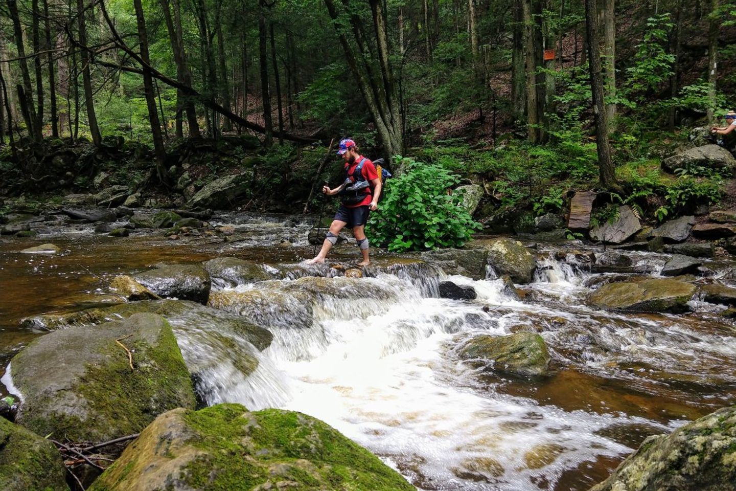
The morning started off well enough. The rain had ceased and despite the humidity it was relatively cool. We hiked up and down on squishy pine-straw trails and eventually descended into a valley with a wide, rushing brook. Because of recent rain the brook was running higher than usual. It looked like it could be a dangerous crossing, especially since it lacked any rope hold or partial foot bridge. Kristen, being slightly more confident on rock crossings, took out a trekking pole, changed into camp shoes, and journeyed across. Easier than expected! Levi followed more carefully and without issue (and without shoes at all).
Following a few more up and downs, we descended and came to a flat rocky path alongside a river. Although the trail was flat, our bodies were tired and our feet were especially achy. What should’ve been a brisk 4 miles turned into a crawl and we took a much needed break at the south parking lot.
Tight Achilles. Bruised balls of the feet. Feeling tired despite good sleep. Itchy from mosquito bites. Not knowing when we would next stop in town to shower and do laundry. Carrying a wet tent. Running low on snacks. Dreading the next uphill. Knowing the rain was returning at any moment.
Sometimes there are rough days on the trail, and this was one of them. We had only zeroed in town two days prior, but if possible, we needed another stop into civilization.
At the top of the next climb (which was a doozy–if we thought rock scrambling ended in New Hampshire we were sorely mistaken) we made some calls to locales in Kent, CT and found an opening at The Fife n Drum.
With the promise of town, our spirits lifted and we did the final 4 miles of the day easily. 4.8 actually…it was a bit of a road walk from the trail to the Inn. We were rewarded for our efforts though–this stop was the closest we’d come to most people’s idea of a honeymoon.
The town of Kent is picturesque with clean, orderly buildings and high end boutique shops.
We entered to the restaurant and were welcomed to the bar despite our ragged appearance and undeniable stench. We had a delicious dinner and then made our way up to our room, a beautiful king suite with a lofted ceiling.
After showering and rinsing out our clothes, we promptly collapsed into bed. A wonderful ending to a terrible, horrible, no good, very bad day.
Day 62: 12.8 miles Kent to Wiley Shelter
We successfully avoided hiking until 12:30. Kent had a wonderful Coffee & Chocolate shop which we stopped by for breakfast. We needed to buy some more snacks so Kristen shopped at IGA while Levi charged phones and checked out the Kent Welcome Center. There just happened to be an ice cream shop on the way back to the trail head, so that necessitated another stop, complete with a milkshake and a close game of checkers. At last, we were on our way.
There was about an hour of dry hiking before the rain moved in. We threw on our rain gear and continued slowly, especially on Levi’s least favorite downhill terrain–large granite slabs. At some point we crossed the border into New York, but there weren’t any fun signs to mark this momentous occasion.
At .1 miles from the campsite, we stopped at a water pump and filled up. On our last bottle, we heard a group moving up the path. It was our tramily! We found the shelter completely empty and all set up inside. During a break in the rain we hung our bear bags and encountered a large owl sitting on a tree branch. Hoo! Hoo!
Day 63: 8.8 miles
Wiley Shelter to Telephone Pioneer Shelter
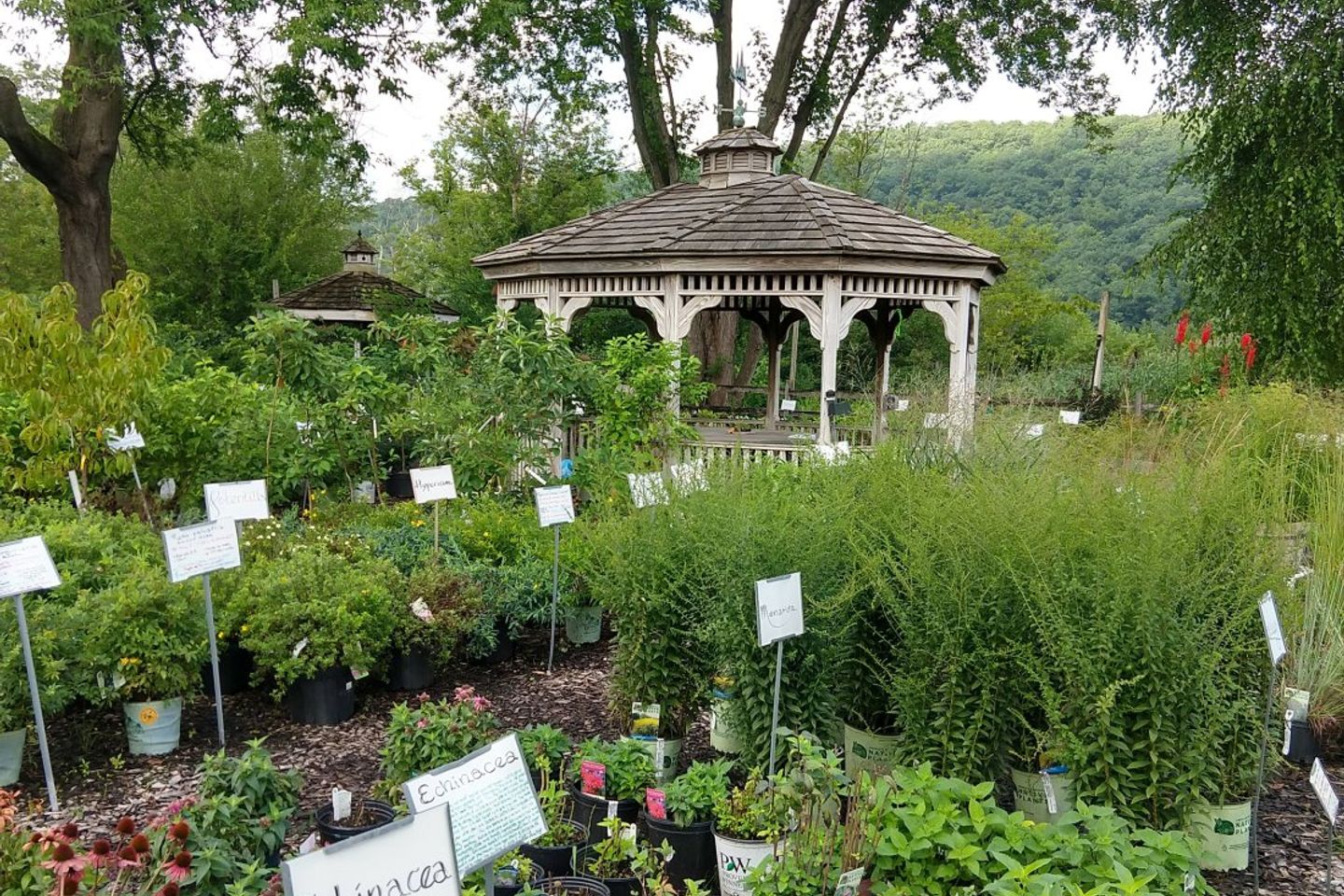
In the morning we hiked about 5 miles to Native Landscaping Inc, a garden store along the trail which is friendly to hikers. We took a break at their gazebo, bought some ginger ale, and asked about the best way to get into the nearby town of Pawling.
Unfortunately for us, hitchhiking is illegal in New York state and Pawling didn’t have any Lyfts or Ubers available. We ended up walking the three miles into town to pick up our resupply boxes from the post office. Once all four boxes were in-hand, we found a pub to eat nearby where we could also sort all of our goods.
Like Kent, Pawling had a welcome center with public restrooms and power outlets. We charged up, repacked our bags, and made one last stop (CVS for new insoles) before taking a cab back to the trailhead.
Our bags were heavy and we were worn out by walking to and through town in the heat of the day. Exhausted, we paused at a shelter 3 miles from town and looked at our maps. Either we could continue on another 7 miles and have to choose between a 14 and a 28 mile day the following day, OR we could throw in the towel and pull two 20-mile days to get into our target town.
We threw in the towel. It was a mostly great night of sleep (some rowdy NOBOs arrived and were loud until around 9) and we were ready for big miles the next morning.
Day 64: 21.7 miles Telephone Pioneer Shelter to Canopus Beach
We headed out bright and early, managing almost 8 miles before 10am. Around 11:30 we took a half mile detour to our first NY deli. There was a pizzeria connected to it, so naturally we stopped there as well. All in all we had three slices of pizza, a chicken club, three drinks, and ice cream. It was a great lunch and we were ready for more hiking.
Around 3:30 we stopped at RPH shelter– a fully enclosed sleeping building with a patio, flower garden, and newish privy with toilet paper. We only stopped long enough to snack, use the privy, and look at the rest of the day’s terrain on the app.
The final five miles flew by. Around 6pm we hit the side trail for the beach! Some SOBOs we had met back in New Hampshire greeted us, and they just happened to have grilled leftovers which they shared happily.
Day 65: 20.2 miles Canopus Beach to Ft. Montgomery
We got up and out early, heading around the lake to get back to the trail. The terrain was a jumble of ups, downs, and road crossings. It got hot, humid, and sticky early on. There were lots of stone walls, one of which formed a ledge we walked along.
Around 14 miles into the day we came to a road crossing which had a deli at it’s junction. The Appalachian Market did not disappoint. We downed two large Gatorades and a Ginger Ale, ate a deli sandwich apiece, and talked for awhile with a New Yorker.
Bellies full, we continued on slowly. At the peak of Anthony’s nose, the mosquitoes finally abated and we made our descent towards Ft. Montgomery.
The trail converged with a road which led us to the Bear Mountain Bridge and across the Hudson River. Once across, we stopped in a shady park to call for a shuttle to the motel and to talk to some other hikers. They were a mother and son doing a section hike and were very curious about gear and taking time off life to do a thru hike.
Our shuttle arrived, driven by “Grandpa,” the owner of the Bear Mountain Bridge Motel. He got us checked into our room and gave us the low-down on laundry, restaurants, and his grandchildren (one of whom we met the next day). Our attempt to have a lazy night in was thwarted by the pizza place which doesn’t deliver on Thursday nights. Fortunately there was a BBQ joint across the street, so we hobbled there for dinner.
Our attempt to watch the Steelers-Packers preseason game was ruined by the NY Jets hogging tube time. It was probably for the best.
Day 66: 15.5 miles Ft. Montgomery to Fingerboard shelter
We started our day with a trip to the Bagel Cafe and had a semi-surprising visit from one of our extended tramily members. We knew he had plans to stay at the Motel the same night we were there, but he hadn’t arrived by the time we went to bed. He ended up using the late night and 100* heat index as rationale to take a zero day. We marched on.
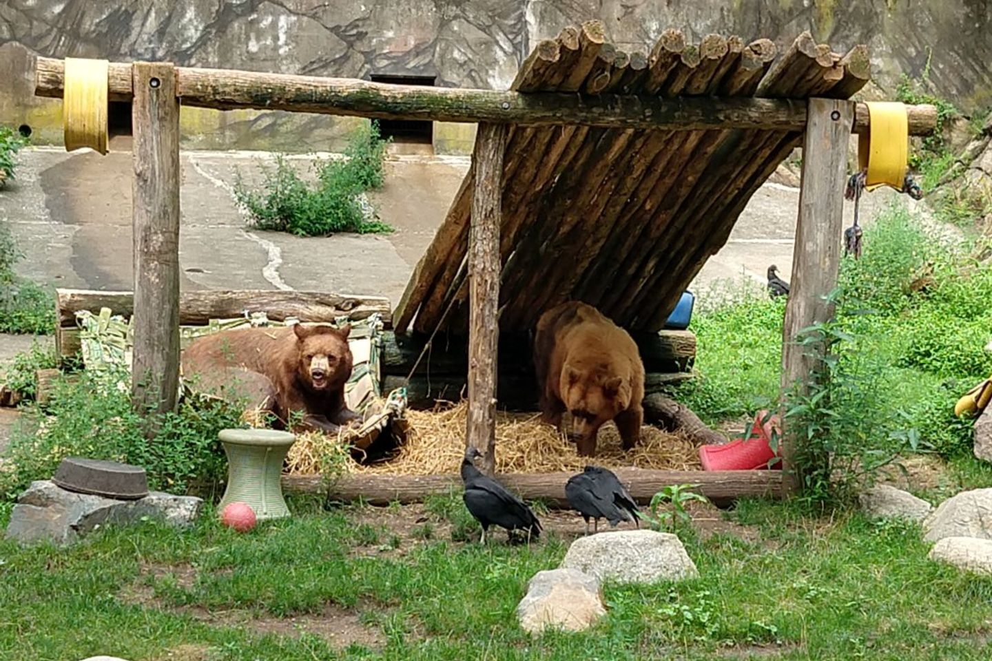
We first got back on trail near the bridge and soon after hit our lowest point so far. Literally. The trail makes its way through Bear Mountain Zoo, and the bear exhibit is at 124 ft. of elevation. We saw two adorable sun-bleached black bears from the safety of their enclosure.
Next we climbed Bear Mountain, which seemed to be a very popular weekend hiking destination. It was hot and humid, but there were stone stairs nearly the entire way up. We hiked for a bit with a girl named Rachel who was doing a section of the AT before starting a new job. We climbed up and down West Mountain and Black Mountain before the terrain leveled out a little bit.
At one point, Kristen was leading and saw some movement off to the left. It was a rocky section of trail and she slowly approached. A snake, about 4 ft long, was spanning half of the trail. It’s tail was in the path and it’s head was hidden in the brush and presumably down a hole. Upon closer inspection as we tiptoed around it, there was a rattle on the end of it’s tail. Our first rattlesnake sighting!
Ambling on more cautiously now, we made our way to Fingerboard Shelter. It was a hot, rainy, buggy night.
Day 67: 21 miles
Fingerboard Shelter to stealth site
By 5:55am we had had enough of the mosquitoes and prepared to hit the trail. We used the last of our bug spray as Levi ran back to the shelter from retrieving the Bear bag, a swarm of blood suckers on his tail. Sadly, the bug spray can only do so much and we continued to be eaten alive.
The first fun event of the day was the Lemon Squeezer: a section of massive boulders with a human-sized gap between them. We both managed to make our way through without even having to remove our packs!
Somehow our day managed to get even buggier. We received countless compliments and jealous comments from day hikers about our head nets. One of our tramily members (Red Line) caught up to us for a bit and we hiked with him until we came upon a couple more day hikers…or so we thought. It was MnM’s parents surprising her with a visit! She was obviously overjoyed and their visit couldn’t have come at a better time. She was the most bit-up of all of us, had a small fall earlier in the day, and was struggling with the heat. Parents to the rescue!
Although the McMenemys invited us along to town, we had to get in place for our own rendez-vous the following day. So we walked on.
Shortly after the parking lot, we came across some trail maintainers who were weed whacking and clearing the brush around the trail. We thanked them for their work and said we hoped the cleared brush might help deter some of the mosquitoes. They asked if we had enough spray, and when we said we ran out but would pick up some the next day, one of them ran to their car to give us their can. Talk about Trail Magic!
We were aware of a pending rainstorm (and both in need of the privy) so we picked up the pace making it to a nearby shelter a few miles away by 3 pm. According to our weather app, the chance of storms had decreased and we seemed to be in the clear for the rest of the afternoon and evening. We left the shelter and soon found ourselves hiking along a granite ridgeline. The sky looked ominous, but we figured the storm was passing over us and would clear shortly.
Thunder rumbled, wind blew, and we put on our ponchos minutes before the rain began pounding down on us. At the first sign of lightning we returned to the cover of trees and chose to wait out the storm from the relative safety of the forest. When the storm cleared, we walked a few more miles to a road where we hoped to stop for hot dogs and ice cream.
To our great disappointment, the hot dog stand was closed. The Bellvale creamery was open though, so we continued down the road. After one giant ice cream and milkshake we we’re still hungry. We knew we were heading to a stealth site (not a shelter), which would likely be buggy and provide no cover for cooking dinner. Logically, it made sense to order another round of ice cream and shakes for dinner!
After filling our bellies with Bellvale Bog chocolate, Calf Trax, and The Great White Way, we got back on trail and hiked until sunset. We found a flat spot, set up our tent, and got ready for bed.
Day 68: 16.9 miles
Stealth Spot to Pochuck shelter
The bugs were awful, so we started walking fast. We were only a mile from the New Jersey state line, and stopped briefly on the ridgetop to savor the moment.
After a fast ridgeline walk, we hiked down what locals like to call the ‘Stairway to Heaven.’ It was a weekend, and therefore extremely crowded with locals.
When we got to the bottom we were greeted by Michael Freeman, a former colleague of Levi’s father. Michael was extremely accommodating and took us to grab bagels, gigantic sub sandwiches, groceries, and some trail beers. We were extremely thankful and had a wonderful time.
After departing, we hiked a long, smooth boardwalk through a beautiful marsh. At the end of the boardwalk, we stopped to filter water and Kristen’s trail beer tumbled out of her pack and busted on a rock. It was a sad moment.
We got to the shelter, cracked open our only remaining cold one, and phoned home only to realize we were a mere 14.1 miles from the New Jersey High Point, and therefore a short drive from family friends Stu and Sheerie Berjansky. Thankfully, they were going to be available the next evening and welcomed us to stay with them.
Day 69: 14.1 Miles Pochuck Shelter to High Point State Park HQ
Occasionally we think a tent spot is flat, only to wake up with our pads slid in one direction or another. This morning we awoke with our feet pressed against the foot end of the tent. Whoops.
Our walk to High Point was rather uneventful. We got there right as Stu pulled up in the parking lot. The park office was handing out free sodas to thru hikers so we stopped in, fueled up, and hopped in the car.
Once at the house, we caught up with Stu and Sheerie and met their three loving doggos. They filled us up with pretzels, chips, guac, chicken, steak, corn, potatos, beer, and cider. It was a relaxing evening and we went to bed with full hearts and full bellies.
Day 70: 14.3 miles High Point HQ to Branchville
We slept in until almost 8! A one-dog wake up party (Wrigley) came to energetically escort us downstairs towards the smell of coffee and blueberry pancakes. As we ate and discussed the day’s agenda, Stu decided to join us for our 14.5 miles to Branchville.
Sheerie dropped us off at the High Point HQ and we hiked a very quick and uneventful 14.5 to Branchville.
In the evening after dinner, we were left to our own devices while the Berjanskys went out. So we Netflixed and chilled. (The new Dimitri Martin sketch is great!) Around 8:00 we got a phone call from Levi’s dad asking us if we were still awake. Yes!
Dale was on a business trip in the area, and was able to stop by for a few minutes. We hugged and discussed the finer points of having such an immense beard. It was a great reunion.
Day 71: 7.7 miles Branchville to tent site
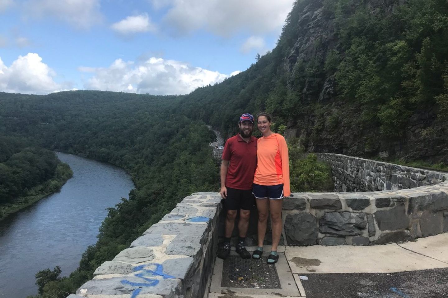
In the morning we went into the town of Milford and stopped at an amazing bagel place for breakfast. This NY/NJ/PA corridor sure knows how to make bagels! We went to see Sheerie’s studio, stopped at a grocery store to grab snacks, and then drove to the Hawks Nest- a winding section of road running along the Delaware river.
We stopped back at the house to have lunch and to grab our freshly laundered clothing. It was difficult to say goodbye, but hike on we must. After Wrigley, Brynn, Stu and Grace said their heartfelt and slobbery goodbyes we got in the car. Stu and Sheerie dropped us off at the trailhead in Branchville and we hiked a quick 7 miles to the tentsite.
Day 72: 20.7 miles from tent site to Delaware Water Gap
Seeing as we are hiking the Appalachian Trail, we deemed it fitting that we should spend a night camping. It drizzled overnight, but overall it wasn’t a bad experience. We should try it more often.
But alas, there was more family to be seen.
We hiked a level but rocky 20.7 down to the Pennsylvania border, where we were abducted by the Greenbergs and shuttled to far away Kendall Park, NJ for three days of R&R.
Day 73: Zero in Kendall Park, NJ
After a blissful night’s rest, we awoke to French press coffee and fresh bagels. Cousin Danny gave Levi a lesson on proper bagel cutting technique after Levi ‘nearly sliced his hand off’. Turns out, bagel-related injuries are the most common cause of visits to the local ER.
We spent some time catching up with Caryl and Kira, began a load of laundry (yes, our clothes smelled after only 35 miles), and avoided working on this blog. Following laundry, we borrowed the car and headed to a local REI to get a new filter and non-deet bug repellant.
As all of our trips to REI usually go, we spent an exorbitant amount of time debating products. In the end, we got a new filter which uses UV light to stop microorganisms from reproducing in water. We also got new socks, a collapsible cup, and bug repellant.
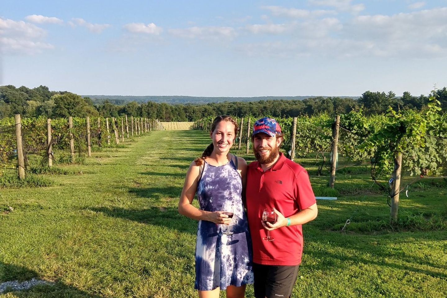
For dinner, Danny picked up hoagies and we all headed to Old York Cellars winery. The weather was perfect for walking in the vineyard, listening to music, playing Scrabble, and of course, drinking wine.
Day 74: Zero in Kendall Park, NJ
Day 74 was a relaxing one. We were slow to rise, and only did so when we remembered that there were bagels waiting for us.
We treated our clothes with bug repellant and lounged outside writing our previous blog post while waiting for our clothes to line dry.
We had dinner at a wonderful pho place, and then paid a visit to an incredibly ornate BAPS temple to experience one of their open Hindi services.
The day was capped with a trip to the Bent Spoon, a gourmet ice cream shop right outside of Princeton’s campus.
Day 75: Zero in Delaware Water Gap, PA
We started our day with a hearty breakfast of peanut butter cup pancakes and watermelon. After breakfast, we began packing, and departed for Delaware Water Gap shortly after lunchtime.
We stayed at the Deer Head Inn, a spot famous for weekend jazz performances. Instead of staying for the evenings performance, we made our way around town. We stopped for more fuel at a local outdoors shop, got some drinks and super glue at the gas station, and ended up eating Stromboli and chicken fingers at the pizzeria.
We had a relaxed night back at the inn, excited to meet up with tramily members Toots and Pawpaw (formerly known as Story, Country Kitchen, DB, and Jukebox… Sometimes trail names are hard) the next day.
Previous: Aug 16th, 2018
Next: Sep 11th, 2018


