Want to document and share your hike with friends and family?
Our App is Available for iOS!
Download it now!
Gorham to Hanover
Gorham to Hanover
Bedhead Aug 10th, 2018
Day 30: 15.2 miles Gorham, US rt. 2 to Carter Notch Hut.
Our first day in the Whites took us through the Carter peaks in the Wildcat range. The climbs were long, but not as difficult as the Northbounders had been claiming.
What was supposed to be a ten mile day turned into a 15 mile day complete with our first Hut encounter.
In the Whites, a series of huts were constructed by the Appalachian Mountain Club (AMC, also known as the Appalachian Money Club) as a means for tourists to see the rough ranges in relative comfort. They come complete with bunk rooms, a mess hall, indoor composting toilets, and caretaker quarters for the staff. For a mere $120-$160 a night, one can have dinner, a sound night’s sleep, and breakfast, all with a view. Most of those pennies go towards the logistical nightmare that is the caretaking staff literally carrying all supplies to the hut on their backs. There are no roads up there.
Thankfully, the AMC has designed a few alternatives for the frugal thru-hiker. They are as follows:
Work-for-stay. Huts will employ 2-8 thru-hikers during the breakfast or dinner hours in exchange for a spot on the mess hall floor and leftovers.
Stealth camp. If the forecast isn’t life threatening, staffers are happy to point out the nearest tenting spot, usually located outside a .25 mile radius around the hut for environmental impact reasons.
Armageddon. If the weather forecast shows truly unsafe conditions, huts will accept as many thru-hikers as will fit on their floors.
Some members of our tramily were lucky enough to secure a work for stay this night, but we were directed to a stealth camp for the evening.
Day 31: 10.7 miles Carter Notch to Osgood Tent Site
We started off the day with a bit of a miscommunication with the tramily. Because some tramily members did a work for stay, we assumed they would be staying late to eat breakfast leftover. Turns out, they were on dinner duty and left early. Some of us staying at the stealth site missed the memo and had a late start to the day.
We climbed out of the notch and summited Wildcat before descending to Pinkham Notch visitors center for a food resupply. We had lunch there with two section-hikers who are currently studying Philosophy at…Pitt! H2P!
A short hike to Osgood tentsite placed us right at the base of Mt Madison, our gateway to the spectacular Presidential Range.
Day 32: 10.1 miles
Osgood Tent Site to Lakes of the Clouds Hut
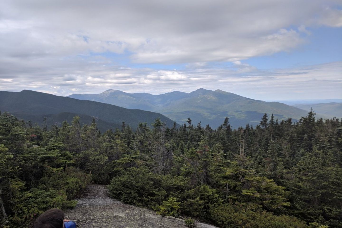
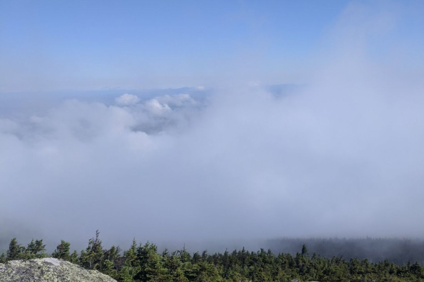
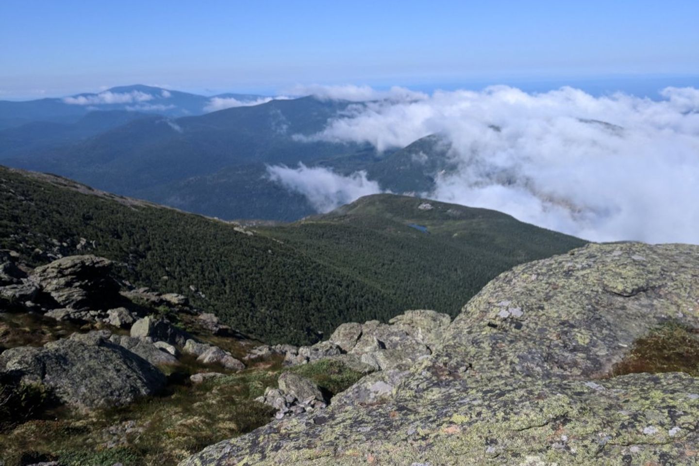
In hopes of beating out a storm, our day began early with a sunrise ascent of Mt. Madison. It was a very rocky climb, more boulder scrambling than trail hiking as we neared the peak… Or what we thought was the peak – Mt. Madison had a number of false peaks leading up to the final summit. This turned out to be the only view we saw from a peak in the Presidential Range due to heavy fog and light rain.
After hitting the top, we carefully made our way down to the Madison hut. Many people at the hut were only just leaving for the day, but we were already 3 miles in and over a mountain by 8 am.
Our tramily had split into its two regular hiking parties. As we filled water bottles in the hut, some members of the advance team managed to take the wrong side trails right after the hut and had to turn around to get back on trail. We had a front row seat to the confusion and got to watch them reroute from the warm comfort of the hut.
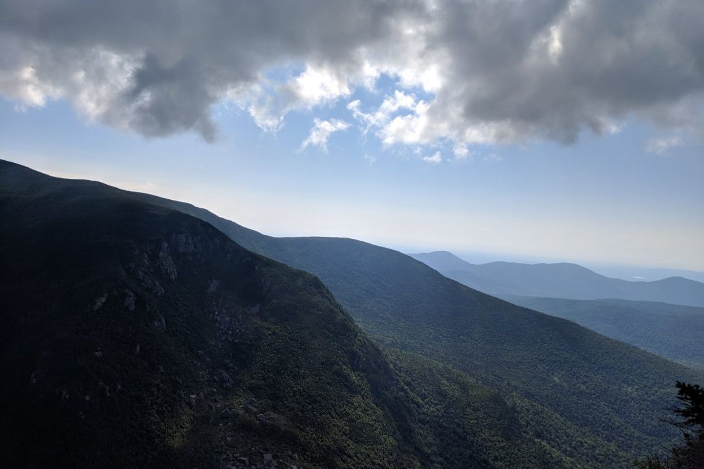
The Presidentials are decently marked with sign posts and Cairns, but due to the alpine environment, the trails scarcely have white blazes. As we got farther up Mt. Washington, those cairns became harder and harder to see through the thick cloud covering the mountain. We had few instances of navigational uncertainty but fortunately we managed to stick to the trail (unlike our amigos who got lost again). After what felt like an eternity, a man standing about 20 ft. ahead of us bellowed, “Congratulations! You made it!”
‘Made it where?’ we thought, looking around confused.
Five steps later we saw a building through the fog: we had arrived at the peak of Mt. Washington, the second highest point on the trail! Slowly we wandered around the top, following our noses to the building containing concessions. Many chili dogs, warm beverages, and moments of rest later, we pushed on to Lakes of the Clouds hut.
At Lakes of the Clouds, Levi and I did our first work-for-stay. After all of the paying guests finished dinner, the “croo” (mostly college aged kids who work at the hut) showed us to delicious leftovers and our work assignment: dishes. Following work, we laid out our sleeping pads on the mess hall floor. Unfortunately for us, several guests were still in the middle of a card game during ‘lights out’ and they continued to play loudly and with much headlamped commotion. We didn’t get to sleep until 11 pm.
Day 33: 11.1 miles
Lakes of the Clouds Hut to Dry River Campsite
As we picked at leftovers and waited for friends to finish work for stay, we met a former thru-hiker named Neon who had hiked to the hut with the intention of delivering trail magic to hungry hikers. Score! We stayed at the hut for awhile talking to him and another hiker named Jet about our trail adventures while eating Neon’s apples and homemade pizzas.
Neon hiked with us for awhile and we stopped for a bit at Mizpah hut.
On our way around Mt Eisenhower, Rerun, a member of our tramily, had the misfortune of twisting his ankle on the flattest terrain of the trail. His ankle ended up being the size of a grapefruit by evening.
A difficult climb down from the range (including an actual descent of a rock face) left us exhausted. Luckily, we were able to hitch to a campground with showers and laundry. The night was capped off when a very nice camper whose sons had thru-hiked the PCT purchased us trail magic beers.
Day 34: 14.7 miles
Dry River Campsite to Galehead Hut
The morning started off with a long incline, but we enjoyed unobstructed terrain. Magically, the incline flattened out and we relished in smooth flat trail. Around every corner we thought it might take a steep turn uphill, but the red carpet trail lasted almost five miles. It was glorious and we were making excellent time.
After a steep climb up a cascade we arrived at Zealand hut and had an early lunch there. One of the volunteers at the hut asked us about our plans for camping that night given an impending hailstorm. We had mentioned a lean-to, but the caretaker urged us to push a few miles past it to the shelter of an enclosed hut. She stated that hut personnel know to take in hikers given dangerous weather conditions, and suggested requesting a work-for-sleep deal.
Great climbs and views led to our eventual arrival at the Galehead hut. Unfortunately, the caretaking team was made up of volunteers while the usuals were out for a required caretaker banquet. These volunteers were not up to speed on safety protocol for thru-hikers and were adamant that no more could stay at the hut. Furthermore, they alleged that hikers should be able to proceed an additional three miles over dangerous terrain even in the impending conditions. The caretakers were rude, loud, and even resorted to using profanity in their misguided frustration. Multiple members of our group cried. It was after much discussion that the caretaker yielded and we spent the night.
Day 35: 2.8 miles
Galehead Hut to Garfield Ridge Campsite
The storms held off until morning, so we decided to book it away from the formidable volunteer caretakers towards the Garfield Ridge Campsite lean-to.
The trail was steep, rocky, and included scaling the face of a waterfall.
Once in camp, we wrapped up and waited out the storms.
Day 36: 10.2 miles
Garfield Ridge Campsite to Lincoln, NH to stay at The Notch Hostel
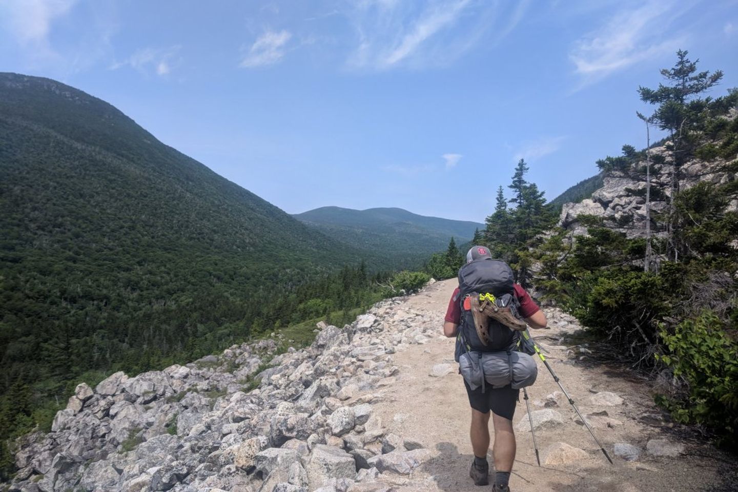
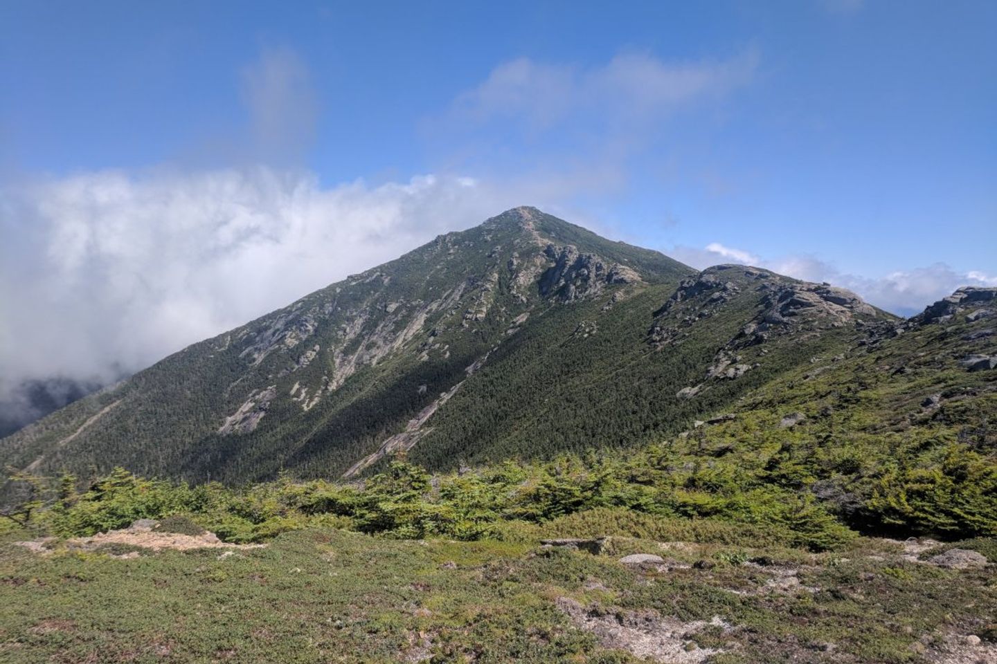
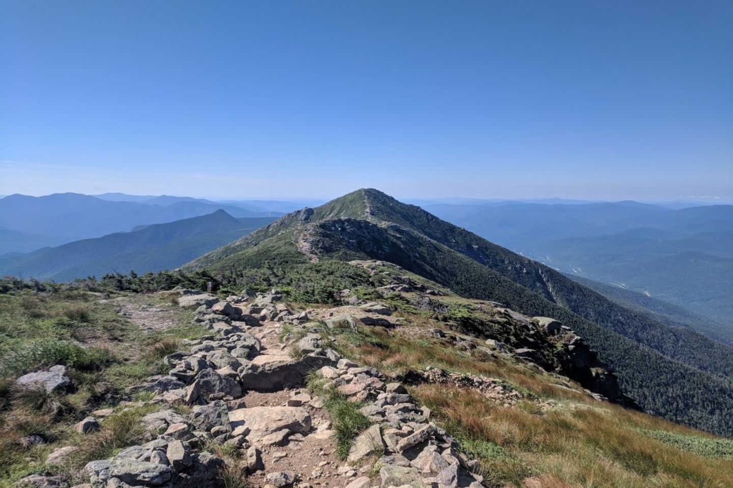
The storms died down, but fog haunted us on our ascent of Mt Garfield. We were very fearful that we wouldn’t have any views on one of the most scenic ridgelines in the world, Franconia Ridge. As we ascended Mt Lafayette, however, the mist parted and revealed 360 degree views of spectacular mountain ranges.
The ridgeline was exhaustingly beautiful, and the wind was downright tenacious. We were very thankful for our rain gear as the wind was so strong that we could walk straight while leaning 20 degrees to the right.
Once down from the ridge, we hitched to town and gorged ourselves on McDonalds and pub fare.
That night we stayed at the Notch Hostel, a wonderfully organized place run by a woman named Bookie.
Day 37: 16.2 miles
The Notch Hostel to…Lebanon!
Bookie dropped us off at Flume Visitor Center and we took the .9 mile bike trail back to the AT. Maybe it was the coffee at our final hut, but the penultimate peaks of the Whites went by like a breeze. The Kinsmans were rocky, beautiful, and we felt good hiking them.
All went swimmingly until we hit the base of Mt Wolf. Levi tripped on a root and landed face first on a boulder. The initial bleeding was intense as forehead wounds usually are, but subsided after 10 or so minutes. Levi was able to brace for the fall and did not exhibit any concussion symptoms.
We were able to reach out to Keith and Delaina, college friends of Kristen who live in nearby(ish) Hanover. Thankfully, they chose to drive over an hour to pick us up at a trailhead and drive us to a clinic.
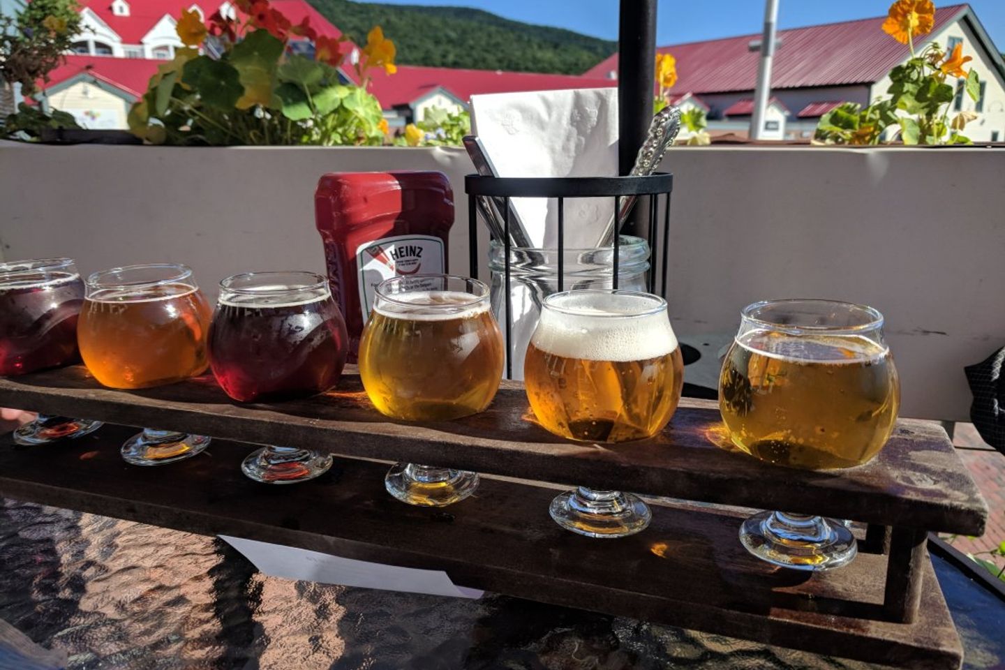
After some initial cleaning of the wounds, the doctor determined that no stitches were needed. This was cause for celebration in the form of beer and buffalo chicken pizza.
Day 38: Zero in Hanover
Doctor’s Orders.
Day 39: 18.5 miles
Back on the trail to Jeffers Brook Shelter
Taking a zero day really paid off, despite the circumstances. Our day started off on our escape route (Reel Brook Trail) and took us by the scene of the incident just before Mt. Wolf. Mt. Wolf was more technical than expected, and made us glad we had gone back the way we did two days prior.
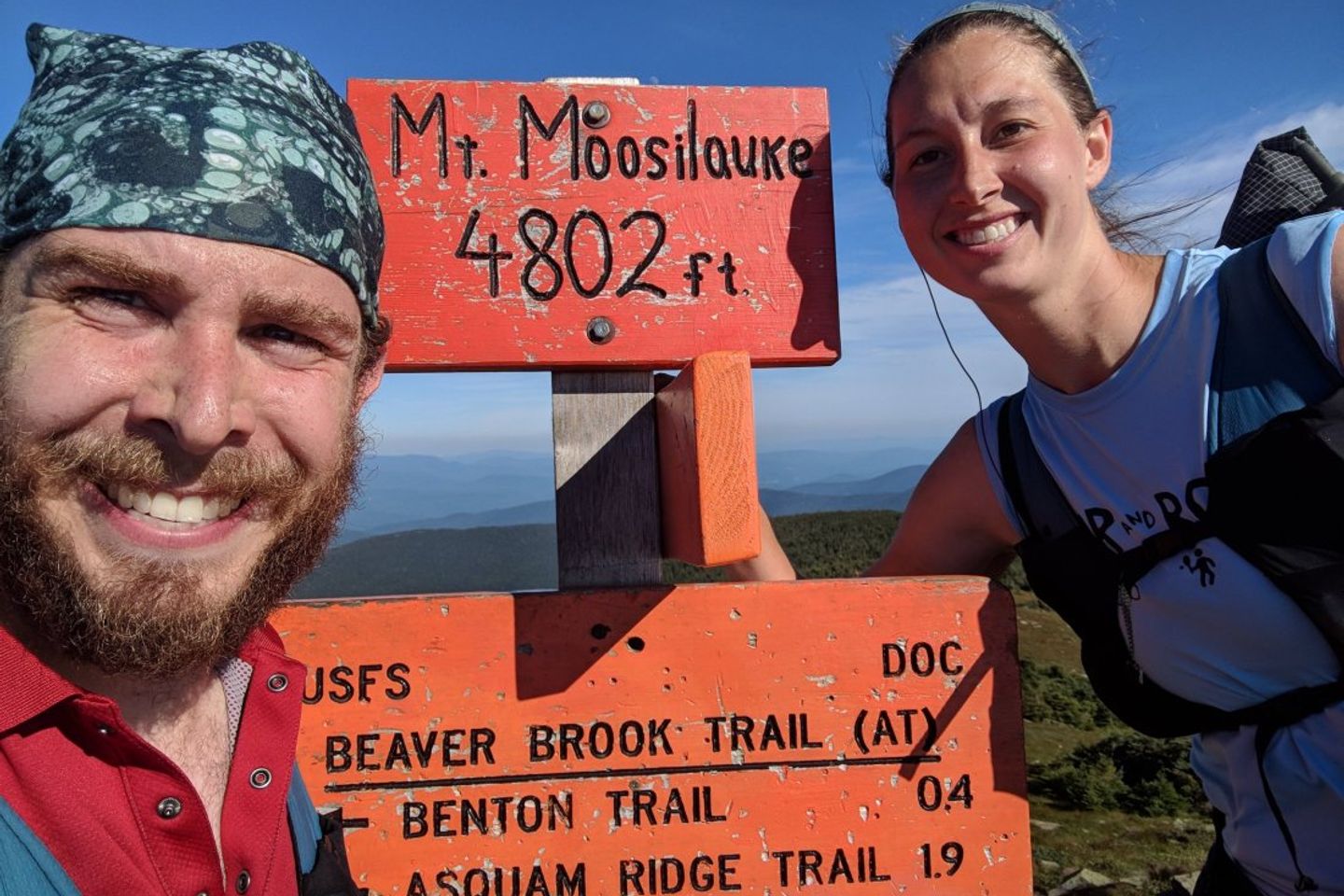
After a quick mile of smooth trail, we ascended Mt. Moosilauke. The jury is still out as to whether that’s pronounced moose-ill-lock or moose-ill-lock-ee, even among locals. All we can say for sure is that the first 1.5 miles of climbing were pretty close to 1.5 miles of actual climbing. While it wasn’t something we weren’t used to, it was a fitting final 4k climb in the Whites.
Given an impending early morning rainstorm, we decided to push an additional 6.9 miles over the peak and down to a shelter at the base of the mountain. The peak included an alpine zone with unusually long grass and 360 views. It was relieving to be able to compare the intimidating terrain we had come from to the more welcoming terrain ahead.
Day 40: 15.7 miles
Jeffers Brook Shelter to Hexacuba Shelter
The early morning showers held off until about 10 am, which allowed us to take advantage of the smooth terrain. Mt. Mist was a relative breeze, and a 3 mph pace came naturally to us.
Unfortunately, heavier rains came through just as we started Mt. Cube, a granite capped peak not unlike many we saw in Maine. Slick surfaces and leftover fatigue from the previous day slowed us considerably. While we had our sights set on a 21 mile day, we decided to play it safe, dry out, and recharge.
Day 41: 17.7 miles
Hexacuba Shelter to Moose Mountain Shelter
The rain paused for a few hours giving us an opportunity to make some substantial miles, but then it came back with a vengeance. We trudged through one of the worst storms of the trip thus far, but managed to make it to leaky Moose Mountain Shelter with time to make dinner before nightfall.
Day 42: 11 miles
Moose Mountain to Hanover
Still soaked through from the day before, we hiked down into the city of Hanover for some much needed showers, laundry, pizza, beer, and gelato.
Previous: Jul 20th, 2018
Next: Aug 16th, 2018


