Want to document and share your hike with friends and family?
Our App is Available for iOS!
Download it now!
Baxter SP and the 100 Mile Wilderness
Baxter SP and the 100 Mile Wilderness
Bedhead Jun 22nd, 2018
Day 1 – 5.2+5.2 miles, 8000+ ft in elevation change.
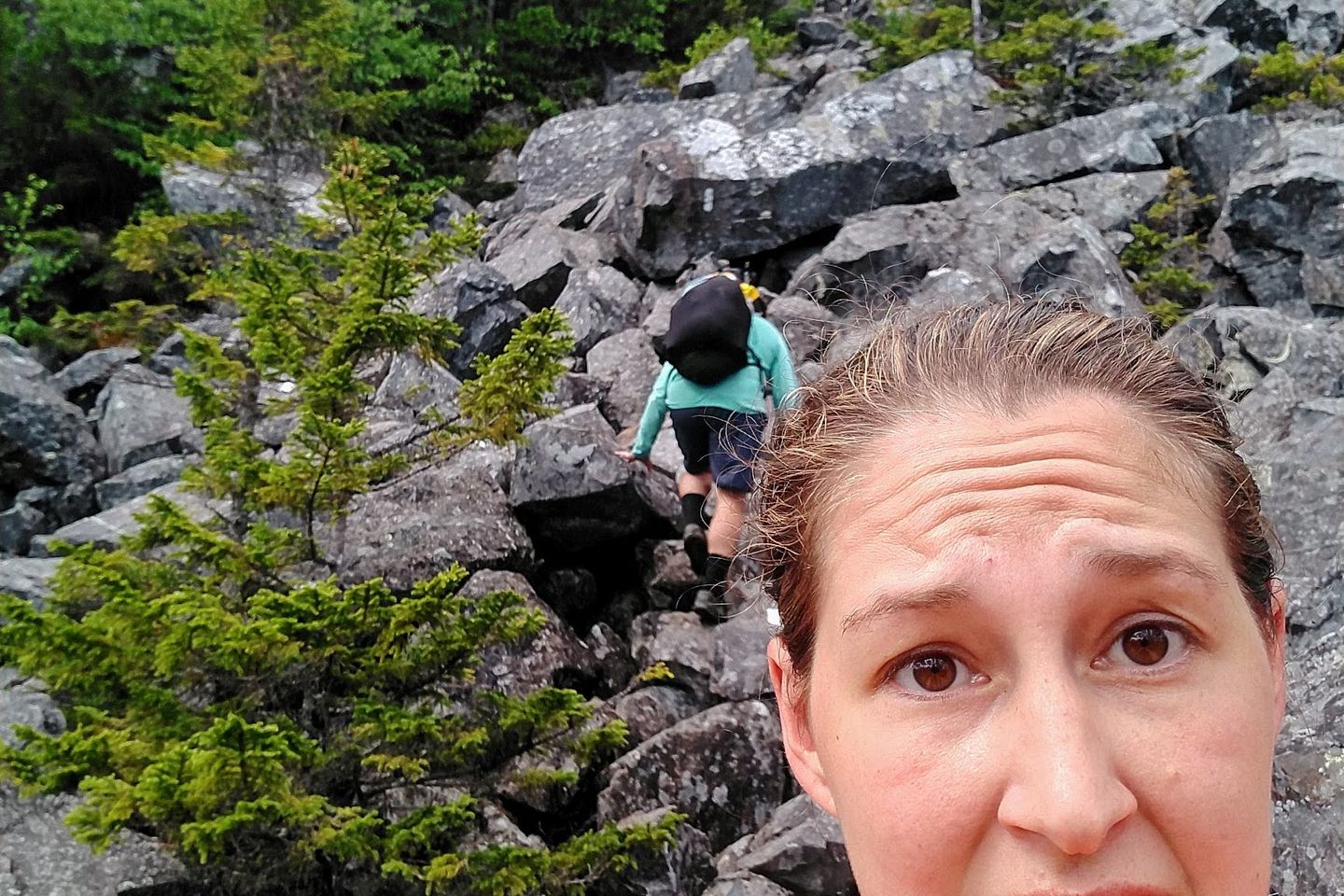
Our first day started with us climbing 5.2 miles and 4000′ to Baxter Peak on Mount Katahdin in order to start our journey south. The climb was tough, and included multiple rock scrambles. Some locations included rebar hand and foot holds, but most had the climber depend on granite and friction to make their way up.
Views above treeline were breathtaking, and the alpine ecosystem was packed with beautiful low-lying vegetation.
Once we reached the northern terminus, we started the AT by turning around and going down the same way we came up. A seasonal spring near the top was dry, leaving many of our group without water on the first few miles of the difficult descent. The granite was rough enough to chew a rubber piece off the bottom of Levi’s shoe.
Thankfully, the full group made it to the peak and back without issue, and set up camp at Katahdin Stream Campground.
Day 2 – 17.8 miles
Day 2 saw less elevation but more miles. Upon leaving the campsite, we hiked 9.1 miles to exit Baxter State Park. Right outside is Abol Bridge with wonderful views of Katahdin when the weather is clear. We weren’t so lucky. We had our first rainy day.
Shortly thereafter, we entered the 100 mile wilderness. Entering from the north end means instant gloomy overgrown and mossy ancient forest. Roots and rocks coat the ground, and an incredible silence fills the air.
After a few miles, we started an ascent to rainbow ledges, a granite capped hilltop with occasional views of the expansive wilderness. We ended our day by setting up a rainy camp next to Rainbow Lake, the only flat tent site for a few miles. Luckily, the rain stopped by evening, and despite dropping to 35 F the condensation on our tent was not bad.
Day 3 – 15.2 miles
Day 3 started slow as we were trying to dry out everything from the day before. The trail took us by some beautiful lakeside views as well as some mountaintop panoramas.
We first started feeling the effects of food intake and got zonked at separate points. Camp at Wadleigh Stream Lean-to was particularly buggy.
Day 4 – 13.5 miles
Day 4 was limited in elevation but included very tricky terrain. We wanted to break 20 miles, but unexpected miles of swamp rock-hops and root scrambles encouraged us to leave some trail for the next day.
We spent the night at the Antlers campsite, which was a beautiful lakeside site with (gasp) cell service. Good company was had, and we got word from a speedy section hiker regarding others who started the same day. Many are still on trail, but a few others have dropped out.
Day 5 – 19.7 miles
The return of the miles. We got an early start and a nice boost from smooth trails. 12 miles were down by lunch, which is when we picked up our paint bucket food resupply for the rest of the 100 mile wilderness. With full packs, we decided 7 more miles and 2800 feet of elevation gain was a no brainer.
We ended our day at Logan Brook Lean-to halfway up Whitecap Mountain, the 100 Mile Wilderness’ highest peak. The camp site is a small tent city tucked next to a beautiful cascading ravine. Kristen almost caught the lean-to on fire while cooking in the wind, giving her the trail name Danaerys.
Day 6 – 12.8 miles
The day started off with a windy and foggy ascent of White Cap Mountain followed by a rough ramble through the White Cap range. The subsequent peaks allowed for great views and brief breathers before the next rocky descent.
Rain and the looming Chairback range inspired us to stay the night at an unnamed campground.
Day 7 – 11.1 miles
Day 7 took us into the Chairback range, by far the toughest challenge yet. We tackled Chairback, Columbus, Third, and Fourth mountains and had enough. The mountains are so exhausting that they gave up naming them after the second one.
We took a short side trail to beautiful Cloud Pond and spent a couple of hours drying out before taking an early bed time.
Day 8 – 16.2 miles
After a good night’s rest, we decided to get ourselves in good position to exit the 100 Mile Wilderness by the next day.
Great views on Barren Mountain led to a long day of PUDS (pointless ups and downs) and some scenic stream crossings. We settled down at Leeman Brook Lean-to a few miles from the exit, ready to heal up and chow down the next day.
Day 9 – 3.0 miles
After an early start, we made it into Monson just in time for breakfast at Shaw’s Hiker Hostel. We were met by a few familiar faces and many more have since joined.
Previous: Jun 11th, 2018
Next: Jun 28th, 2018


