Want to document and share your hike with friends and family?
Our App is Available for iOS!
Download it now!
Day 94 (July 28, 2021)

Day 94 (July 28, 2021)
Shawn Bryan Jul 28th, 2021
Saratoga to 7.8 miles out on County Road 500 (7.8 miles)
The big problem for today was water. We had once again used Google to map out a route, this time to Rawlins. (This would be 2 to 3 hiking days). However, since we were in dry sagebrush country (unless next to the North Platte River) and not on the CDT, we didn’t know the water situation. Looking at imagery of our route did not look hopeful. Pockets had put out a Facebook request for any help in placing some water caches along the way. (We had already asked Disciple and he couldn’t.) She got two responses (amazing!) but one backed out due to a work shift change. The other was from Rawlins. He was excited to help out and we arranged a time to meet him at the Family Dollar store in town to load up the one gallon water jugs.
The plan was for he and Just Jim to go out and place the caches and send us the locations while we got started hiking, then Just Jim would catch up. (We had been delayed by a combination of laziness and coordination for the caches.) After we loaded the water, Feral, Pockets, and I started hiking out along our proposed route.
We got just outside of town when we got a call from Just Jim to stop; they had run across a problem. We found a lone shade tree and waited for them. They had placed one cache and were on the way to the second and found the road blocked by a gate marked Private Property. (Side note: this was on a county road so shouldn’t be. However, we didn’t think confronting a Wyoming rancher would be smart.) The man from Rawlins had come up with a different route he was familiar with that avoided the ‘private property’. The only bad news was that it was longer, but it worked. We all agreed and they set off to place the water caches on the new route.
Because of all this, we really got a late start on hiking. So much so that Pockets decided to go back into town and start tomorrow; the hot springs were calling. Feral and I pushed on, but with a much reduced goal of camping at the first cache.
We made it. But it is amazing how hard it is to find an open spot to set up a tent in wide open sagebrush country. The sagebrush is tough and some open spots are old anthills, which won’t hold a tent stake. We found an area not far past the first cache though and set up. And, as a side note, we have to carry out our empty one gallon containers from the cache. I am doing it by crushing them and tying them to my pack.
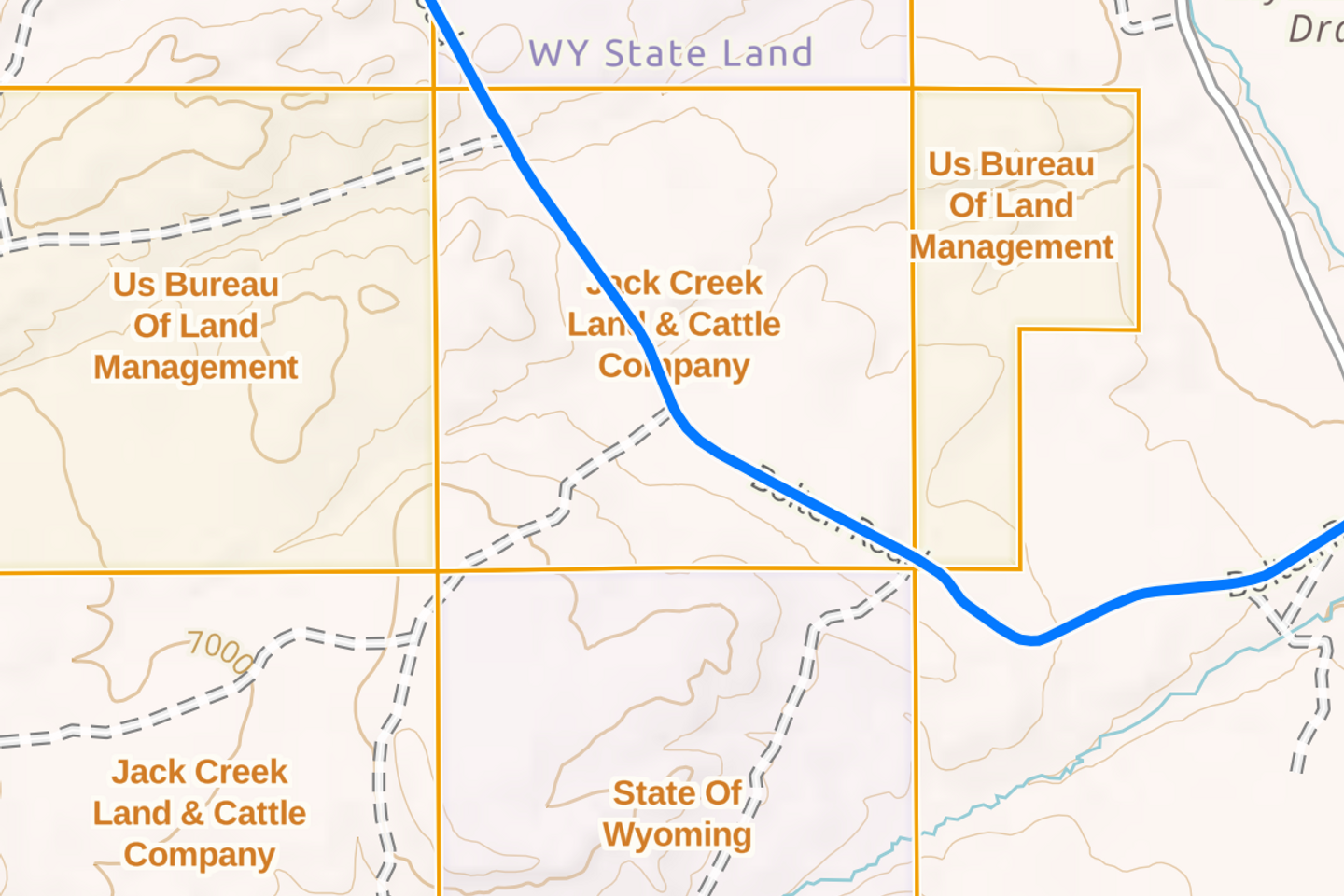
Final note: land responsibility/ownership is a tricky thing here. It is literally a patchwork of BLM, state, and private property. You can’t just camp anywhere. In general, we should only camp on BLM or National Forest Service Land. Even a public road through private land gives no right to camp there. I have an app that shows land ownership to help keep ourselves out of trouble.
Previous: Jul 27th, 2021
Next: Jul 29th, 2021