

Want to document and share your hike with friends and family?
Our App is Available for iOS!
Download it now!
Day 79-85--CA Hwy 49 (Near Sierra City) to CA Hwy 36 (Near Chester CA)
Day 79-85--CA Hwy 49 (Near Sierra City) to CA Hwy 36 (Near Chester CA)
Otter, A Procrastinor's Journey(s) Jul 14th, 2021
Written Tuesday, 13 July 2021
This is, without a doubt, the toughest single week of hiking I have ever had, with temperatures soaring into the low 100s, big climbs every day, and some very dry sections with long water carries.
My previous toughest two days on Trail were back in 2019 on the Appalachian Trail (the back-to-back days I climbed Mahoosuc Arm and hiked into Andover in Maine), but I had a couple days that displaced those at the top of the list this week. Honestly, if it weren't for Anchor's encouragement, I'm not sure I would have made it to Chester.
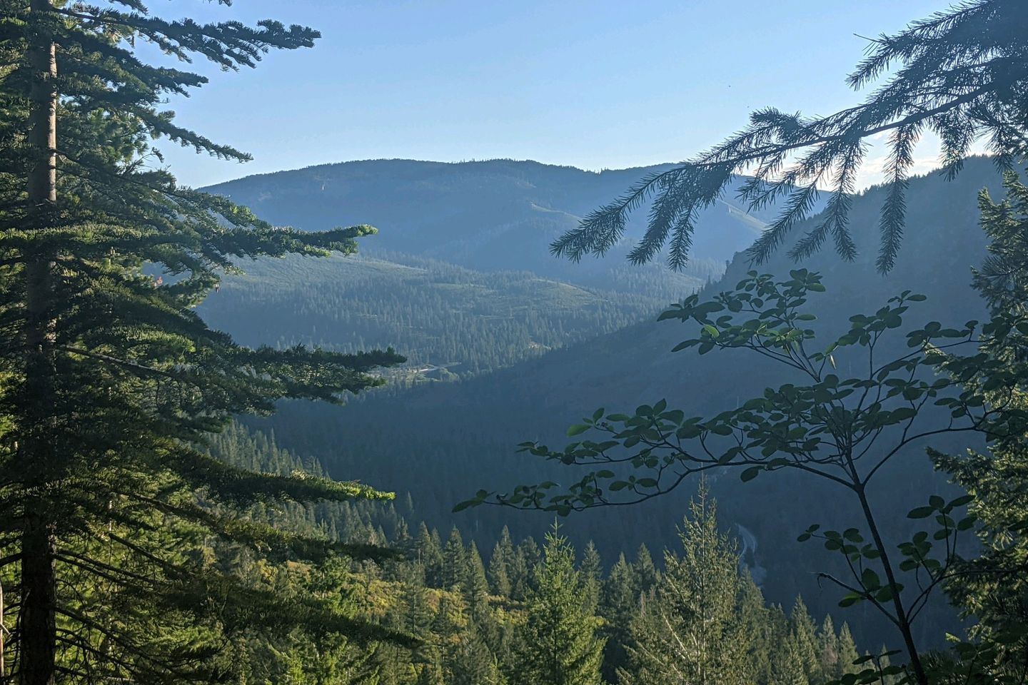
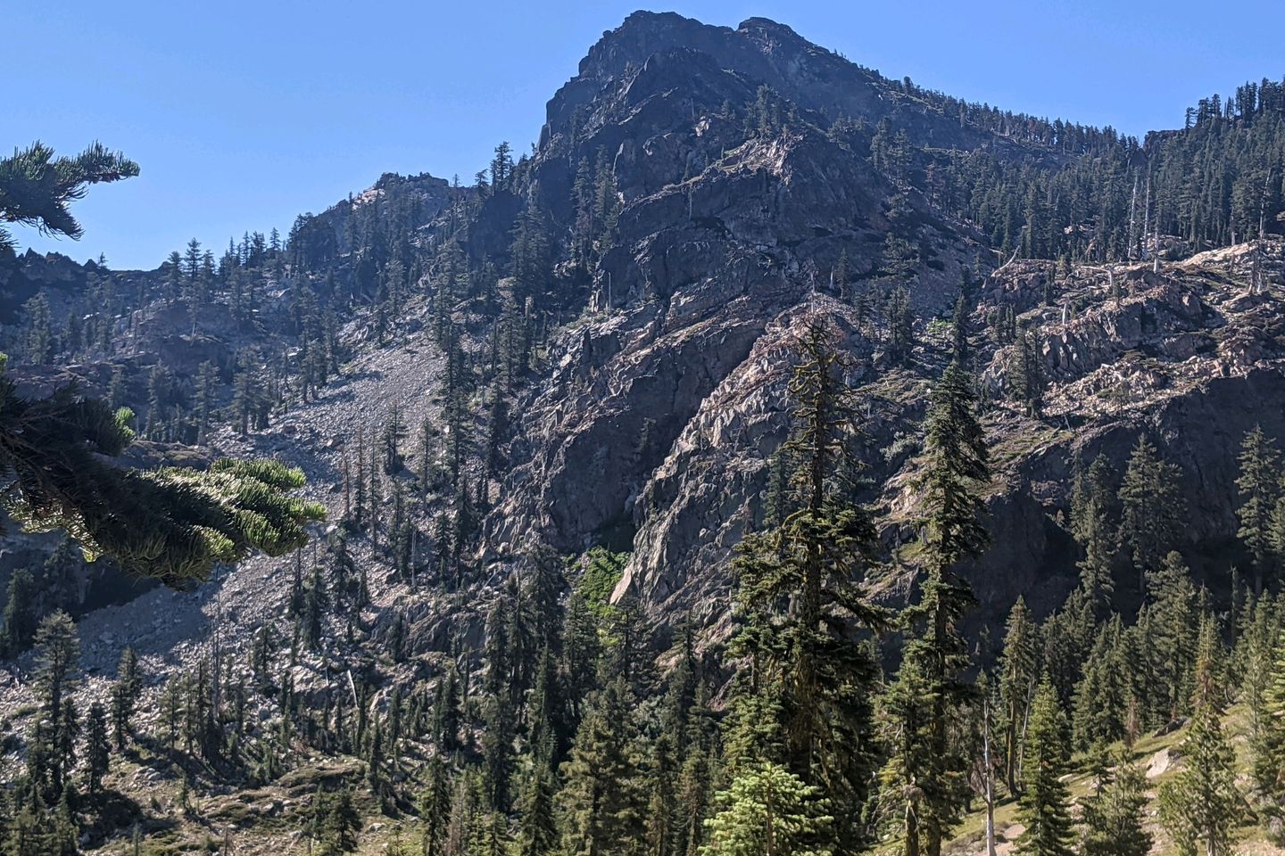
In some ways, the easiest climb of the week was the first one, the 3,100+/- foot climb from the highway outside Sierra City to the to the top of Sierra Buttes, a set of imposing volcanic outcroppings overlooking the Lakes Basin.
Of course, for Anchor and me, it seems even longer since we have a preliminary 450-foot climb during the 1 1/2-mile walk from town to the trailhead.
Luckily, we have an early start, and the Trail turns out to be very evenly graded, climbing at a steady 350 feet per mile so what could get into a real climbing rhythm, interrupted by just one rocky patch. We're also blessed by a quirk of geography that keeps us in shadow for most of the ascent so it's a lot cooler than it might otherwise be.
Wish we had that kind of luck the rest of the week, but we definitely did not.
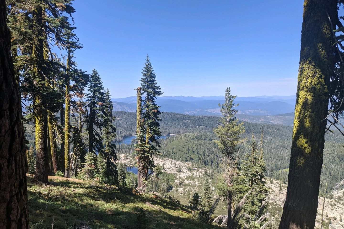
However, this climb is done before we know it (Anchor is way ahead of me by now), and the rest of the day is relatively straightforward, with some knock-out views of the Lakes Basin and up close looks at the volcanic peaks. In fact, the day was easy enough that, when we arrived relatively early at our planned stopping point, we decided to press on another 4.1 miles to the West Branch of Nelson Creek, and I didn't feel wrecked. Except for the fact that the afternoon was quite a bit warmer than usual, it was just about a perfect day.
Wednesday started similarly, but--uh oh--things changed suddenly. I got off to a good, early start, and, even with a steep climb in the morning, I covered about 13 or 14 miles before 1000, and I'm already starting to think we might be able to add some miles at the end of the day.
Ha. Haha. Hahahahaha.
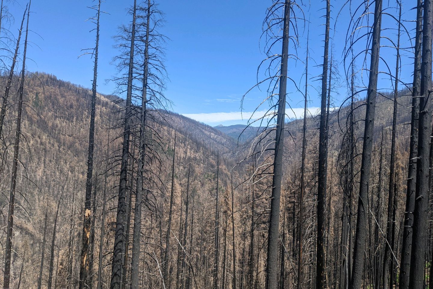
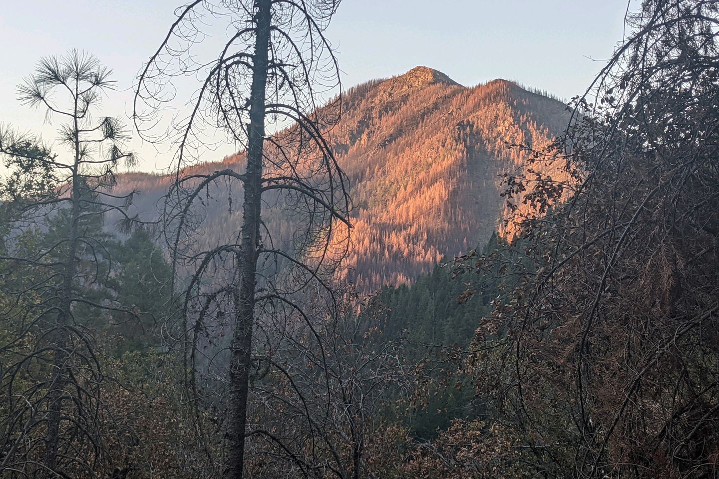
This is where the Trail turns into a gigantic poop show! Unbeknownst to me, the next dozen miles were the scene of a huge forest fire within the last couple of years. Anything resembling shade was burned away. The Trail has been turned into a firebreak, with ankle-deep dust slowing my progress. The temperatures are rising. There's no water. And I start to think about what my tombstone will say after they find what's left of me.
This goes on forever! Or at least another 12 miles. And today is hotter than yesterday.
To make matters worse, the last few miles were a steep, rocky, shadeless descent into a deeeep gorge, to the Middle Fork of the Feather River--a beautiful, fast flowing stream that we are FORBIDDEN to access because of safety and environmental concerns.
Well, if anyone from the U.S. Forest Service is reading this, that was definitely not me washing the dirt off and getting drinking water from the river. It was someone else.
This was, undoubtedly, the toughest day I have had in ovet 3,500 miles of long-distance hiking.
At 2,955 feet MSL, our campsite is at the lowest point we have been since before entering the Sierra back at the beginning of June. The air here actually feels thick.
Thursday will certainly be better, except for the fact that it begins with a 4,000-foot climb out of the Feather River canyon that is both steeper and longer than the descent into it. Geez. Every single morning this week.
Even with the climb, I make decnt time, and the only real slowdowns for the day are the heat, and the relative lack of water. The fee available water sources today all require side trips off-Trail to access them. Ugh
Anchor and I get to Clear Creek Spring late in the day and decide it's a pretty good spot to camp, in spite of a few bugs. Tomorrow, we will pass through the "town" of Belden CA, where there is a general store for resupply, and a small restaurant where we can get a meal
LOL. How do you think that went?
Friday morning is a relative novelty since, instead of starting with a massive ascent, it begins with a massive descent into another gorge. Awesome!
At least it's not terribly hot. Yet. Anchor and I make the plunge down to 2,218 feet, which is probably the lowest we have been since crossing under I-10, all the way back in the San Gorgonio Pass (over 1,000 miles ago).
We were just congratulating each other for making the 10+ mile trip before 0830 when we step up on the porch of the General Store, only to discover that it won't open for another 2 1/2 hours. Also, no restaurant until 1100.
You gotta be kidding me. There is no way we are staying around for 2 1/2 hours while the day heats up, just for an overpriced resupply and a shirt-order frozen burger patty.
I said some very bad words.
Anchor and I do a quick calculation and decide we do have enough food in our food bags to get us to Chester so we light out for the next hill, which, as you have probably already guessed, is not long in coming.
Yep. We descended into a gorge, and now we're going to climb out of it...over 5,400 feet over the next 14 hit, unshaded miles.
I am not making this up.
As a side note, it's a good thing we didn't wait for the General Store to open (Editor's Note: this is not what Otter thought at the time. In fact, he griped about missing breakfast all day and into the night). If we had waited, the climb would have been even hotter which would have been awful on a day when temperatures topped 100°F.
Our only saving grace was that water on this side of the mountain was plentiful, and we could stop every hour or so for more H2O. If that had not been true, I probably wouldn't be writing this to you now.
Even with the good water, I was praying for mercy from baby Jesus, Mary, and Joseph, and I'm not even Catholic!
The upward slog took pretty much the rest of the day, with just a little bit of descent into camp once I crested the hill. As usual, Anchor beat me to camp at Frog Creek and was well along her chore list by the time I arrive, disgustingly sweaty, grimy, and tired. Also grouchy. Today instantly replaces two days ago as my toughest day ever on the Trail. Just brutal.
I swear someone told me that the PCT gets easier for a while in Northern California and Oregon. When does that start?
Not Saturday, that's for sure. The heat continues. The big ups and downs continue. The lack of shade continues. And there's less water on the Trail.
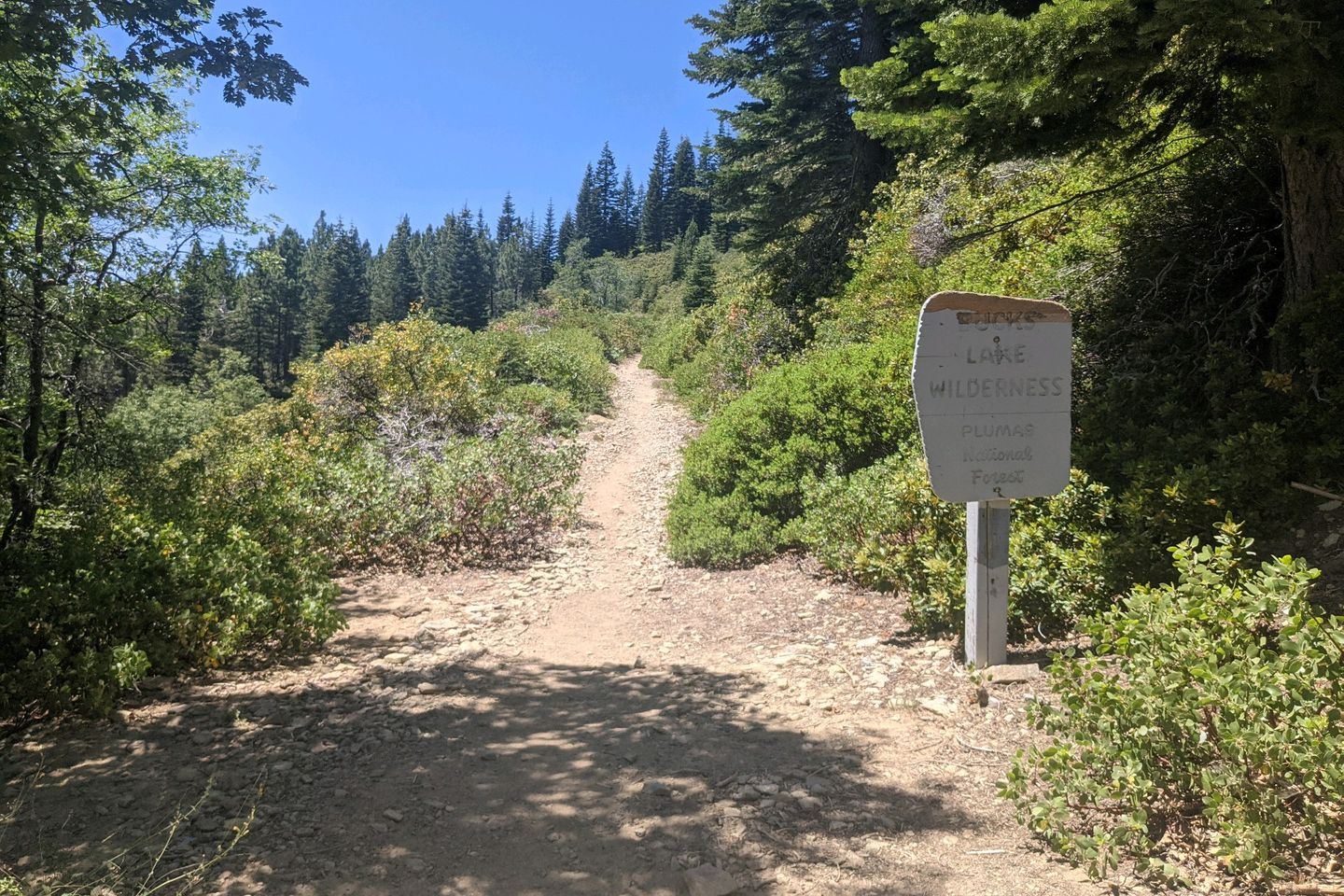
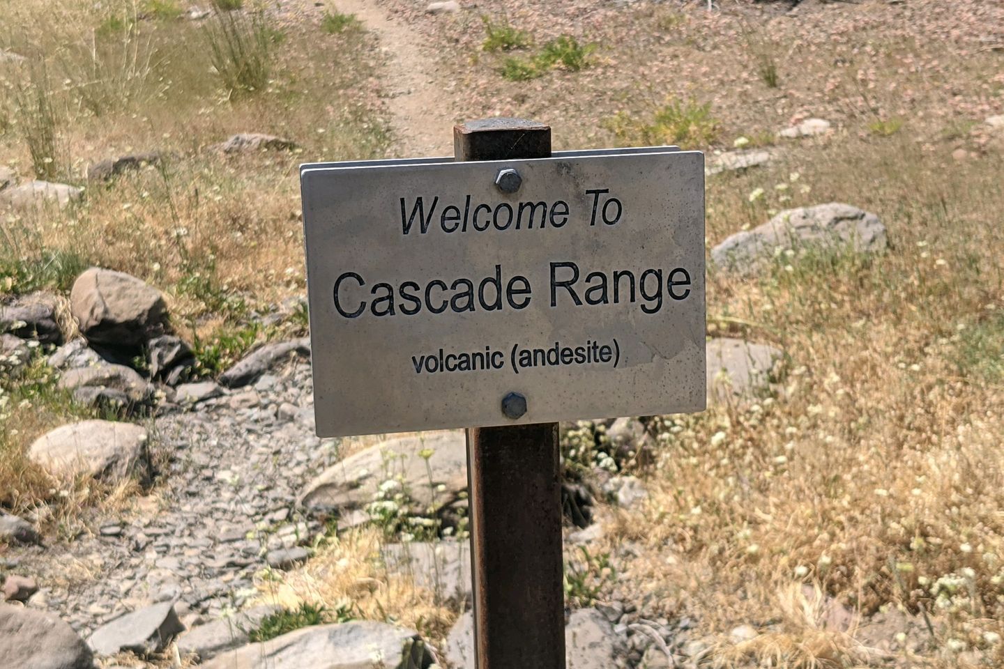
Sometime early on Saturday afternoon, we reach the official end of the Sierra Nevada mountain range and enter the Cascade mountain range. There's even a small sign welcoming us to the Cascades (a small sign on the flip side welcomes southbound hikers to the Sierra). As a geologist, I would have guessed the transition had taken place a hundred miles ago when the mountains became obviously volcanic in origin (Editor's Note: Otter is NOT a geologist. He's an aerospace engineer, and not a very good one).
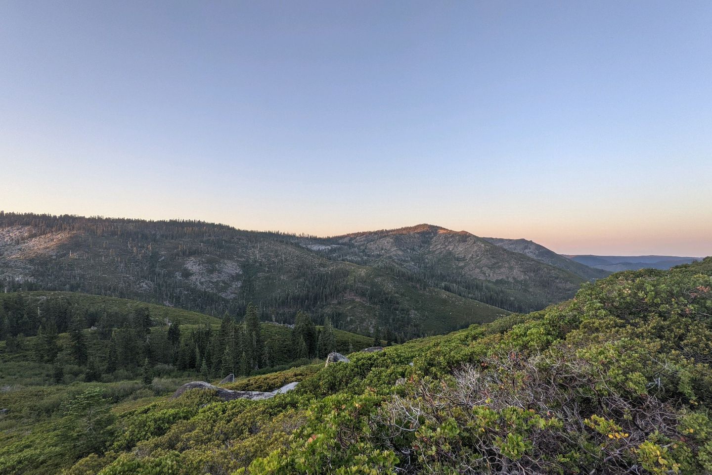
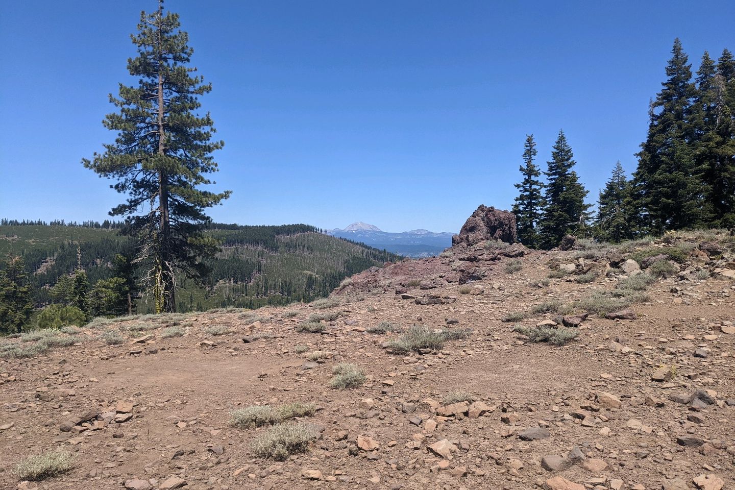
At any rate, the you can really see the difference in the terrain from the High Sierra. In the Sierra, the views were dominated by enormous, searated, rocky crags. Here, the hills are more rolling and covered in trees or other vegetation which gives them a much softer character, almost like the southern Appalachian ranges.
On Sunday, for the first day since we arrived in Sierra City, we have less than a mile of climbing during the day. Of course, we do have a 2,000-foot climb during the hottest part of the day, and the water sources are, again 10-12 miles apart. Local temperature are in the high 90s.
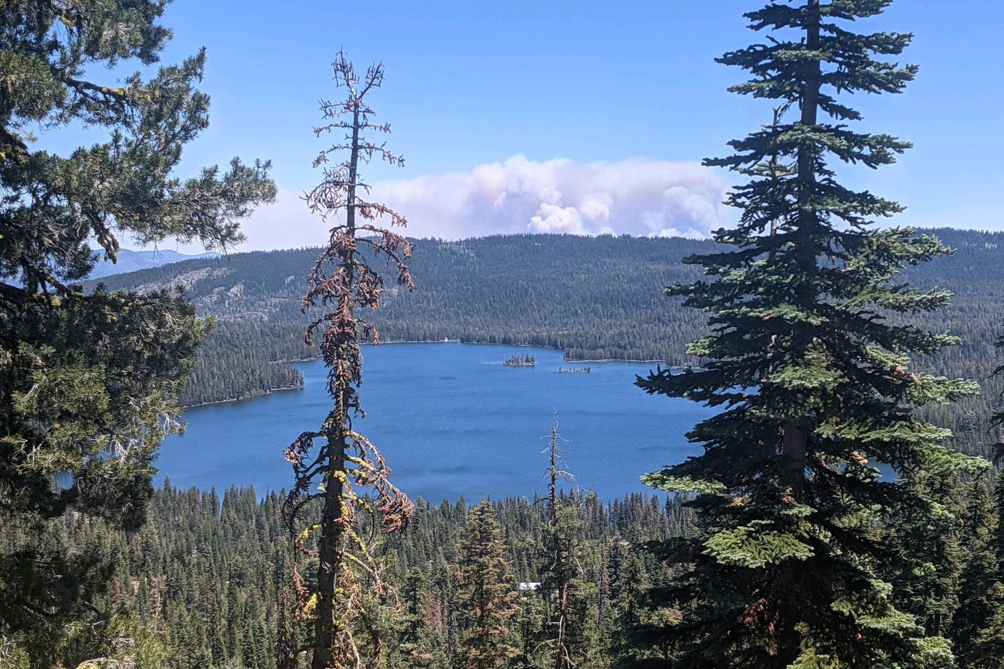
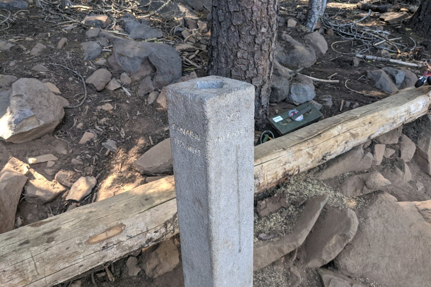
But it doesn't matter because this afternoon we reach the official mid-point of the PCT, at around 1,325 miles. Lots of picture-taking and fist-bumping ensued.
And then we hiked another 5 miles to water at Soldier Creek, which is also where we set up camp.
Monday is a short hiking day--just 3 1/2 downhill miles to California Highway 36 where we wait for over 90 minutes for a hitch into the town of Chester for resupply and a down day on Tuesday.
Also, we eat all the food.
Honestly, for the first time at the end of a segment, I am wrecked. I'm really hoping for lower temperatures and a little less daily up-and-down when Anchor and I resume hiking on Wednesday.
Colonel Sanders rolls through on Tuesday, after spending some time with his wife off trail. He is now probably half a day ahead of us.
Baewatch is somewhere within a day of us (ahead or behind)
Catch is currently well back, nursing shin splints. We're in daily contact via text message or Garmin InReach. Anchor and I both hope there is a way to rejoin with her.
We watched the 2021 Major League Baseball All-Star Game tonight, and it reminded me of the time I hiked through a thunderstorm to the Allenberry Resort in Pennsylvania to watch the 2017 All-Star Game. We could definitely use the rain here and now.
Anyway, that's all for this segment. Tomorrow (Wednesday, 14 July) we'll start hiking again, headed toward Dunsmuir CA, which we should reach in about a week.
Until then, we'll be safe, dry, and warm (but hopefully not as warm as we have been the last several days).
Miles Hiked This Entry: 138.0 Total Miles Hiked: 1,331.3
Sea Otter Fact of the Post:. Interesting new research shows that one way sea otters stay warm in the chilly waters of the Pacific Ocean is that their mitochondria leak heat directly into their bodies rather than converting all their food into cellular energy. Read more about it here: https://www.sciencenews.org/article/sea-otter-warmth-mitochondria-muscle-metabolism-biology
Previous: Jul 6th, 2021
Next: Jul 21st, 2021
Comments (4)
@screetahoe, yes, the heat is murder, but the only solution is to section hike to get more favorable weather, at, as an east coast guy, that's not in the cards for me. But I definitely, definitely recommend section hiking over thru hiking
Chris it is been very fun reading through your Journal and I love that you called it a procrastinators journey. I thought of The Hobbit when I saw this and thought, "There and Back Again... someday." It is been great to scroll through the different events and take a look and I hope you're having a blast. Professional hiker? Can definitely see those Army tendencies in you occasionally, and I mean that with all due respect. Looking forward to seeing the next 79 days. StayWell, stay safe and happy trails.
Otter! Cody's mom and Jean's mother in law here. Enjoying your PCT trails and tribulations. You picked hottest year on record, I think! Sorry to have missed seeing you in South Lake Tahoe. This has been my fave post of all. Sounds just brutal though. Really really good reading. Drip drops are my go to life saver. Stay safe and well. Cynthia Kendall


@Wedillard, hahaha. You know my tendencies all too well. Hope your air conditioning is working. I know it's even hotter there than here! Stay cool (and stay in touch!)