2021 Continental Divide Trail Thru-hike

7
Aug
2021

Day 104 (August 7, 2021)

1711.6 to 1719.6 (8.0 miles) The winds died down right after sunset last night so I ended up with a good night’s sleep. It was cooler than expected this morning; we got a little spoiled with the warmer night temperatures across the Basin. The reduced visibility from the smoke persisted. I could not see the sun this morning until 30 minutes after sunrise. The first couple of miles continued on the road we chose to parallel the ‘bad’ trail until the trail crossed the road. It was nice to get on real trail, but it was mainly just markers leading up a rocky ridge. The geography was definitely changing at this point, and it made sense. South Pass City had been a gold boom town, with mining in these hills. I scared several groups of pronghorn as I came over small rises. It is cool seeing them close up, even if only momentarily as they run off. The trail on top of the ridge was very rugged sharp rocks. Tough to walk on but beautiful at the same time. The trail went up and down and followed close to a small stream then up again. We started seeing signs of the old mining activity. The trail climbed steeply up a rocky hill and dropped very steeply into a small valley with a creek. Here there was lots of evidence of old mining; mine waste piles, wooden beams etc. The trail had some markers that evidently had signs in the past describing some of the mining activity. We crossed a small creek on a decrepit bridge and were suddenly at South Pass City historic area. The historic area has restored and replica buildings from the gold boom era, starting in 1867. (Interesting fact: the first female justice of the peace anywhere was in South Pass City). We had arrived earlier than expected, so took our time wandering through the historic area before meeting my dad. I heard my dad in the parking area as I approached. Awesome. I introduced everyone and we went to the small store and got cream sodas and sarsaparilla. Then he brought us to Lander for a planned zero tomorrow. There I got to see my mom as well. Thank you mom and dad!

Day photo preview 1
Day photo preview 2
Day photo preview 3
Day photo preview 4
Day photo preview 5
Day photo preview 6
+1
8.0 mi
·
20,585
6
Aug
2021

Day 103 (August 6, 2021)

1690.8 to 1711.6 (20.8 miles) Surprise - another thunderstorm last night. It really was a surprise. I woke up at 2 AM to see lightening and darkness rapidly approaching from the west and zipped my outer tent door. We got some pretty intense winds and heavy rain, but it didn’t last for long. At least the morning was beautiful and calm and the storm had abated long enough for my tent to be mostly dry. Again the morning was cool and calm for good hiking weather. The first goal was a water source called Mormon Springs. The highlight of the day for me was seeing concrete markers for the Oregon Trail! Most of the day was spent hiking a part of the Oregon Trail, or more correctly, the Seminoe Cuttoff of the Oregon Trail. (The Seminoe Cutoff avoided several crossings of the Sweetwater River during high water times.) Mormon Springs had great water, but was a little hard to locate exactly. The spring itself is not fenced off and is on the backside of a low mound/rock formation. It is not obvious from the trail. The water was cold and clear and much appreciated. We had decided that we would all meet up at a bridge over the Sweetwater River late in the day to decide where to camp. Our original plan (from several days ago) had been to camp at the Sweetwater. But we felt now we could go further and we had motivation to do so; my dad is meeting us at South Pass City to bring us into Lander. We don’t want to be late for that and want to have less miles to cover in the morning. The trail left dirt roads for a while to follow along the bank of the Sweetwater River. I loved this as the river is important historically as the water source for the Oregon Trail after it leaves the North Platte River west of Casper, Wyoming. I found Feral near the bridge, laid back in a chair under a portable awning. T, supporting his wife, had set up there and was now welcoming us. Thank you. We waited for Pockets and Just Jim to make a decision for where to camp. We all felt good (even my left shin was less sore than normal) and we decided to push on another 7 miles to leave an easy 8 miles to South Pass City tomorrow. We also decided to follow the recommendation of previous hikers and not follow the redline of the CDT for the next several miles but instead use a dirt road that closely parallels the trail. Many have commented that the trail in this area is not really a trail but just some markers occasionally in the sagebrush. We picked a spot along the road to meet and find the nearest open area in the sagebrush to camp. Feral and I set off first from the bridge. We did a little cross-country route of our own to cut off a big 90 degree bend in the road. The hiking went well, but we started noticing a change in the conditions. Darker clouds were forming behind us, but also the visibility was dropping. The visibility had been reduced somewhat all across the Great Divide Basin from wildfires in California, but only a little. Now it was dropping quickly. Feral found an open area just prior to our planned spot that was too good to pass. As we set up our tents, the winds picked up and became gusty. No fun. But, eerily, a wall of reduced visibility approached. It looked like rain at first but then we realized it was smoke. As it reached us we could smell the smoke and the sun turned red. Since I had coverage, I was able to find out this was predicted, as a high pressure system moved in. That was a relief since the sudden change could have indicated a nearby fire. Pockets and Just Jim had spent some time visiting with T so were a ways behind. Unfortunately, that meant dealing with the wind and smoke while hiking. They arrived ready to set up. Who knows if it will rain tonight. But it is exciting that I get to see my parents tomorrow along with it being a town day!

Day photo preview 1
Day photo preview 2
Day photo preview 3
Day photo preview 4
Day photo preview 5
Day photo preview 6
+1
20.8 mi
·
47,177
5
Aug
2021

Day 102 (August 5, 2021)

1667.9 to 1690.8 (22.9 miles) I have become bad about taking pictures. Only two today. Sorry. The big first important goal today was to get to a water cache 12 miles from our campsite at the cow ponds. And we were motivated to make it quickly because of the poor quality of the water from last night. We generally need less water during the morning hours too. Normally I am the first out of camp since I am the slowest hiker but Feral beat me out this morning. And it didn’t take long for Just Jim and Pockets to pass me. The race was on. The weather was clear with moderate temperatures again, but warmer. Nothing much to report from the morning hike. I missed a turn when the CDT joined a major dirt road for a short distance and kept hiking up the road. Realizing I should be seeing the water cache I checked the map and saw my mistake. I turned around to find where the CDT diverged from the road. I hate bonus miles. The water cache is interesting. It was built specifically for CDT hikers nearly in the middle of nowhere. It is a corralled enclosure with a large information sign showing water sources across the Great Divide Basin and two boxes where water jugs are placed and usually some candy; we had suckers. Someone had also placed a water jug with cold water in it apparently not long before our arrival. It was awesome. We have heard it is a church group that maintains the cache. Whoever it is, thank you. Having plenty of clean water also allowed me to back flush my water filter, which was badly needed after the cow ponds last night. It was totally gross seeing what came out of the filter. The good news is that it filtered all that stuff out in the first place. The afternoon trail was more interesting, and where I should have taken more pictures. The last several miles before reaching the next water source and potential campsite had more up and downs and interesting red rock formations. And it also got very windy. In my estimation, we had been lucky with the winds across the basin. Now we got to see what they could do. A steady moderate wind is mentally fatiguing both because of the sound and the adjustment of your gait to accommodate it. And there is no real cover to get away from it. The water source is called Weasel Spring. (It is hard to imagine seeing a weasel out here.) It is in a seemingly odd location as it was in a narrow rocky ravine after climbing up a short but steep rocky hill. It is in a large fenced area and again had a metal culvert to collect clean water. We had decided to camp at the first good site past the spring. There was a large meadow-like area free of sagebrush shortly past the spring. It was still difficult to find a spot as it turned out much of the area had small mounds formed by tufts of grass. And some of the smooth areas had some type of grass with hard stems. Additionally, we wanted some protection from the wind. We found some acceptable spots near a short rock formation and set up. The good news was that the wind died down toward sunset (as it often does). It is so pleasant, I decided to sleep with my outside tent fly door up to see the stars.

Day photo preview 1
Day photo preview 2
22.9 mi
·
53,233
4
Aug
2021

Day 101 (August 4, 2021)

1644.6 to 1667.9 (23.3 miles) Our campsite last night did protect us from the wind, but we ended up with condensation. It made sense in retrospect. We were in a low spot below the reservoir and downwind. In the Basin with condensation. We just can’t win. No clouds today, but still moderate temperatures for August so I can’t complain. The first goal was a piped spring with no name. The trail in the morning had long sections of sand of various depths. The deeper it was, the harder it was to walk. Fortunately, several of these sections had worn hard paths next to them where cows had walked, so we used them. The piped spring was great. It was flowing well with cold clear water. It was a long carry to our campsite near a pond this evening, but with good quality water. There was more hills in the afternoon , but that at least meant the occasional tree. For me this day was not very memorable for some reason. Nothing bad, just nothing great. I had to work harder mentally to get in the last miles. I got to the cow ponds, our desired campsite first. It was not pretty. Though there was lots of water, they were stagnant with no inflow or outflow. And the shores around both were muddy and, well, cow fouled. We had little choice but to get water due to our long carry from the piped springs and it was twelve more miles to our next source. I gathered some water and filtered it. Before filtering it looked like Gatorade. After filtering it still had a yellowish hue to it. Here’s hoping the filter got all the nasty stuff. My filter slowed down noticeably as I filtered. I can’t wait to get to the next source for some clean water. Also, the ponds were in a valley with few flat spots to camp. We spread out and kicked away dry cow patties at our spots. Not great, but we have what we need. And we had some great motivation to move fast to the next water source in the morning.

Day photo preview 1
Day photo preview 2
23.3 mi
·
53,331
3
Aug
2021

Day 100 (August 3, 2021)

1620.6 to 1644.6 (A&M Reservoir) (24.0 miles) Well, maybe camping on cracked clay soil wasn’t the greatest idea. No thunderstorms last night, but a steady rain developed early in the morning hours and stayed steady for several hours. It was enough to puddle up in places and turn the top half inch of soil into a sticky mess. Yuck. And the Great Divide Basin is supposed to be dry? After packing up the wet and muddy tent, I again took off first. My shin was far better than expected but still hurt. Thank you ibuprofen. The first part of the trail was an old paved surface, but that quickly turned into dirt/clay. Hiking in that when wet is miserable. The wet clay sticks in layers to the bottom of your shoes and cakes up thick until there is too much and it falls off and starts over. Even worse, it does this unevenly on each shoe and between shoes. For example, the right shoe may shed the front half and still have a thick layer toward the heel while the left shoe has a moderate layer all across. It’s a horrible feeling. Stopping to attempt to scrape it off has no practical effect; within two steps it starts all over. The only good news was that the trail was intermittently sandy. Usually I don’t like hiking in sand, but it is far preferable to the wet clay. What a choice. There were a lot of left over clouds and a light breeze that kept it cool, so it was not all bad. There were lots of pronghorn to see all day. And something new - our first SOBO hikers. We talked to several. These are hikers who started in mid-June (early for a SOBO CDT) and have been crushing big miles. The only bad news is this is kind of far south for us to be seeing our first SOBOs. We are definitely behind. The wet trail lasted longer than I anticipated but gave way to drier conditions eventually. There were some sections with deeper sand, but nothing too bad. Our first goal of the day was a water source named Bull Springs. The terrain was more varied than I had pictured. There were some small up and downs with changing rocks. I liked it. And the mostly cloudy sky kept it cooler than normal. Bull Springs was in a small valley with very much larger sagebrush, some higher than me. This spring had a solar pump feeding a small pond and a culvert pipe in an enclosed area. Perfect. Though it was a little early, I ate lunch there as well. Just Jim and Feral showed up as well. After our break, it became obvious we could be in for afternoon thunderstorms. We hoped for the best and pushed on. The next stretch was much flatter and straight. I could see the trail ahead for many miles until it disappeared over a rise. That turned out to be mentally hard. Sometimes it felt like I was making no progress, with that trail on the hill seemingly not getting any closer. Yep, still a long way to the hill.... Thunderstorms did develop around us, but we always seemed to be just on the edge of them, with only a drop of rain or two. Actually some good hiking weather. I ran across J taking a break in the afternoon and we leapfrogged each other for the remainder of the day. Our goal for the day was a big water source, called A&M Reservoir. It was built with a joint effort by an oil company and outdoor enthusiasts to provide some fishing opportunities in the basin. Seems odd out here, but it is next to a major, well maintained dirt road that makes it accessible. My shin was OK, but grew more painful with more miles on it. It especially hurts on descents towards the end of the day. We did eventually reach the hill and made the descent toward the reservoir. It had became somewhat windy by now. There were some campsite possibilities on the edge of the reservoir but they were exposed to the wind. We chose to set up camp in a large ravine that led from the outlet of the reservoir and had a shelf just large enough for us and provided some wind protection. Hopefully no rain tonight. Edit: Today is my 30th anniversary! Thank you for being so supportive and sticking around so long. I love you Karen.

Day photo preview 1
Day photo preview 2
Day photo preview 3
Day photo preview 4
Day photo preview 5
Day photo preview 6
24.0 mi
·
59,579
2
Aug
2021

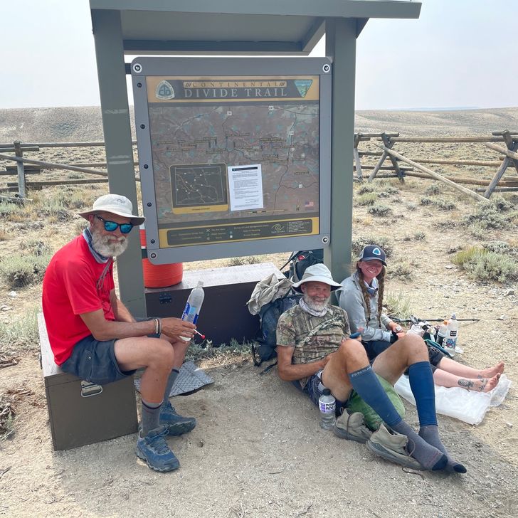
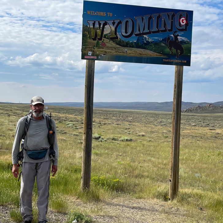
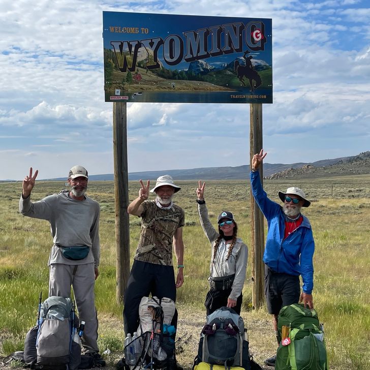
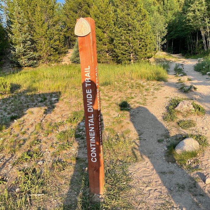
Day 99 (August 2, 2021)

Rawlins Econo Lodge to 1603.6 to 1620.6 (18.5 miles) 
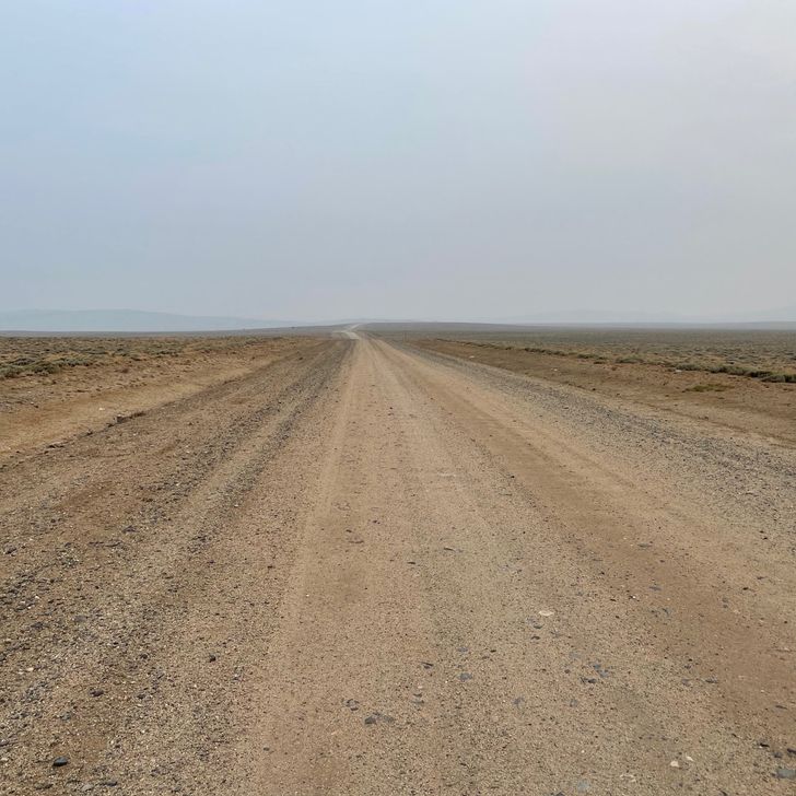
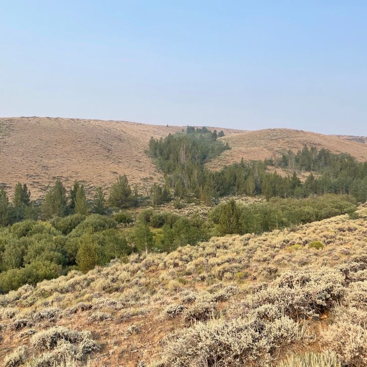
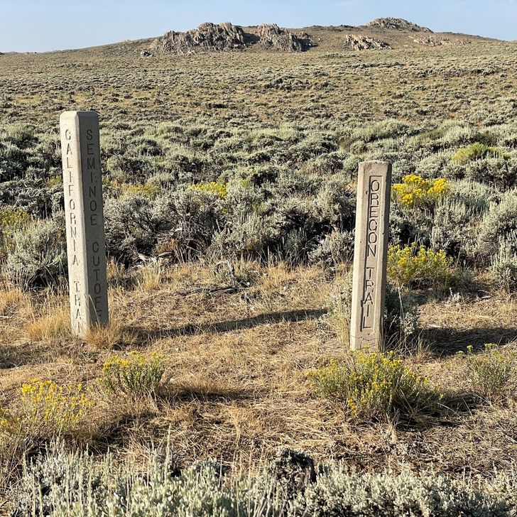
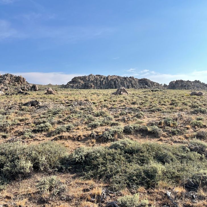
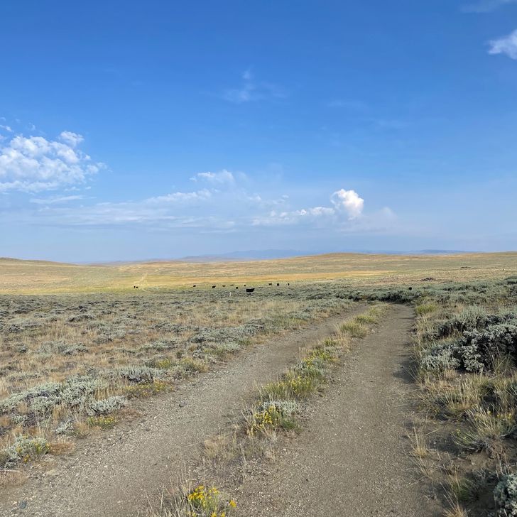
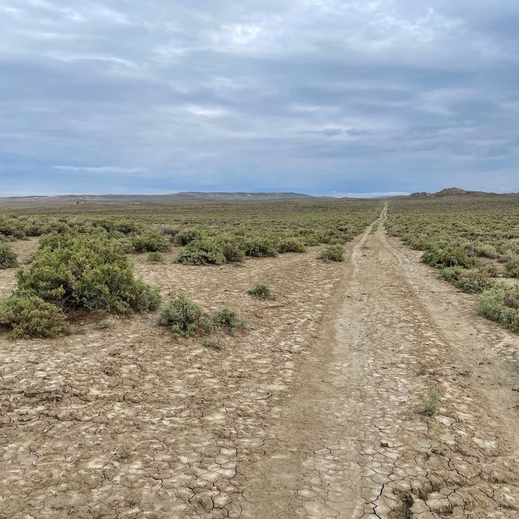
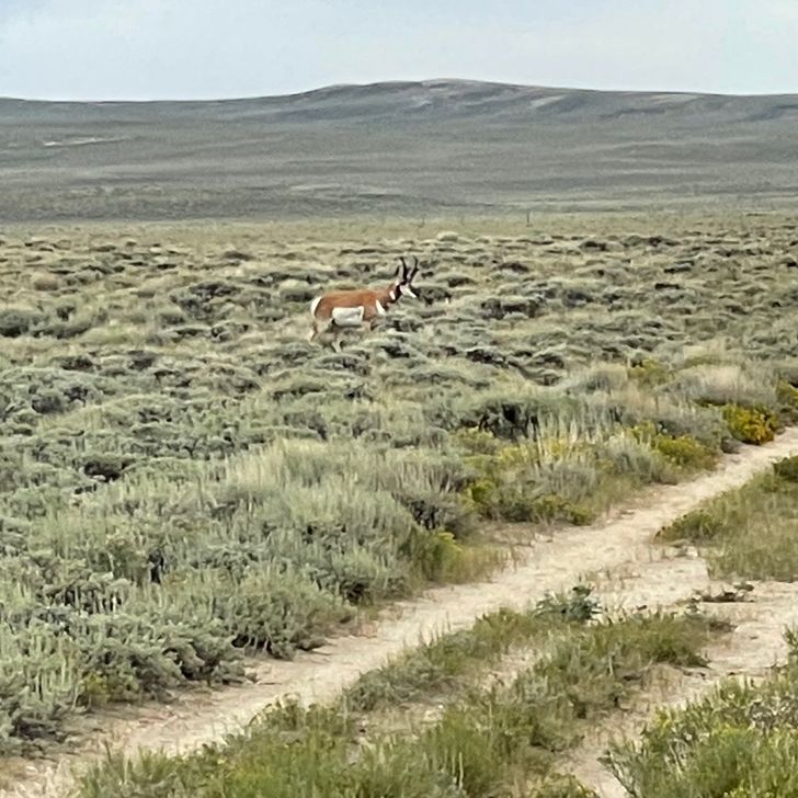
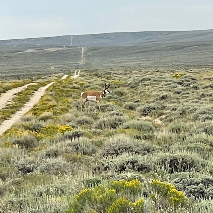
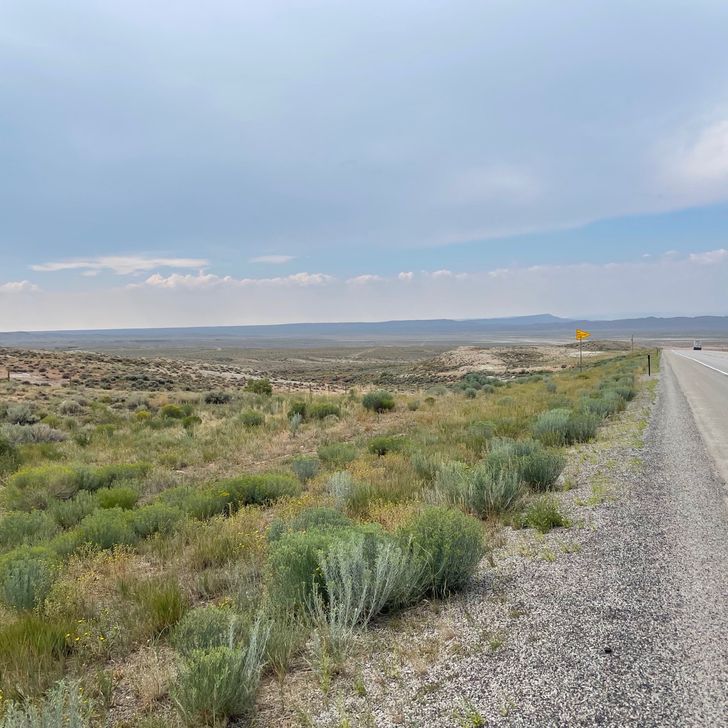
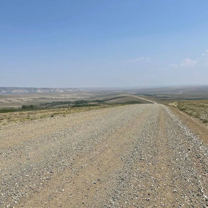
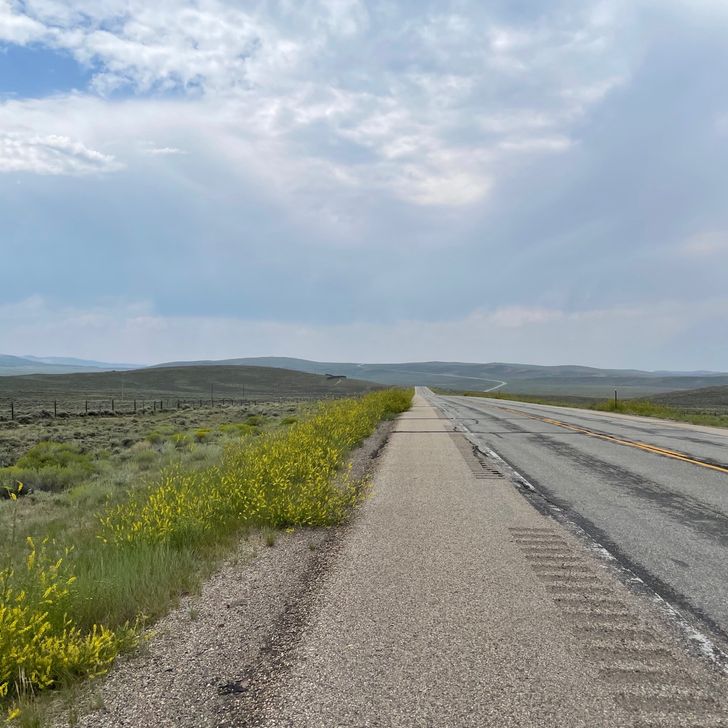
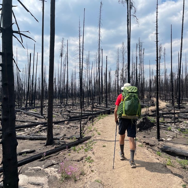
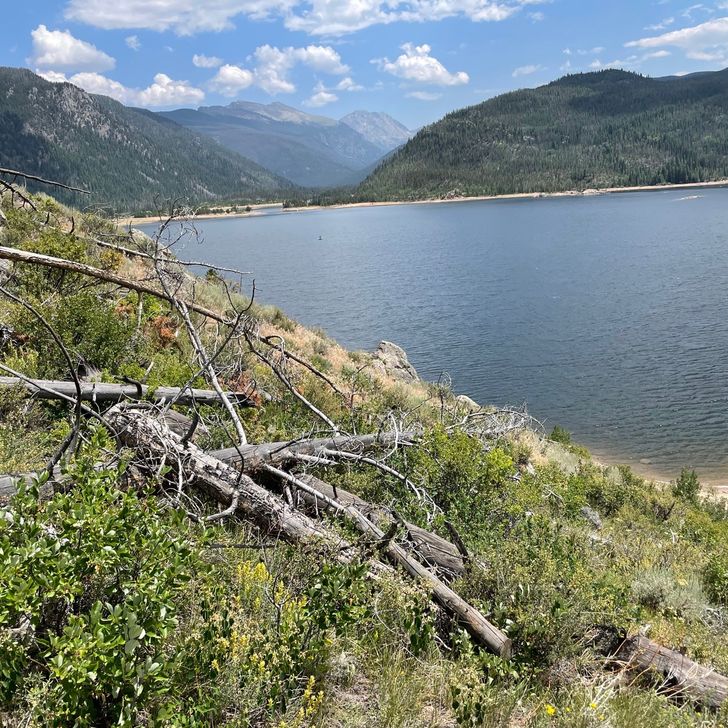
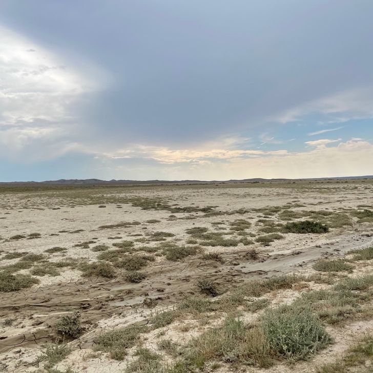
Back on the trail today, into the Great Divide Basin. This section is somewhat notorious on the CDT for several reasons. First, it is wide open sagebrush and desert like. Trees are rare. Second, it is mostly dry. You get spoiled in Colorado (NOBO) with not having to think a lot about water. Now we are back to planning longer water carries like back in New Mexico, and may have to deal with less-than-desirable water sources. Third, Wyoming can be windy and you are exposed to any thunderstorms. Last, it is one of the longer sections without resupply, about 120 miles. However, the trail is mostly dirt roads or two-track Jeep trails and has much less vertical on average. Because of this, some hikers will complete a 24 hour challenge, where they see how many miles they can complete in one 24 hour period while in the basin. We are not going to do that. Our plan is based mainly on available water sources to avoid dry camping where we can. 
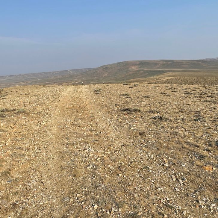
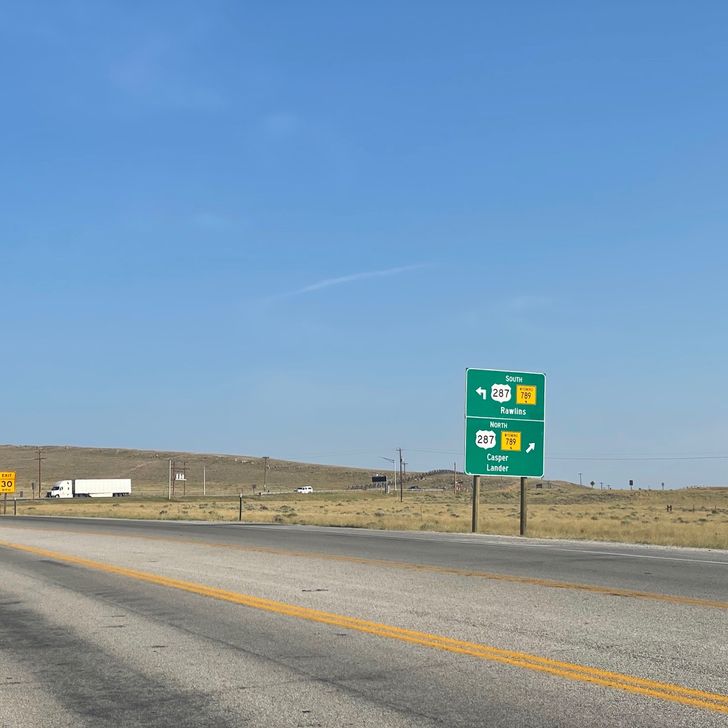
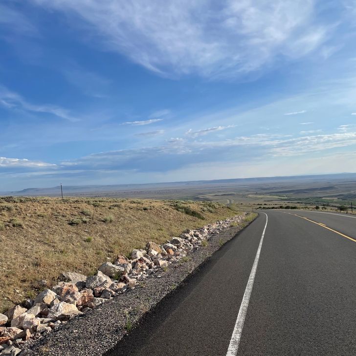
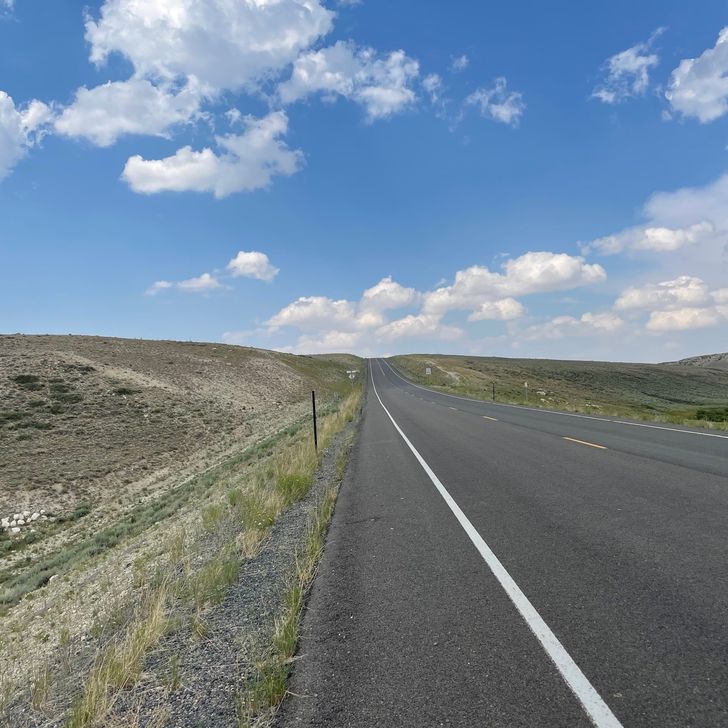
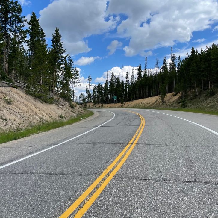
I got hiking first since I am concerned how my shin will do. The first 15 miles of the hike once outside of town follow alongside a highway, but not right on it. Then the trail turns away and runs mostly northwest across the basin. My shin felt far better than several days ago, but was still sore. But I hiked at a decent pace. Our goal today was a spot near a BLM campground about 3 miles after the trail turns away from the highway. There is one water source along the way. The first night will be a dry camp, which requires having enough water to reach the next source and for supper and breakfast. 
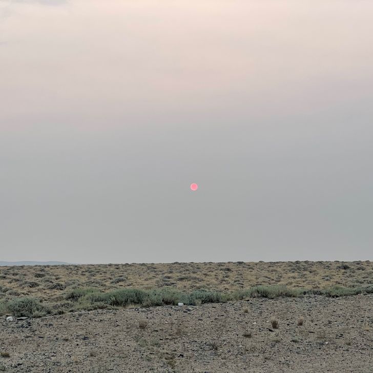
Overall the hike went well for me. The weather was clear and cooler than normal for most of the day. The trail was far enough from the highway that you couldn’t see it at times. I was careful to stop and stretch more often, and take ibuprofen occasionally. 
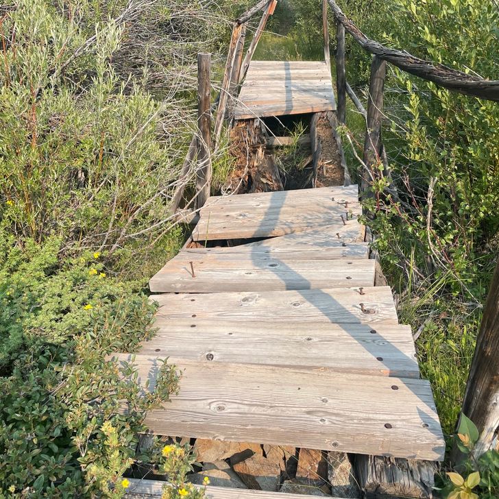
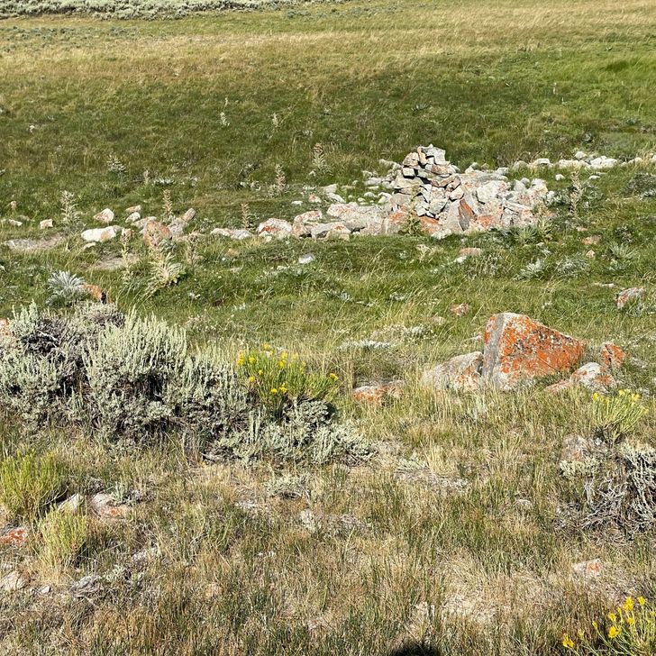
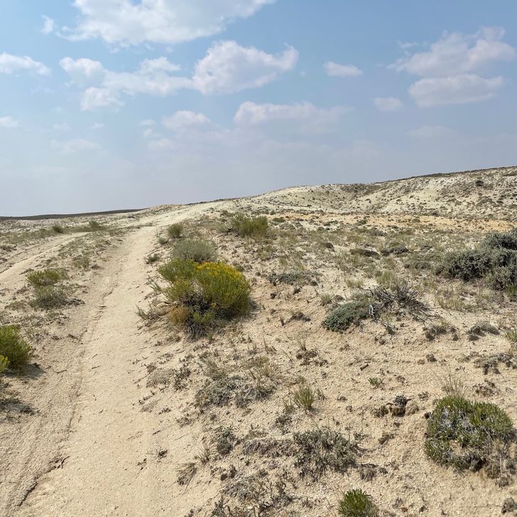
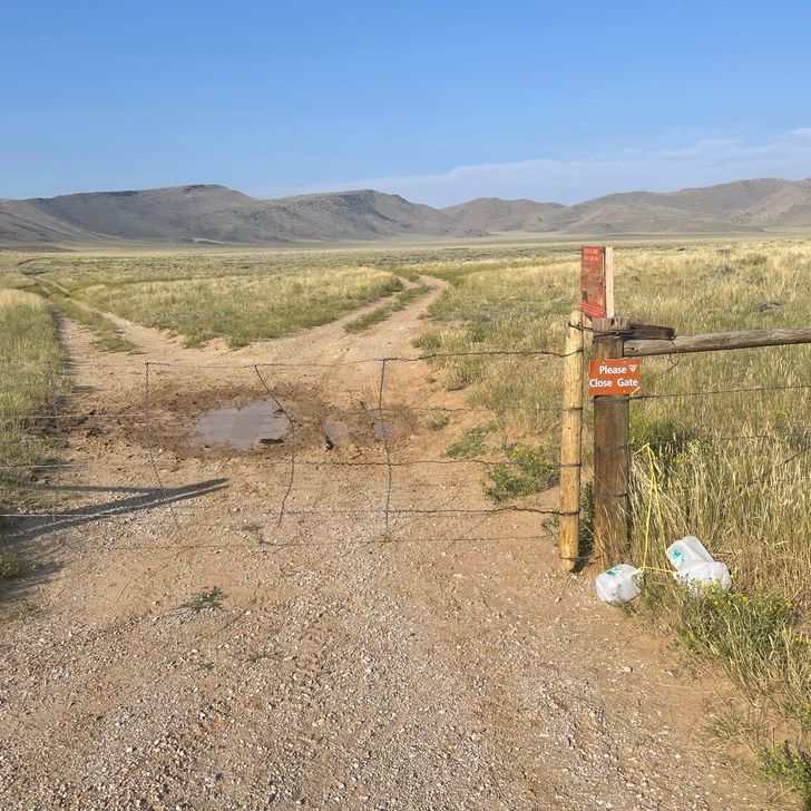
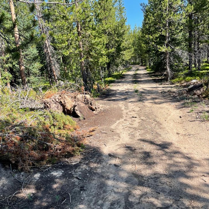
The CDT was back to some of its old tricks. It would be along a road for a short time, then take off cross country without a sign. But if you looked carefully across the sagebrush, you might see a small marker in the distance. Many of the markers had been blown down. At one point our map showed a gate at a fence line. But there was no gate. Pack off and under the fence. Things like this don’t even bother me any more; it’s just the CDT. I looked quickly both directions to ensure there wasn’t a gate nearby and then just went under. Pack on, and off again. 
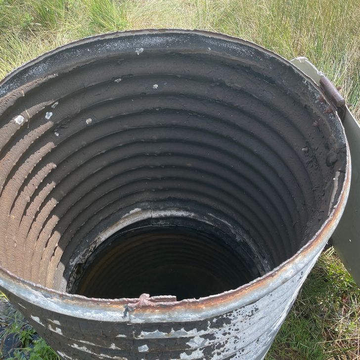
The water source was called Fish Pond, which was enclosed by a wooden fence to keep cows away from the spring itself, though water flows from the area to a pond for cows. Within the enclosure was a piece of metal culvert set vertically with a lid that collects some of the water and prevents bugs and debris from fouling the water. Good, fresh, cool water. It is 16 miles to the next water source, so I collected 3 liters for that, plus 1.5 liters for camp. Additionally, it is always a good idea to ‘camel up’ which simply means drinking some water while at the water source. I normally drink about a liter, spread out over 30 minutes. It was time for lunch anyway. 
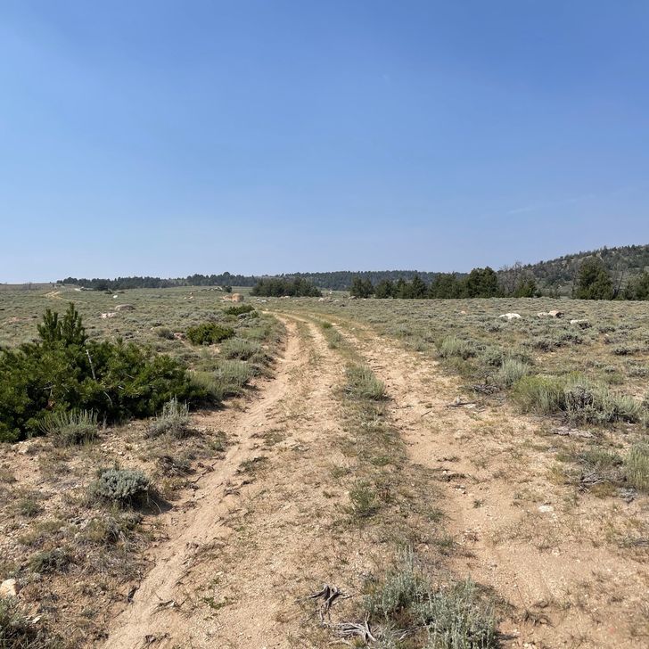
The trail followed the highway more closely as it became constricted by narrowing terrain and descended to where the trail departs the highway for good. We had reports that the first several miles of trail at that point were not marked at all and was in bad shape. We elected to go a little further on the highway and follow a road that intersects the CDT slightly past the bad section. 
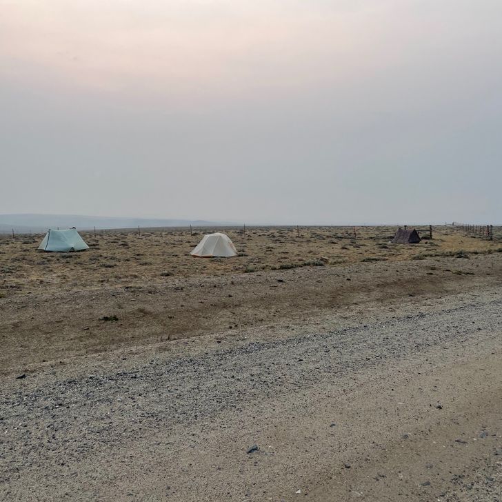
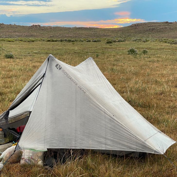
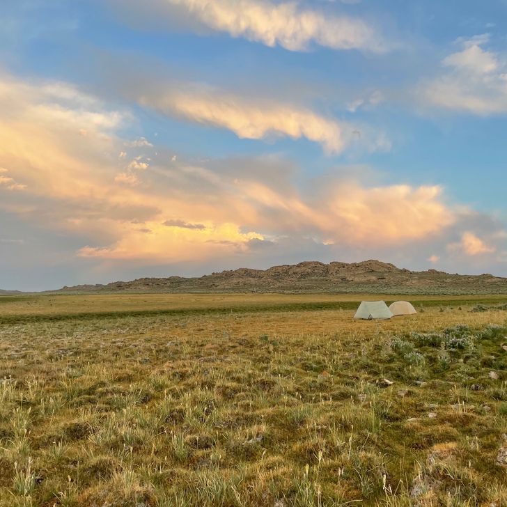
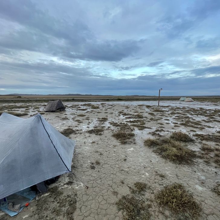
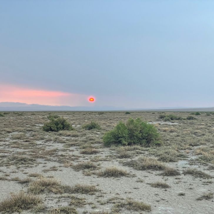
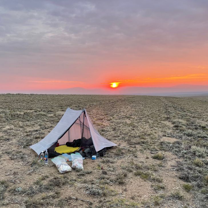
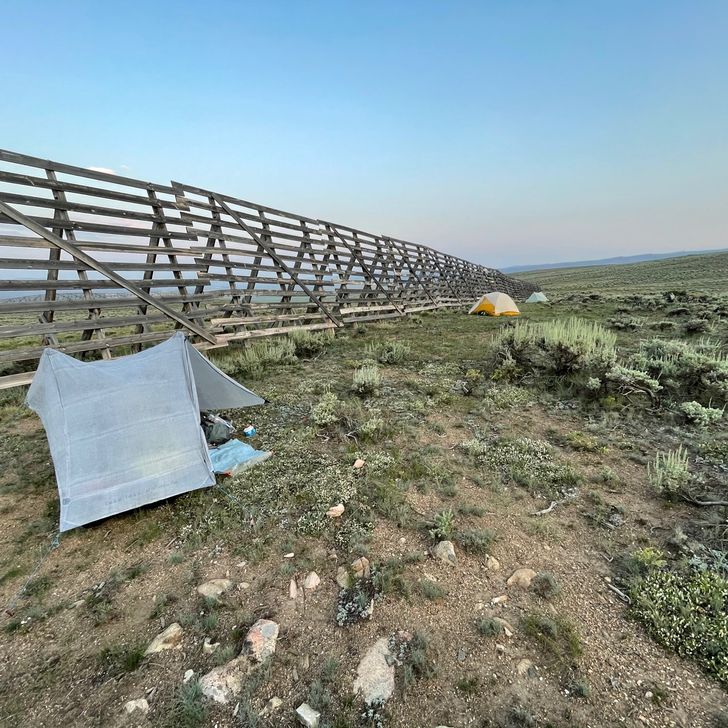
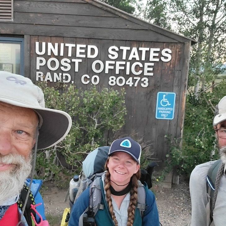
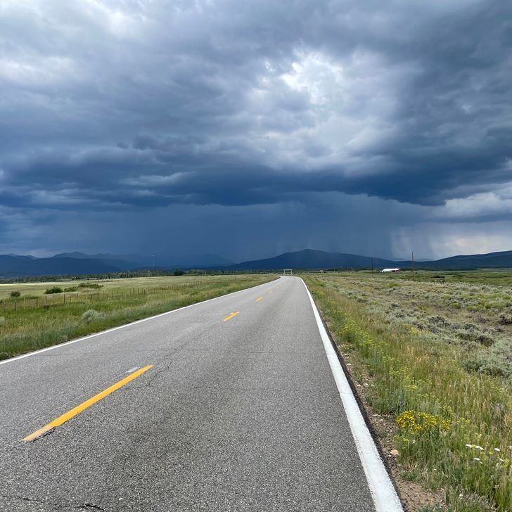
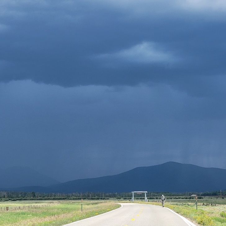
With the trail descending into a wide open area, I could see our campsite area for an hour-and-a-half before I got there. During this last part, thunderstorms could be seen developing north, west, and south of me, but it remained sunny where I was. I reached our goal before 5:00. Just Jim and Pockets had waited for a shop to open in Rawlins before departing and Feral had relaxed a little longer in town before starting. I was unaware of this, so didn’t set up camp, waiting for them in case we decided to go further. While waiting, the man who was supporting his wife in the CDT drove up and stopped to talk. His trail name is T, and hers is J. She had selected a campsite about 1.5 miles past ours and would be by shortly. 
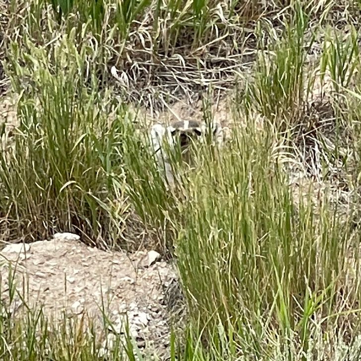
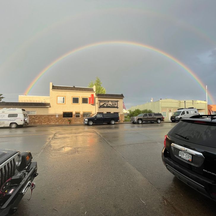
When the gang all arrived, we decided to camp at our selected spot, since there was open ground, though it was a crusty clay mixture. Nearby storm clouds were dissipating and created some good photo opportunities. Then a group of wild horses almost walked through our camp. This is something I had been wanting to see, and Pockets was ecstatic to see them. An overall good day of hiking.

Day photo preview 1
Day photo preview 2
Day photo preview 3
Day photo preview 4
Day photo preview 5
Day photo preview 6
+7
18.5 mi
·
45,287
1
Aug
2021

Days 97 and 98 (July 31 and August 1, 2021)

Double zero in Rawlins Per doctor’s recommendation, and as it worked out for my hiking partners, a double zero for me. My hiking partners were still on trail and spent one more night out and came into town yesterday. Their stories are the most interesting. That additional night was rather miserable for them with the thunderstorms. Feral spent that night at a campsite with a privy at it. Bottom line: he ended up sheltering in the privy due to the severity of the storm at his location. (See his You Tube video, “30 July on the CDT: Storms: Night Three” and the next one.) Pockets and Just Jim were several hours behind Feral. They had decided to hike into the night in order to catch up a little and to possibly see some meteors. They could see storms ahead and to the side of them that were not threatening them. But at one point Just Jim looked behind them and only saw blackness. Very shortly after, the downpour started. They got soaked. And so did the ground. They had to set up in the rain in an area with a clay-like surface that was sticking to everything. And the had difficulty putting in their tent stakes. Let’s just say they were all happy to get into Rawlins yesterday and take a day off today. Also, my brother showed up again! It was great to have a chance to visit and to have some wheels to get around town. Thank you! We had pizza delivered to the hotel this evening which was fun and delicious. We are planning on 5 1/2 days to cross the Great Divide Basin. It is dry, so our hiking plan is focused on the known water sources. Spirits are high. My shin feels better, though still sore and stiff. Here’s hoping it doesn’t slow me down.There isn’t very much vertical on the trail between here and Lander, so that should help. One more piece of news: my parents have decided to meet us for our stay in Lander! This is their first big trip away from home since COVID , so is a big deal for them as well.

30
Jul
2021

Day 96 (July 30, 2021)

7.0 miles on highway 71 towards Rawlins. Not a good day. First, we got winds from passing thunderstorms again last night. The only difference was it came and went in waves, not one long outburst . And being on the small ridge line did not help. To add to the misery, the only rain from it all came right at dawn. It was not enough to make mud, but enough to force us packing up a wet tent. Sigh. Second, I woke up with my left shin hurting. This was unusual as it would start hurting only after hiking some miles. Not a good sign. My shin hurt badly hiking back down the ridge to the road. I stopped and stretched and took some ibuprofen. It helped, but not much. By seven miles in to the hike I was hobbling and barely able to put pressure on my left leg. Very bad. It was obvious I could not continue walking, but it was hard to admit since this could affect my whole thru hike. Silly, I know, but I wanted to keep going. I waited for Feral to catch up to talk it over with him. I also sent a message to Just Jim and Pockets; they were about 6 hours behind us. As Feral was recommending I get off trail, a car pulled over, a young man rolled down his window and said he heard I had a shin problem and needed a ride into town. Whaaa...? He was out supporting his wife on the CDT and had stopped to talk to Pockets and Just Jim and they had told him. A ride before I had even made a decision to get a ride. A new record. He brought me into Rawlins to a hotel and then to Burger King since I couldn’t check in yet. He even offered to take my one gallon jugs (from the water caches). Kindness and a spirit of service beyond belief. But wait... more trail magic to come this day. I hobbled back to the hotel and waited in the shade of a tree for check in time. I used the time to call my medical insurance to get clearance to go to an urgent care; they are quite picky if it isn’t ‘life or limb’. As I was answering their questions, an older couple sat under the tree as well that appeared to be hikers. (You learn to tell.) The insurance company decided I needed to be seen and put me on hold to find a place that was approved. While on hold, the lady under the tree asked if I was a CDT hiker, and we got talking. She and her husband are finishing hiking the CDT, completing sections they had been unable to complete last year. They were driving their vehicle to the end of each section and getting rides back to the start. They had just finished a section to Rawlins. About that time, my insurance company came back on the phone and informed me I had to go to the hospital in Laramie, Wyoming. “Laramie!” I said in exasperation, “That is over 90 miles away! How am I supposed to get there?” Almost immediately the husband hiker next to me said “I will do it.” I sat in stunned silence, trying to understand this. After a moment I asked him if he understood how far it was. He calmly said yes and reaffirmed he would drive me there. I told the insurance company I had a ride and got the hospital details. I was in shock. I checked into the hotel and met the man (trail name The Mayor) in the lobby. He drove me all the way and waited in the emergency room parking lot for several hours for me, then drove me back. In thunderstorms. At least I got to pay for a gas fill up. He said he and his wife had so many nice things done for them on the trail, he saw it as a way to ‘pay it forward’. Absolutely amazing. Thank you doesn’t even begin to describe my feelings. My diagnosis: no stress fracture and no blood clot. Simply an over use muscle injury. Some pain meds, several days off, some steroids, and ibuprofen when hiking were all that was recommended. Yeah! I can keep going. I must mention the thunderstorms. They were intense and beautiful to see in the wide open space of southern Wyoming. But my hiking buddies are out in them. Yikes.

Day photo preview 1
7.0 mi
·
17,217
29
Jul
2021

Day 95 (July 29, 2021)

21.7 miles on CR 500 and Highway 71 (to near last water cache) First I need to talk about last night. Wind — lots of it, and some rain. It appears we were between two thunderstorms at once and got the winds from both, but luckily not much rain. But the winds were intense, gusty, and lasted a long time. That meant lots of flapping noise from my tent, and little sleep. But I was fortunate. Feral’s tent collapsed at one point. Once he got it back up, he spent several hours holding on to his poles to keep it from going down again. Not a pleasant evening. The left over clouds and smoke from California wildfires at least led to a beautiful sunrise. The rest of the day was rather boring. It was hot and sunny with very little breeze. Trees were rare. Even though it was a dirt road, it was hard packed with the occasional logging truck and ranch vehicle going by. It was nearly like walking a hard surface road. And I felt it. As the day wore on my shins began to hurt, especially my left shin. I stretched during breaks to keep ‘shin splints’ at bay. We reached the end of the dirt road late afternoon after finding water cache number three. Feral and I set a goal to reach at least the fourth cache before camping. It was down highway 71. Up until several years ago, this road was dirt and was the CDT. It was then paved and the CDT was moved further to the west in some hills. So, we still were not on the CDT, but close. The paved road did not help my left shin at all. We found the last water cache as planned and had a little more daylight to hike. But hiking some more would put us on private land for a while. But the area near the cache was BLM land. However, we were in a small, steep sided valley as well. Feral thought the top of the west ridge looked flat, so he hiked up to check it out. Sure enough, there were multiple possible campsites up there. The bad news - it is the top of a ridge line and exposed, and we saw thunderstorms in the distance. Cross our fingers...

Day photo preview 1
Day photo preview 2
Day photo preview 3
21.7 mi
·
48,077
28
Jul
2021

Day 94 (July 28, 2021)

Saratoga to 7.8 miles out on County Road 500 (7.8 miles) The big problem for today was water. We had once again used Google to map out a route, this time to Rawlins. (This would be 2 to 3 hiking days). However, since we were in dry sagebrush country (unless next to the North Platte River) and not on the CDT, we didn’t know the water situation. Looking at imagery of our route did not look hopeful. Pockets had put out a Facebook request for any help in placing some water caches along the way. (We had already asked Disciple and he couldn’t.) She got two responses (amazing!) but one backed out due to a work shift change. The other was from Rawlins. He was excited to help out and we arranged a time to meet him at the Family Dollar store in town to load up the one gallon water jugs. The plan was for he and Just Jim to go out and place the caches and send us the locations while we got started hiking, then Just Jim would catch up. (We had been delayed by a combination of laziness and coordination for the caches.) After we loaded the water, Feral, Pockets, and I started hiking out along our proposed route. We got just outside of town when we got a call from Just Jim to stop; they had run across a problem. We found a lone shade tree and waited for them. They had placed one cache and were on the way to the second and found the road blocked by a gate marked Private Property. (Side note: this was on a county road so shouldn’t be. However, we didn’t think confronting a Wyoming rancher would be smart.) The man from Rawlins had come up with a different route he was familiar with that avoided the ‘private property’. The only bad news was that it was longer, but it worked. We all agreed and they set off to place the water caches on the new route. Because of all this, we really got a late start on hiking. So much so that Pockets decided to go back into town and start tomorrow; the hot springs were calling. Feral and I pushed on, but with a much reduced goal of camping at the first cache. We made it. But it is amazing how hard it is to find an open spot to set up a tent in wide open sagebrush country. The sagebrush is tough and some open spots are old anthills, which won’t hold a tent stake. We found an area not far past the first cache though and set up. And, as a side note, we have to carry out our empty one gallon containers from the cache. I am doing it by crushing them and tying them to my pack. Final note: land responsibility/ownership is a tricky thing here. It is literally a patchwork of BLM, state, and private property. You can’t just camp anywhere. In general, we should only camp on BLM or National Forest Service Land. Even a public road through private land gives no right to camp there. I have an app that shows land ownership to help keep ourselves out of trouble.

Day photo preview 1
7.8 mi
·
26,715
27
Jul
2021

Day 93 (July 27, 2021)

Riverside, WY to Saratoga, WY (18.0 miles) Today is mostly a people story, but of course involves some hiking description. The restaurant was not open for breakfast so we ate from our backpacks, but with another town stop at the end of the day, we had plenty. The first several miles of hiking was on the highway before turning off onto our planned dirt roads and Jeep tracks. All went well until we turned off the highway, when Just Jim discovered he had left his wallet in the cabin. He planned to hitch back into town while Pockets and I went on (Feral was behind us). He would just be later into Saratoga. The planned path went well. At first is was dirt roads through ranch areas near a creek, then turned off to a little used Jeep track following a fence line. This area left the creek area and was more desolate; dry with low sagebrush. And it was sunny and hot. Not pleasant but we had water and expected this based on Google satellite imagery. (Modern technology is great.) About a half mile past the last dirt road I got a call from Just Jim saying to stop. The man who was giving him a ride to get his wallet and back was saying our proposed cross country route would not work. He asked that Pockets and I return to the last major dirt road and they would meet us there. Going backwards is not fun. They pulled up and the man and his wife described how our route would be just cross country sagebrush bushwhacking and not a good idea. He outlined another proposed route that mostly avoided the highway. But....it was longer. We thanked him for his advice as he pulled off to return Just Jim to his hike. Pockets and I waited for Feral to show, then we discussed our options. Though it was hard to ignore the advice of a local, we were confident on our route and went our way. I know it sounds cocky, but we had seen worse trail and didn’t want to extend our day. So off we went. Bottom line: our route worked out fine, though it was indeed desolate for several miles. I got ahead as Pockets and Feral took breaks and made it to Saratoga first. Thankfully, the major grocery store in town is on the south side, so I went there for Gatorade, a cherry coke, and some snacks to await the others. As I was eating/waiting, I checked out camping opportunities in town. Unfortunately, both RV parks did not have camping (which is strange) and the nearest public campground was a little out of town. Bummer. Now what. The whole gang was together by now, eating our snacks on a bench in front of the store. As always, we got several questions about what we were doing and enjoyed the conversations. Just Jim got talking to a man who had hiked the AT and was part of a local CDT support group. Upon hearing our dilemma, he offered for us to camp on the lawn of his church, which was just across the street, with access to the bathrooms. Wow! He verified with the pastor and we were set. (BTW: his trail name is Disciple. Very appropriate.) The church is small but has a beautiful lawn. They were even thoughtful enough to turn off the sprinkler system. Thank you Disciple! Our next goal was different from other town stops; hot springs. Saratoga has free public access to where they pump a natural hot springs into two pool-like areas, along with a shower house. Perfect. We walked the couple of blocks there and had a good soak and shower. Perfect for hiker trash. The only remaining goal was food. Since it was late and we had easy access to the grocery store, we decided to eat from the deli section and store food. So we had a picnic of sorts with ribs, various sides, desserts, and cold drinks. It worked out to be a great day.

18.0 mi
·
45,082
26
Jul
2021

Day 92 (July 26, 2021)

Near Coyote Hill to Riverside. (14.0 miles) Another road walk. But completely our fault/plan. The goal was Encampment, WY, which sits next to Riverside. These two small towns are used as a resupply point by some CDT hikers who have to hitch there from Battle Pass. However, due to our road walk plan to get around the fire closure north of Steamboat Springs we needed to hike back up to a Battle Pass to the CDT to keep continuous footsteps on our journey to Canada. Not much to report on today’s road walk. Sunny and warm today with a relatively short distance to cover. We needed to resupply in one of the towns to set up our hike back up to Battle Pass then to Rawlins, so we planned on spending the night somewhere in or near town. Wildlife: lots of pronghorn and a few more white pelicans at a wetland area. The pelicans seem out of place in this relatively dry, sagebrush area, but Carbon County is one of their roosting places. Pretty neat. Unfortunately we had a negative wildlife encounter. Just Jim found a severely injured pronghorn in the ditch by the road near Riverside. Pockets was able to call Wyoming Game and Fish to report it . Sad. The road led into Riverside first. We hoped to camp in the RV park, but they were full, both tent campsites and their cabins. But next door was a small convenience store with some small (outdated) cabins available. The really good news was the restaurant across the street, which was open and had good food. We had lunch and dinner there. And.... Feral introduced us to yet another plan to get to Rawlins. The initial plan to hike up to Battle Pass would be painful so he thought we should hike/road walk to Saratoga south of Riverside and then go cross country from there to Rawlins. That would shorten the trip a little and avoid the long climb to the pass. And being in one more town meant we really didn’t need to resupply very much. We all agreed, but were not looking forward to a whole day of hard surface road walking to get there. A little Google Map magic helped us find a series of dirt roads for most of the walk that was actually slightly shorter than the highway to Saratoga. So that is now our plan tomorrow. We have no idea where we will stay. As we say on the trail, “That is a tomorrow problem.”

Day photo preview 1
Day photo preview 2
14.0 mi
·
27,015
23
Jul
2021

Day 89 (July 23, 2021)

Walden, CO to Wyoming border! (22 miles) ( car to Steamboat Springs) I awoke to a lot of condensation this morning on pretty much everything. It was sort of expected since the ground was damp from the rain and the wildlife viewing area was in a low area near a wetlands. At least there was a moose nearby to see. We fueled up with a hearty breakfast at the same restaurant in town and headed off, all of us carrying a little more water this time. The weather was again in our favor; mostly cloudy, light breeze, and no rain. We had to deal with more traffic on the road today; a busier road feeds into highway 125 at Walden. But the valley has really opened up wide by this point so we are in wide open country of sagebrush and can usually see several miles ahead of us. Our first possible water source (a stream) was great and we topped off our water. The map showed going through a small town next, and we could see it for three miles before we got there. But it was no more than a collection of houses and an even smaller post office than Rand. There was no store at all. Oh well. We were surprised about 5 miles later by a small RV park near where the highway branched that had a small convenience store. Yeah! Hot Pocket sandwich, Gatorade, and ice cream sandwich for lunch. Since we were meeting my wife at the border, we were on a timeline and got going again. The highway branched here, one way going to Laramie, Wyoming and the other towards Riverside, where we were going. This reduced the traffic greatly again. The highway climbed some over a low ridge into another valley. Though we were still in Colorado, it felt and looked different, a welcome to Wyoming. We crossed the Platte River as the valley opened up to the point it really didn’t feel like a valley anymore. We saw more pronghorn antelope, though always at a distance. They are very skittish and run off. Feral and I saw a badger as well, though he was hard to capture in a picture as he just popped up occasionally from his burrow. It was the first time either of us had seen a badger in the wild. We made good time and arrived at the Wyoming border before my wife arrived. Whoohoo! Two states completed! And it was a joy to see my wife drive up as well! What a great day. She took our picture and drive us back to Steamboat Springs where she had found a condo at a great price for us to stay. My mother-in-law had fixed us supper including some veggies from her garden. A good day indeed.

Day photo preview 1
Day photo preview 2
Day photo preview 3
22.0 mi
·
46,277
22
Jul
2021

Day 88 (July 22, 2021)

Rand, CO to Walden, CO (22 miles) All road walk today to make it to Walden, Colorado. It was not exciting. The big unknown for today was water, and it didn’t turn out well. Two potential water sources were unusable; one was dry and the other was just a stagnant nasty small puddle. 22 miles on 2.5 liters of water for me. I should have consumed more than four liters. I wasn’t suffering but definitely thirsty. The waitress at the restaurant in Walden earned a good tip for keeping our glasses full tonight. We were helped by cloudiness most of the day and the threat of rain as we approached Walden, which kept the temperature moderate. We saw a lot of pronghorn antelope today, a first for Pockets. They are very skittish and so are hard to capture on camera. We also saw white pelicans of all things. They migrate here and to Yellowstone (amongst other places) to breed. What a surprise to see them. Walden is a small town, but much larger than Rand. The restaurant was very accommodating as we sat there a long time, both to eat a lot and to wait for Feral. Unfortunately for him, he didn’t beat the rain to town and walked in wet. At least we got an impressive double rainbow. The only remaining problem was where to camp; we are attempting to save money by not going to a hotel. We ended up at a pavilion at a wildlife viewing area near the edge of town. I set up near a willow bush behind the pavilion. Tomorrow is exciting for me for two reasons. First, we reach Wyoming. Second, my wife is meeting us. Yeah!

Day photo preview 1
Day photo preview 2
22.0 mi
·
45,574
21
Jul
2021

Day 87 (July 21, 2021)

1378.4 to 1386.4 (Willow Creek Pass/Colorado Hwy 125) to Rand, CO (17.0 miles) A big change in plans today. We got up and were hiking as normal by 6:30 this morning. The big item for today was planned to be our last climb over 12,000 feet on the CDT, so a mileage goal of about 17 miles. The weather forecast called for an increased chance of afternoon thunderstorms. The morning trail was in good shape; easy to follow, very few blow downs, and not much vertical. It followed down a narrow valley for a good distance and re-entered a burn area from the Troublesome Fire from last fall. Our initial goal was a stream that would be the last water source before the long climb and descent for the day. (Which meant loading up on water to haul up the climb. Yuck. Water is heavy.) We met another CDT hiker at the stream we hadn’t seen before. He had got off trail for a couple of weeks for a friend’s wedding and just got back on at Grand Lake. As we were filtering water, Just Jim got a message from Feral, who had started after us from Grand Lake and had to hike the short section of trail we had completed several days ago. He had been looking at the maps and come up with an idea that would both get us around the fire closure north of Steamboat Springs and cut some distance off; we know we are behind where we need to be. His idea was to hike north on Colorado Highway 125 from Willow Creek Pass. That would turn into Wyoming 230 at the border and lead us to Encampment, Wyoming. From there we would hike up to Battle Pass and rejoin the CDT. This would also save us about 3 days total and get us around the fire. This was a lot to consider but we had to make the decision shortly; we would be at Willow Creek Pass in less than two miles. Pockets, Just Jim, and I decided to hike a little further to a high point about a mile before the pass to hopefully have some phone coverage to evaluate the plan. We had coverage at the high point (barely) and gathered to discuss. Pros: Shorter. It is viable/would work. The route others are taking around the fire involves road walking north out of Steamboat Springs anyway. There are some small towns along the road, so resupply would not be a problem. Cons: lots of road walking, all on paved roads. This makes the hiking more painful over the long term, especially on the lower legs. It also means hiking on a narrow road shoulder with high speed traffic. Overall, paved road walking is not fun, and this will be a lot of it. Also, we have no information on water sources since the new route is not on Guthook. Lastly, I had already made plans to meet my wife in Steamboat Springs and this new route doesn’t go there. We mulled it over. The biggest pro for all of us was that it was shorter while avoiding the fire closure. And we would have to do some road walking anyway due to the fire closure (though less than on our proposed new route.) Regarding water, Pockets and I have another navigation app that shows stream crossings that looks like we would be OK, though not great. And I called my wife. She agreed to come pick us up at the Wyoming border on our new route and haul us back to the already reserved condo in Steamboat Springs. (This is not a short drive! She is a wonderful person and partner!) The final pro was that, as we were discussing this, storm clouds were gathering that threatened the peak we would climb if we stayed on the redline CDT. We voted to take the new route and messaged Feral the news. Apparently we made the CDT mad with our decision. The next 3/4 mile of trail down to the pass was covered in blowdowns. I am not kidding. Oddly, the blowdowns were from both sides of the trail onto the trail which was mostly on top of a rocky spine. At one point we had to get off trail lower on the slope and traverse a burned steep area to get around a particularly bad area. Sorry CDT. We reached the pass and turned north on the road. The shoulder was unfortunately very narrow. The good news was there wasn’t very much traffic. We found out later that the Highway was closed south of us due to a landslide from a burned area. Since we were going downhill and there wasn’t much traffic, the hiking went well. We were in a forested area at first but the valley opened wide quickly to more open, ranch country. We saw some dirt bikes on roads off to the side occasionally, and crossed several streams. We decided to try to camp in the vicinity of a small town called Rand on the maps. We couldn’t find much about it online, so hopes were lowered to find town food. We saw our largest moose to date several miles outside town in some wet ranch land. Cool. Rand is a very small town. Just a couple of houses, a very small post office, and a gift store. The gift store is actually quite nice, but for food it only had a little area of snacks. We all got a cherry cream soda, so chips and some cookies. We got briefly excited when the store owner mentioned a restaurant, but it is only open on Fridays and Saturdays (and maybe Thursdays) so... But, the restaurant owner also allows camping for a fee in his yard. However, he was apparently gone on business/resupply/fishing/ etc so no camping there. (We had time to hike further but decided to stay here both to keep a schedule to reach the Wyoming border for my wife and to allow Feral to catch us tomorrow.) Where to camp? Feral and Pockets went to scope out possible sites while I guarded our packs outside the now closed gift shop. After a long while they came back with grins on their faces. We put on our packs and I followed them. See if you can guess where we slept from the pictures.... (Also see the pictures for the storm that ended up on the peak we had originally planned to climb that day.)

Day photo preview 1
Day photo preview 2
Day photo preview 3
Day photo preview 4
Day photo preview 5
Day photo preview 6
20
Jul
2021

Day 86 (July 20, 2021)

1367.2 to 1379.4 (12.2 miles) We were lazy getting up this morning. Just Jim had laid out a mileage plan for us to get to Rabbit Ears Pass (to get into Steamboat Springs) that had us going about 12 miles the first day. This plan is important for two reasons. First, it splits up two large climbs over two days. Second, it gives us a realistic goal of when to reach Rabbit Ears Pass/Steamboat Springs because.... my wife is going to meet us there! We ate breakfast leisurely at a coffee shop, went back and packed up, and headed for the grocery store for our resupply. The store was nearly at the point we needed to start hitchhiking back into RMNP where we left yesterday, so it worked nicely. As we were putting the food into our packs, Just Jim made a sign saying where we needed to go. At that moment, a National Forest Service employee going into the store saw the sign and offered to take us. Another thumbless hitch. Insane. Our hike started well with a moose and moose calf sighting. (In the trees so no good picture.) We saw several groups of hikers on their way out for the weekend. I also saw another moose several miles later when I fell behind for a needed break. It was warm at first, making for a sweaty climb towards Bowen pass, our first big climb of this segment. However, the usual afternoon storms started developing as we approached tree line and the temperature dropped to a comfortable level. The bad news was that we needed to make it over the pass before any severe storm developed. We made it over and back into treeline before it started raining. And, despite the rumbling thunder, nothing severe. The remaining trail to our campsite was somewhat frustrating; there were a lot of blow downs. Not one severe area, but individual ones all over. It is hard to complain after seeing the tremendous effort put into clearing them in other places. Indeed, it might me that because of all the effort needed elsewhere this section had not yet been cleared. But.... it was still taxing to have to get around them. It is even more work when the trail is traversing a steeper slope. Bottom lines: it just makes it harder. We all commented how the last couple of miles before camp had taken a toll on us. Our campsite was based on comments in Guthook and is a good spot in the trees. The rain has stopped so we got together to cook our suppers. A good day, if slightly more tiring than expected.

Day photo preview 1
Day photo preview 2
Day photo preview 3
Day photo preview 4
12.2 mi
·
37,938
19
Jul
2021

Day 85 (July 19, 2021)

7.2 miles (even though we stayed in Grand Lake) (1341.9 to RMNP shortcut to Livery Trail to Hwy 34 to Onahu Trailhead to 1367.2) OK, this is potentially confusing, so try to stay with me. The bottom line is that we hiked today and hitched back to town for another night in the hostel. We met Feral for breakfast (he had camped about four miles out) and proceeded with town chores. As we did, we came up with a plan to hike today. The next segment has some limitations. Due to a severe fire last fall, the CDT is closed through Rocky Mountain National Park (RMNP). (Side note: this fire had burned right up to the edge of Grand Lake and had been stopped literally at the edge of town.) There is a shortcut trail through the western side of the park but about 2/3 of that is closed as well. This forces a short trail over to a paved road that leads into the park, then following the road until it intercepts the open section of the CDT. We decided to hike this section, hitchhike back to town, then hitch back out to continue tomorrow. Since Feral had just got to town, he elected not to do it with us. Even the short open section of ‘shortcut’ trail was largely in the burned area. It was amazing how close the fire got to town; there were scorched trees within a hundred feet of the hostel. We quickly saw a moose and her calf in new vegetation near a stream in the burned area, but otherwise it was pretty barren. The remainder of the hike was unremarkable. We were waved through the RMNP gate as CDT hikers. The last two miles we were able to hike actual trail in unburned forest before it intercepted the paved road again. There we got a quick hitch from a young couple traveling from the east coast looking for a potential place to move to. Pretty neat. Oh, I ate as much as I could today as well, and have tomorrow morning to eat as well. Hiker hunger is fun when in town.

Day photo preview 1
Day photo preview 2
Day photo preview 3
Day photo preview 4
7.2 mi
·
24,464
18
Jul
2021

Day 84 (July 18, 2021)

1315.6 to 1341.9 (26.3 miles) A marathon day! Wasn’t planned that way, but it worked out. First of all, the weather was good all day. Second, there was only one big climb in the early afternoon, but it was all at once and not excessive. Third, the trail was good (though not labeled well at several intersections.) Feral had camped just 0.2 miles behind Just Jim and I and walked up just as we were breaking camp. We initially set a goal to camp about 4 miles before Grand Lake. I didn’t take many pictures today and I don’t know why. So a quick description of the day: - First stop was a trailhead with a double privy, a trash can, and a picnic table. Nice! - The remainder of the morning trail was all in forests but a drier environment. The trail gradually climbed over a high point of land to begin a steep, switchbacked descent to Monarch Lake. - We ate lunch near the Monarch Lake outlet at a picnic table. Feral decided he was going for a dip after lunch. - After Monarch Lake the trail was at first a road through cabins and campgrounds. Lots of people. - The road turned to trail along an arm of Lake Granby. It initially climbed slightly up the side of a ridge line but bounced up and down. Eventually it climbed with switchbacks up to climb over the ridge toward the Colorado River. - Though hiking along the Colorado River, it looks and acts like a lake as it approaches Lake Granby, and only acts like a river as it approaches Grand Lake upstream. - In this area the trail crosses into and out of Rocky Mountain National Park several times, which is confusing. - At our planned spot to camp, Just Jim convinced me that with the good trail and a decently fast pace, we could make Grand Lake tonight. (There is both the lake and the town named Geand Lake.) Skeptical at first, I was swayed when he found online a BBQ restaurant that stays open late. With pulled pork dancing in my brain we pushed on. - We did make good time and reached Grand Lake before sunset. The route into town passes through an area with very nice vacation homes ($$$$). - Pockets texted she would be in town as well! She met us at the restaurant. The team is back together. - We are staying at the Shadowcliff Hostel, a really cool place perched high above the Colorado River feeding Grand Lake. It’s a steep climb up to it, but worth it. - The pulled pork was worth the effort.

Day photo preview 1
Day photo preview 2
Day photo preview 3
26.3 mi
·
64,658

About This Hike

Continental Divide Trail
Total Distance— mi
Total Days
Journal Entries0
Avg Distance/Day— mi
Longest Day— mi
Waypoints0

Map

Explore the full hike map