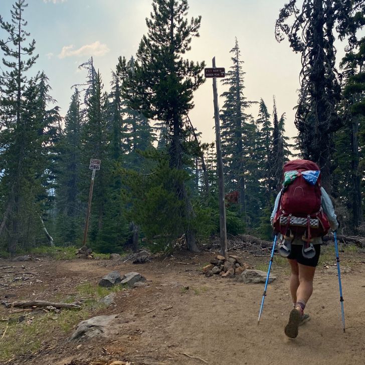
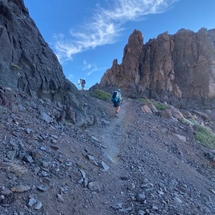
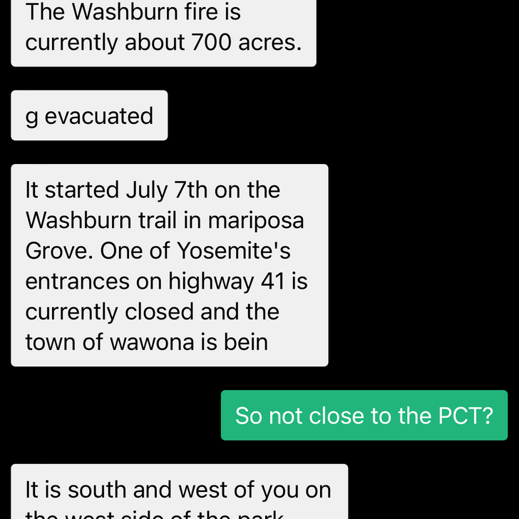
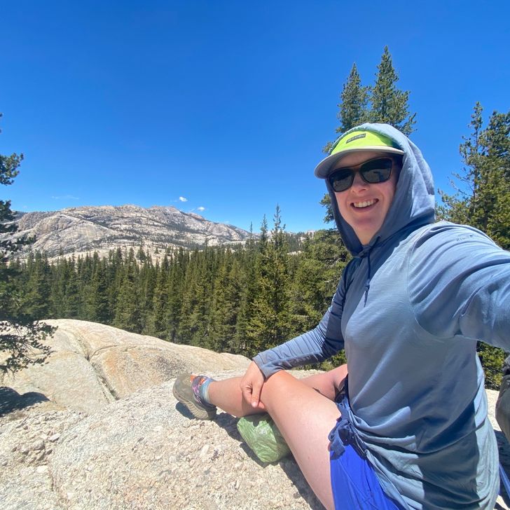
2021 Pacific Crest Trail Thru-hike

1
Sep
2022

119 — Goat Rocks

Mile — 
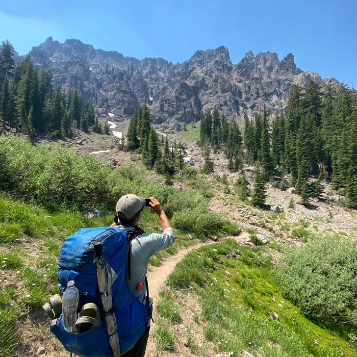
Rose: gorgeous views near the end of the day, Cispus Basin 
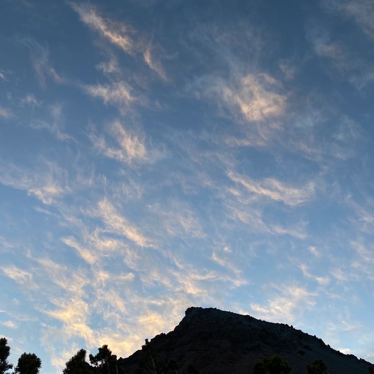
Thorn: the decision not to press above tree line for camp, missing a gorgeous sunset Bud: the Knife’s Edge tomorrow — 
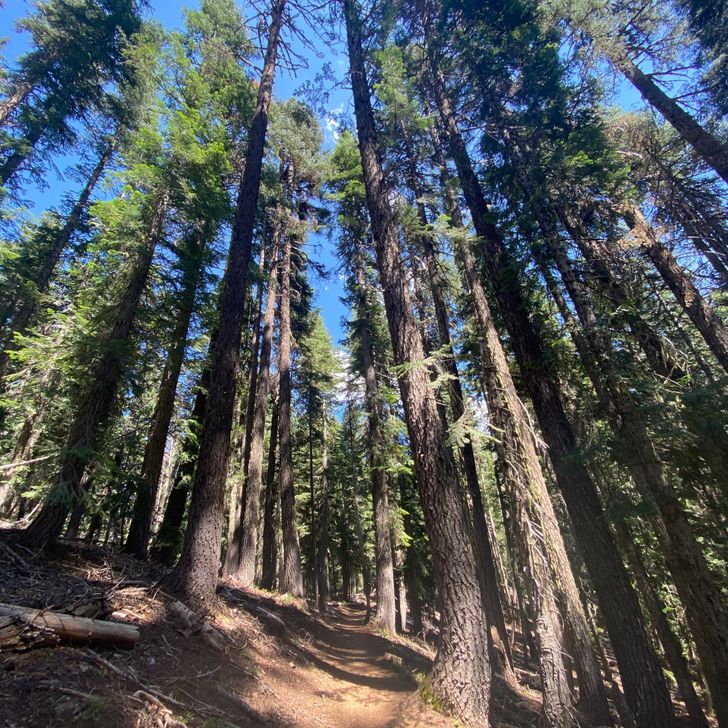
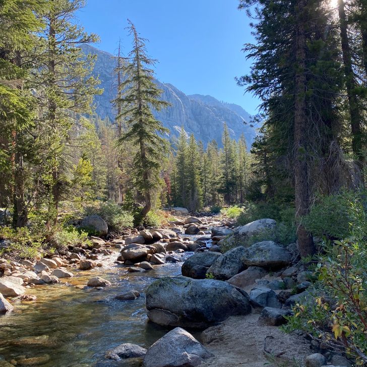
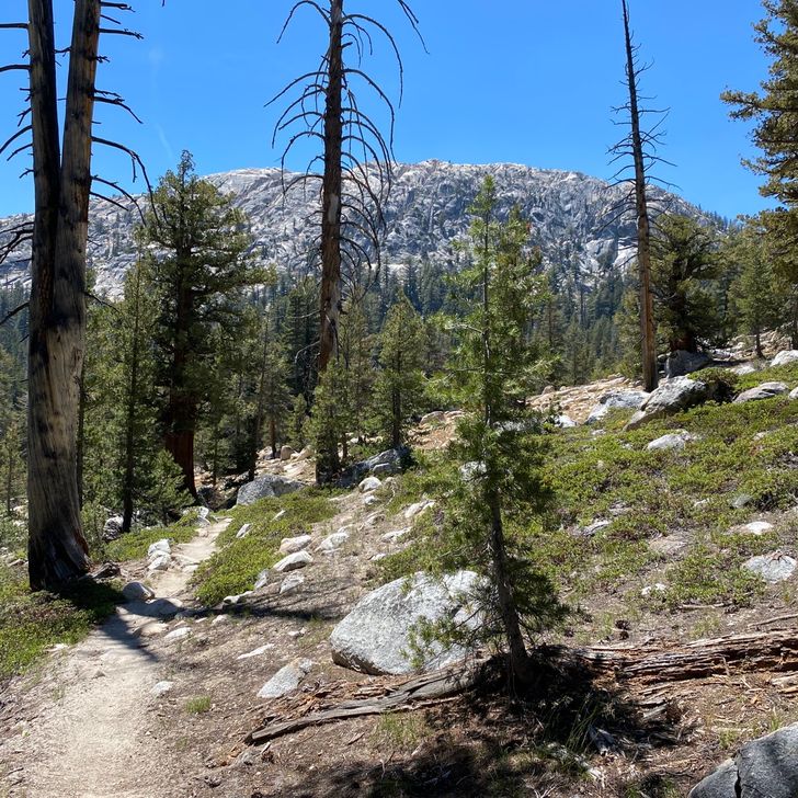
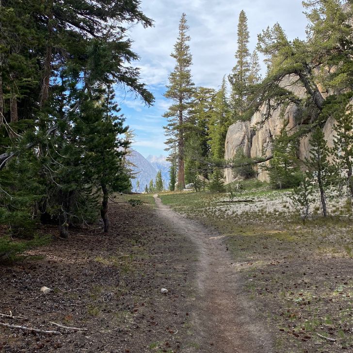
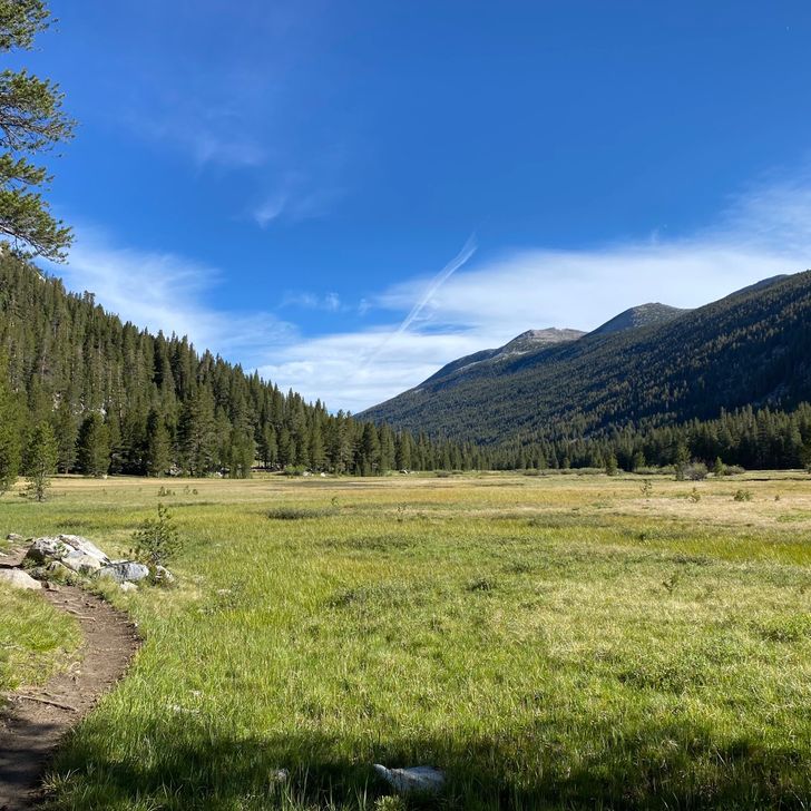
A day that made up for the tedium of yesterday, if not as splendid as the day before it on Adams. The forest gradually openned up. As Beans sad within the first hour of the day, “That pond is more interesting than all of yesterday.” (It wasn’t even that good of a pond) 
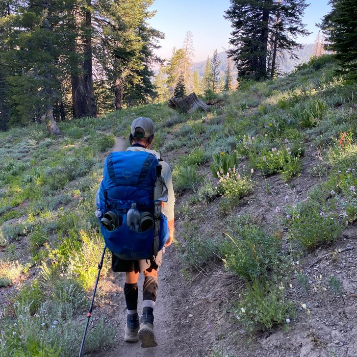
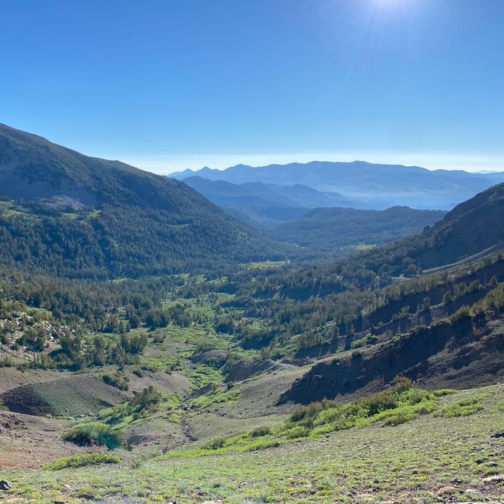
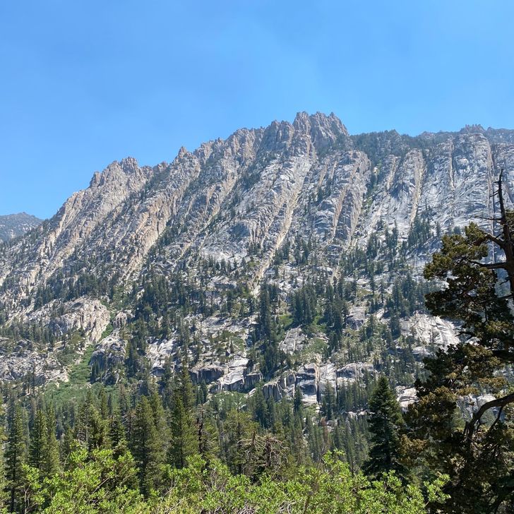
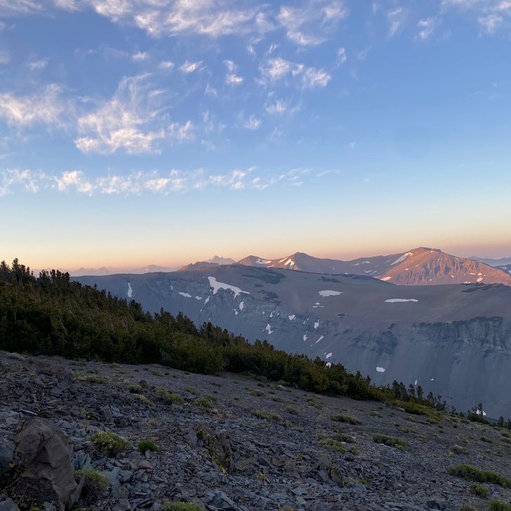
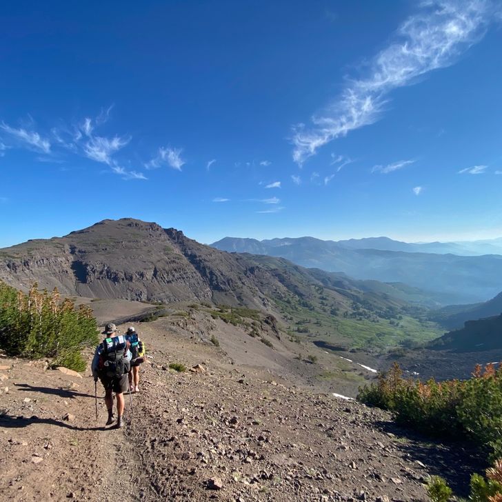
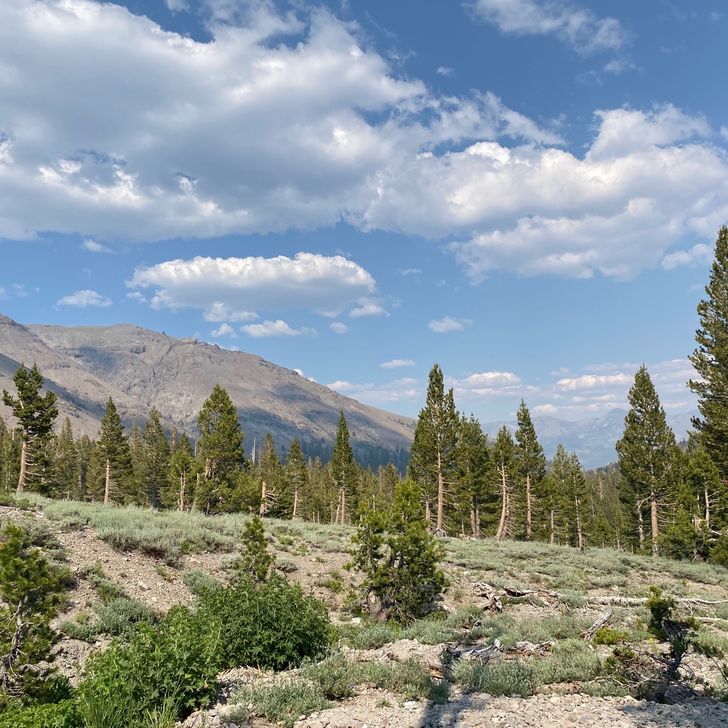
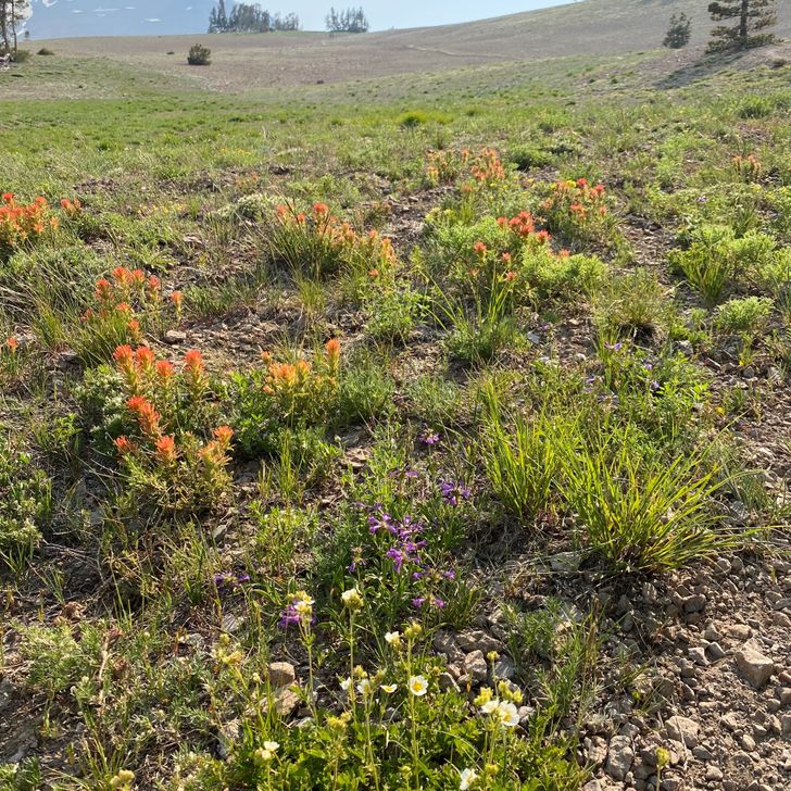
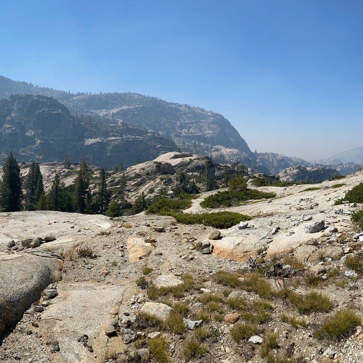
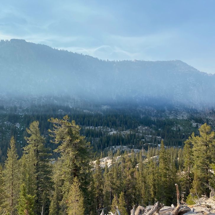
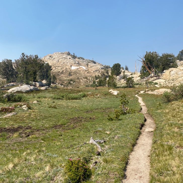
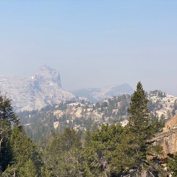
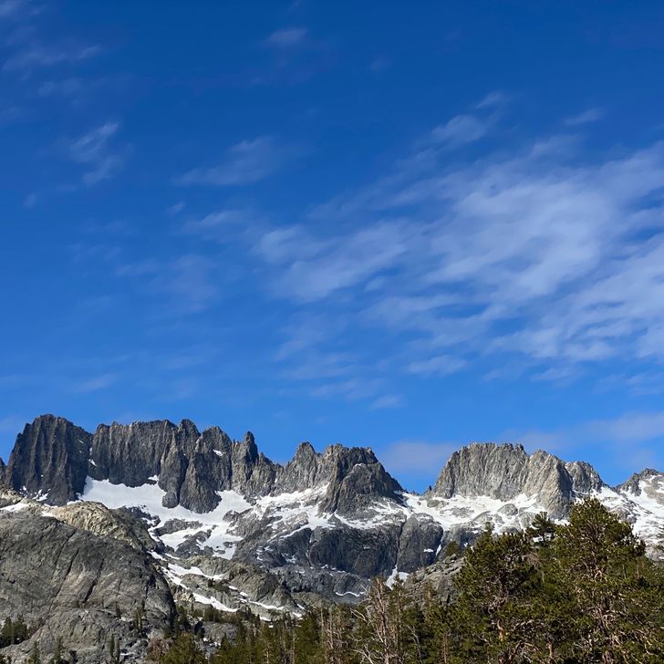
The trail wound up until we were ascending and traversing subalpine hillside meadows broken by trees with a glorious view of Mt Adam’s to the south. The only thing to spoil the view is a heavy haze brought on by the week’s heat wave (and the smog you can see looking west toward the I-5 corridor). Today or tomorrow should be the last day of the heat wave though. In truth, it hasn’t been too bad as long as you stay in the shade. You could definitely feel the heat on the southernly ascent. I started playing the game of pause-in-the-tree-shade and hustle-to-the-next-shady-patch. 
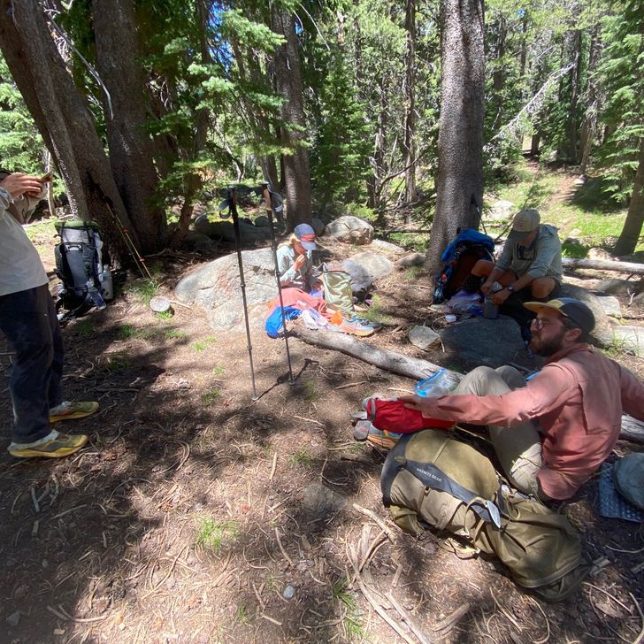
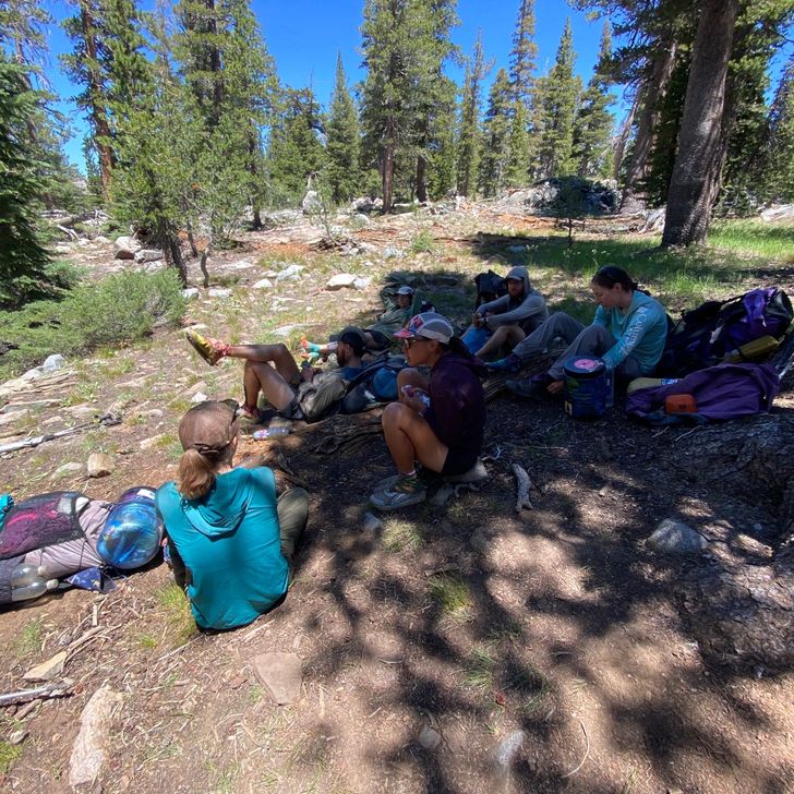
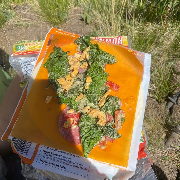
We lunched on a small ledge just below the trail. No other level ground could be found. Because there was no cheese at the Trout Lake store, our tuna wraps are sadly simple: just tuna, Mayo, and the last of our crumpled chips for some textual interest. I finished my chips today, so tomorrow will be a very flat wrap. It doesn’t help that we stretch our tuna between two wraps so that we can get the extra calories of an additional tortilla, making the wraps more tortilla than filling at this point. 
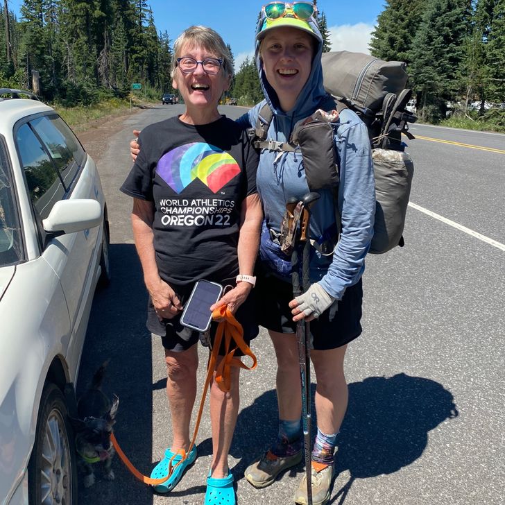
Beans showed me how to eat around the core of a carrot, which I had never done. One of our favorite things to pack out are carrots. I love having some fresh crunch deep in the backcountry. Unfortunately, the store also did not have apples. ? Our carrots were provided by David Winterling when he picked us up from FS23 and drove us into Trout Lake. What a sweetheart. We asked he bring us carrots, and instead of grabbing an easy bag of baby carrots, he must have peeled and chopped a pound of big carrots for us. The big carrots are holding up much better than the slimy little baby carrots do. We usually try to finish off the baby carrots three-ish days into the backcountry; the sliminess makes me nervous. The big carrots lack the slime and have maintained such a good crunch. — 
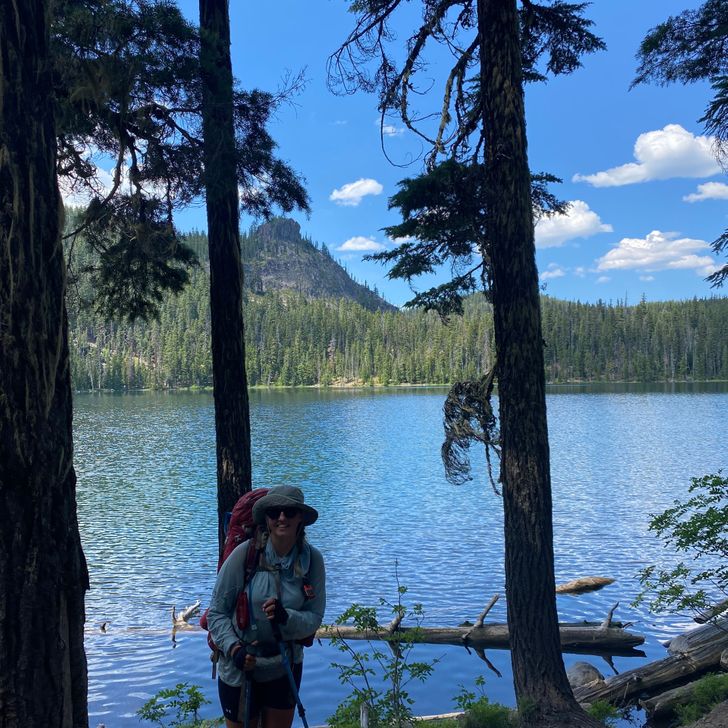
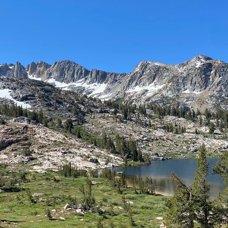
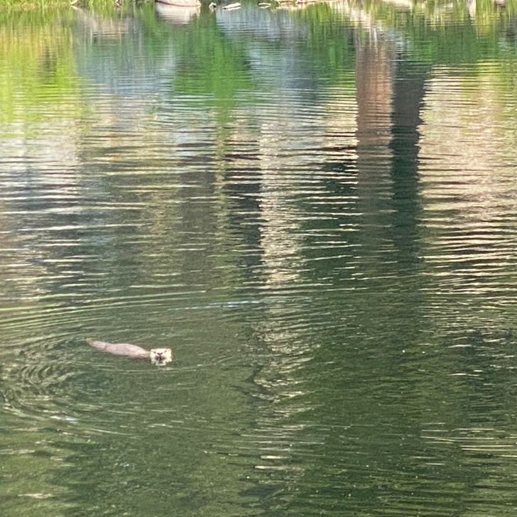
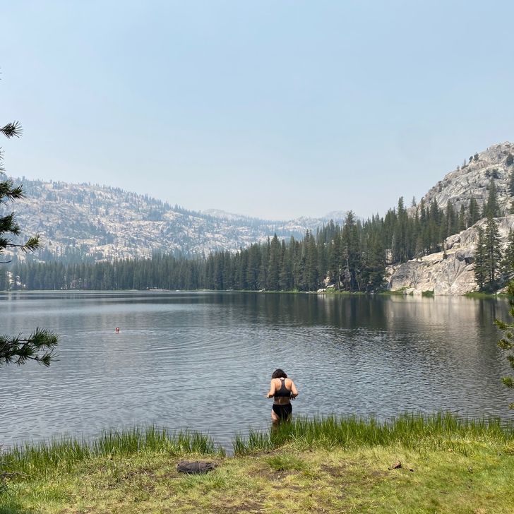
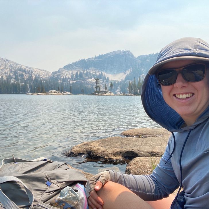
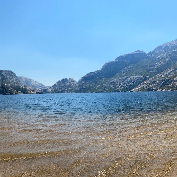
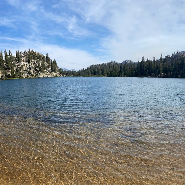
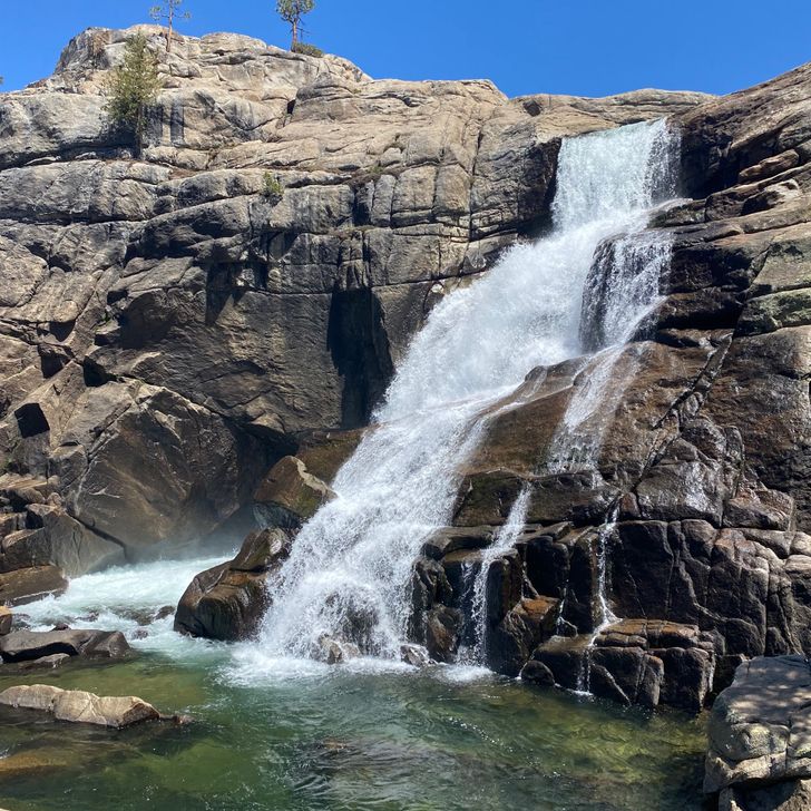
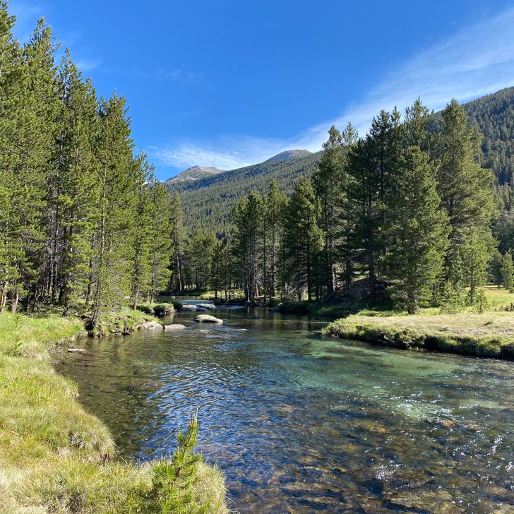
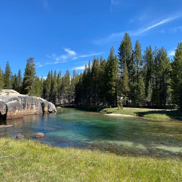
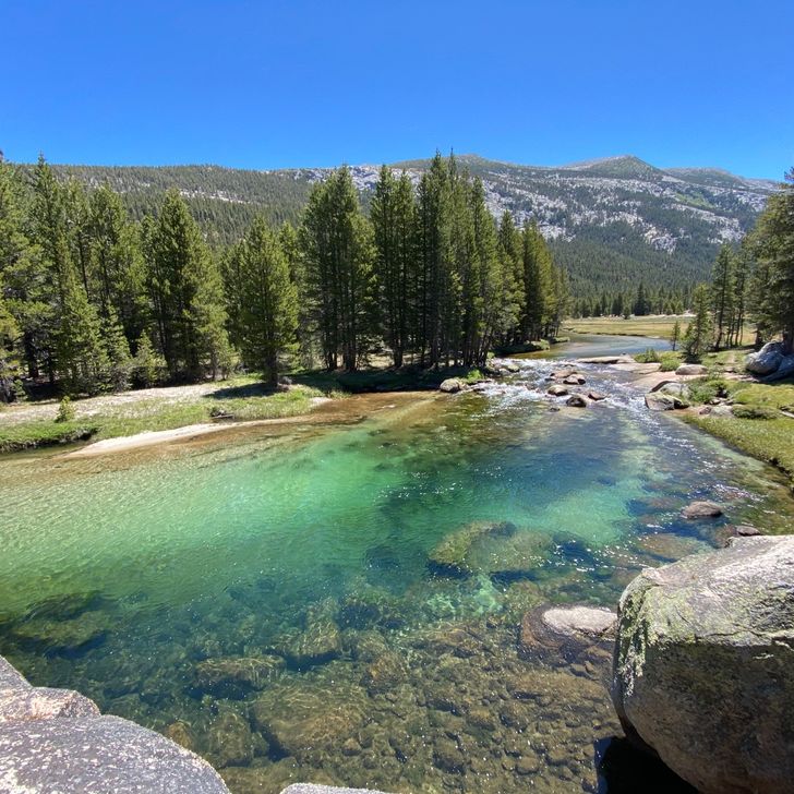
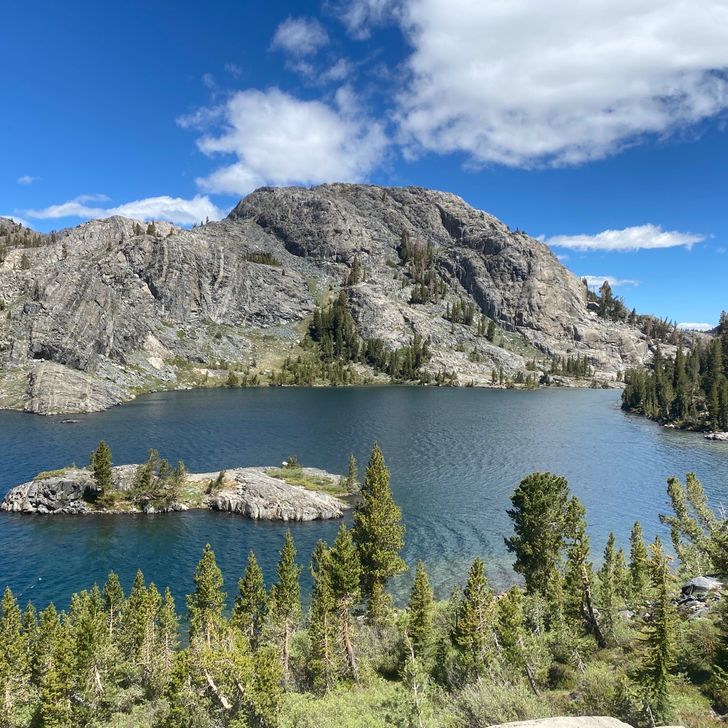
Mid afternoon, we breaked to gather water from a lake. We were hot from the climb and the heat wave. We had a problem: the lake was entirely too swimmable. We quickly stripped down and jumped in the lake (after gathering our water). We dove down, floated on our backs, and splashed around. After 5–10 minutes, a man appeared on the far shore to gather water and also enjoy the water. We sat with bated breath. We couldn’t leave the water now without being exposed so we waited. After another 5–10 minutes, we decided it was time. The man was paying his own mind, so we swam to where we staged our shoes and scampered out to dry in the sun. — 
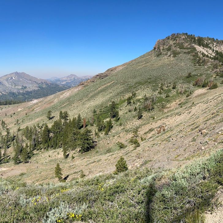
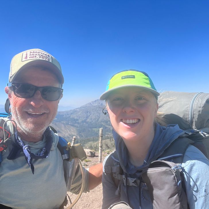
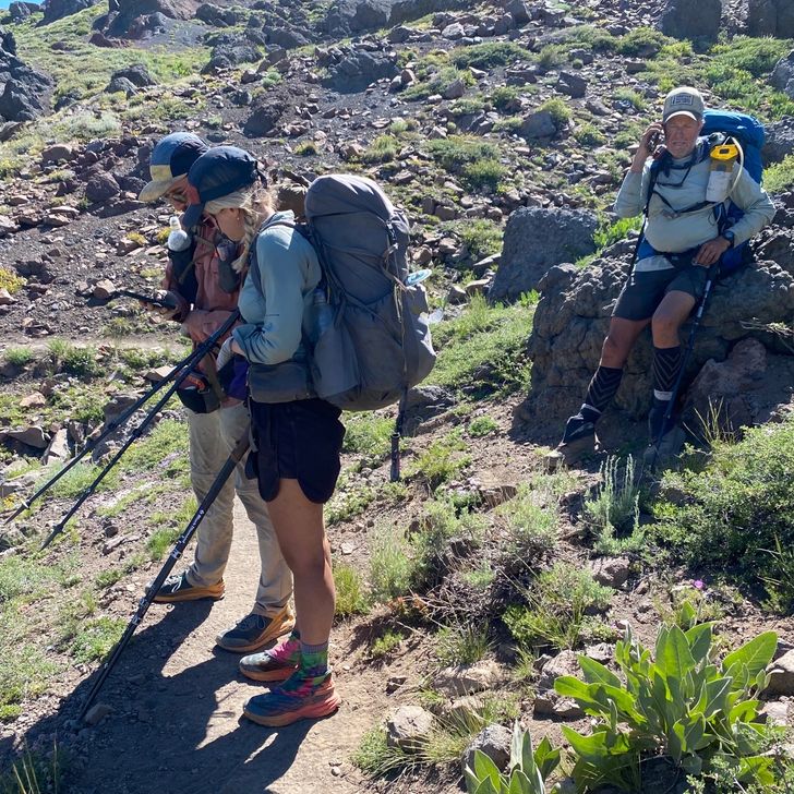
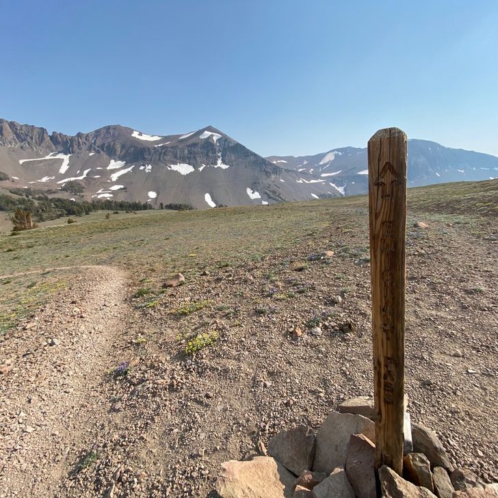
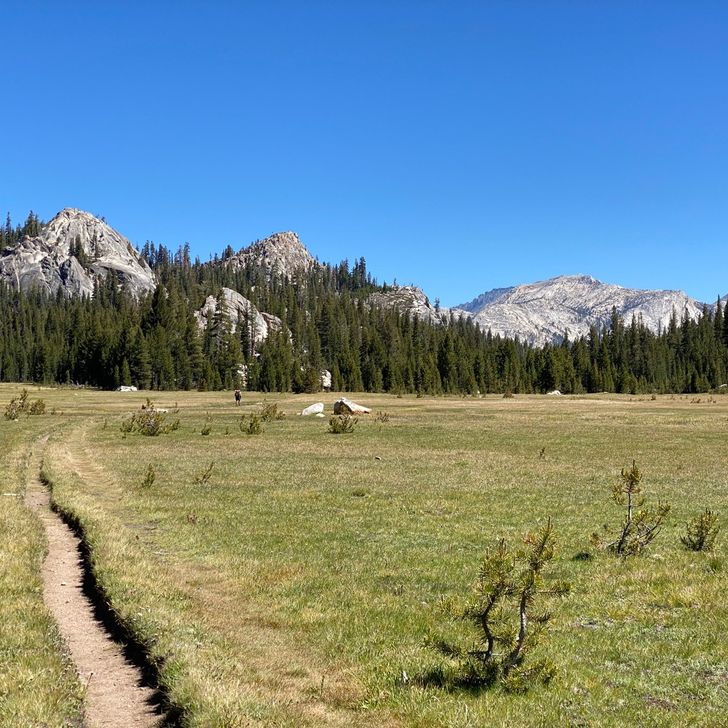
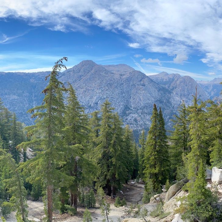
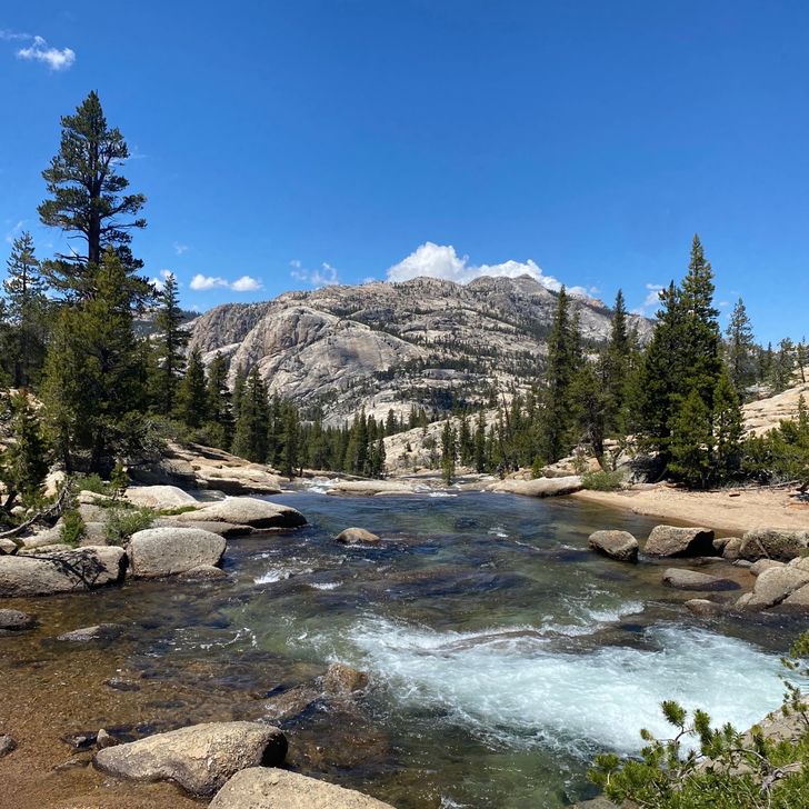
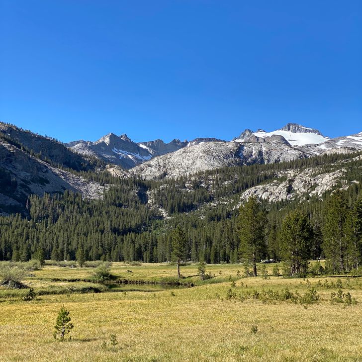
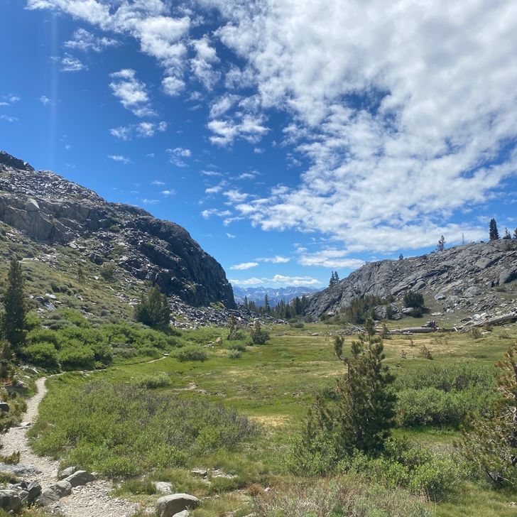
We rounded the horn on the ascent, up and over a lesser pass into the high meadow of another drainage, and gained the steeper traverse to Cispus Pass, the highest point of the Washington PCT. No view of Adams from the pass, but a pretty glacial drainage nonetheless. While we rested at the top (and Beans sent a text to her mom), Ash and Blue joined us! I knew they weren’t far behind, because Semi had texted me just out of Trout Lake. We talked a little at the top and as we descended into Cispus Basin. We parted as they got water. I had hoped we would camp together for some more catching up, but they passed by our chosen campsite in the evening. They wake up very early and are still doing 20–23 miles per day, so I don’t think I’ll see them again sadly. 
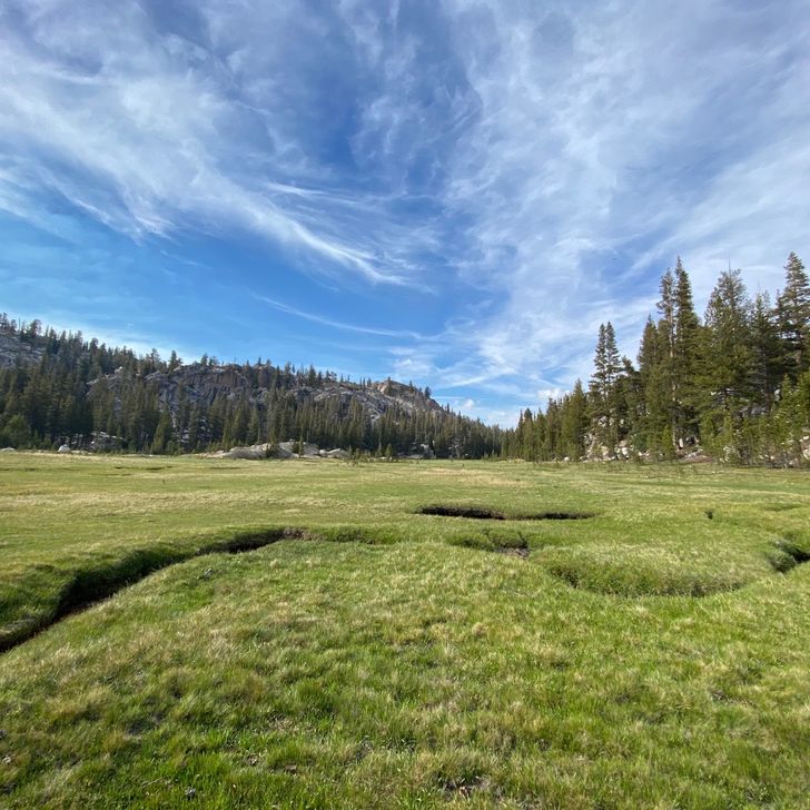
Part of me wishes we were pushing more miles through this. The elevations look mighty tough in our last couple weeks on trail, so now is when we could hammer out some miles, but I have made plans with friends based on a 15 miles per day itinerary, so I confess that we have loitered the last couple of days, yesterday with the tedium not motivating us to hike farther and today to luxuriate in the views, tomorrow will continue the luxuriation while on the Knife’s Edge. By only doing 15 tomorrow, that will leave only five to do on Saturday morning to get to White Pass. We could easily have pushed a couple more miles tonight and then tomorrow we could have pushed into White Pass for the night, but again, the itinerary. Again, I am slightly sad to not be hiking without an agenda. I liked the freedom of hiking and seeing where and when I got to places in a week. I will enjoy returning to the freedom north of Snoqualmie. Ofcourse, it’s obviously worth it to me to sacrifice this small freedom to see my good friends along the trail. — 
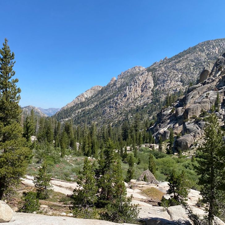
I am slightly miffed that we didn’t press on for another 1–1.5 miles to the next camp. I knew the next camp was in the alpine, and with the good weather, it would make a fine camp. Our camp for the night is tucked into a copse of trees close to tree line. By walking to one of the tent sites, I could see the pinky hues of the sunset on Mt Adams. I imagine the pinks would also have been mirrored on Mt Rainier to the north. Through the trees I could see the orange haze on the western horizon. It would have been a glorious sunset to have witnessed from up high, lessened in clarity but enhanced in color by the haze. If there’s one regret I have of this trail, it’s that I’ve not had nearly enough glorious campsites with gorgeous sunsets (since the desert). I must change this fortune before it’s too late.

31
Aug
2022

118 — Boring Forest

Mile — Rose: maybe the nap? Not much honestly Thorn: the monotony of the forest Bud: hiking up into the Goat Rocks should provide some views — Mt Adam’s glaciers glowed pink this morning in the dawn light. It wasn’t quite as majestic as I would have liked, but it’s not more than can be expected while camping on the northwestern side of a mountain. I sat drinking tea out of my new mug (since it’s getting colder and I’m tired, I’ve been enjoying coffee or tea in the morning, so I finally ordered a mug. I can drink a hot drink and eat food at the same time!) and enjoying the gentle alpine dawn. Beans, on the other hand, was not in a good mood. Around 3 am we had just a little bit of rain. At 4 am, there was some predawn wind. Unfortunately, Beans’ tent stakes were torn from the soft sand in the wind and her tent collapsed on her. She painted quite the picture of hobbling around on swollen feet muttering curses while resetting her tent in the dark. And as these things go, the rest of the morning had small mishaps that contributed to her tired, frustrated state: she couldn’t find her toothbrush, she dropped her water bladder in the sand and it got dirty and got sand in her morning tea, the mosquitos came out much thicker in the morning than last night, etc. I tried to cheer her up and not bring down my good mood. It did a little. Although my view of the mountain was broken by the extreme angle and spindly trees, I would have loved a quiet morning of reflection and admiration while drinking my tea. I tried playing some music to pick her up, but alas! it’s my “pick me up” playlist and not hers. We didn’t leave camp until 8:30 because of the bad mood delay. ~ After fifteen minutes, any and all views completely disappeared for the rest of the day, which made for an incredibly boring day. Our view for eight hours was a ten foot wide corridor bordered by dense firs and underbrush, the one foot wide trail in the middle, and huckleberry bushes filling the space between the trail and the bordering forest. All day. We never saw more than 50 yards on either side except when we crossed a gravel road. The huckleberries provided some entertainment as some patches still held large berries that we nibbled on through out the day, but only so much time can be spent eating huckleberries. By lunch, we were both incredibly tired, whether from the ill fated morning, the boring walk, or hypoglycemia, who knows. We didn’t even wait for a good lunch spot. We nestled between some firs on the side of the corridor and took a long nap. A few hikers passed us while we were napping. Afterward, we decided that naps before eating lunch are never a good idea; they always go over-long. Our nap/lunch break ended up being quite long as we were both reluctant to start down the green tunnel again. Around four we finally got some relief from the monotony when the trees spaced out some more and we had views of three ponds. The mental relief that the labyrinth openned up 50 yards to show us some scummy ponds should provide some insight into how bored we were. Not even our audiobooks or podcasts alleviated the monotony. The faces of the half dozen hikers we saw during the day reflected our own boredom. At one point, I took a break on a log. Beans and I chatted about the prospect of Gibb rejoining us. It’s been occupying our minds quite a lot: where is Gibb right now? Will he catch up today? Maybe we should hike slower or less so that he will catch up. We should stop X habit so he doesn’t get weirded out. We’ve gotten too used to each other. Gibb will get us out of camp in the morning. Etc. We yelled into the forest, “Gibbbbbb!!!! Gibbbbb!!!” Because when do you get to yell full volume into the void? Might as well do it in the middle of boring, desolate forest. ~ We called it a day and camped in the forest next to some other hikers. The mosquitos, although not horrendous, were enough that we cooked in our tents and silently prepared for sleep. The other campers were welcoming. I have gotten bolder at asking to stay.

7
Aug
2022

94 — Maiden Peak Shelter

Mile 1907.6–1914.4 (6.8 miles) — Rose: Staying overnight in the Maiden Peak Shelter again Thorn: grocery shopping for resupply in the morning—stressful Bud: lake swim tomorrow (hopefully this stretch of trail doesn’t shut down) — This morning mom and I packed up our bedding and went to the store to go grocery shopping. I needed to buy 10 days of food for this stretch (Willamette Pass—Santiam Pass, 4.5 days) and the next stretch (Hopefully the Lionshead will reopen and we can hike through the Mt Jefferson wilderness, 5 days). In some ways the shopping trip was fun, because Fred Meyer’s had so many food choices and mom was buying. In other ways it was not fun: the stress of counting my meals, trying to figure out what to buy, and answering mom’s questions. I bought too much food. Far too much. My pack weighed so much when I got to trail. After grocery shopping, I frantically organized 2 trips worth of food. I was 20 minutes late meeting Magic Beans and her mom at Eugene’s REI. Beans and her mom said goodbye, and the Beans piled into my mom’s old Subaru. Mom drove us to Willamette Pass while chatting and asking questions. We shared stories. Mom and I said our goodbyes on the side of the highway. Beans and I were both eager to get back on trail. The 6.8 miles to Maiden Peak Shelter were increasingly smokey from the fire bear Waldo Lake. At the shelter, we waited out a thunderstorm. I sat in silence remembering my ski trip there 7 years ago while Beans took a nap. A couple waited with us for a bit. We Yogi-ed some water from them since the shelter is a dry camp We still had quite a lot of daylight left, so Magic Beans and I played Rummy while waiting for people to come in to stay the night. After five round, Beans solidly won 245 to 20. We were hoping and expecting for around 4–5 people that night. What we got was a giant 10-person tramily and the hiker Rogue. It was too much hustle and bustle after the quietness of the afternoon. As the cabin began to fill, Beans and I went to claim our sleeping corner in the loft. Outside, we joined several people for dinner in the dimming daylight. This tramily tells us that this section of trail is actually in danger of being shut down from the Waldo Lake fire. Ffffuuudddgggeee. We’ll figure it out tomorrow. Maiden Peak shelter: 13 people total and three tents outside

Day photo preview 1
Day photo preview 2
Day photo preview 3
Day photo preview 4
Day photo preview 5
Day photo preview 6
+4
26
Jul
2022

82 — The Midway Monument

Mile 1331.3–1323.2–1332.5 (17.4 miles) — Rose: midway monument Thorn: getting filthy from the burn Bud: early start tomorrow to beat the heat — The sprinklers did come on at 1am and 2am. During my various wake-ups, I tracked the dark spot on the pavement of the basketball court. If it reached X spot, I would move camp. It looked like two people had to move in the night. Thankfully. It was not me or Beans. We got a late start with everyone in the park slowly awaking between 6 and 8. No one seemed to be in a hurry to move out. We grabbed tea and a donut from the grocery store and got a hitch before I had finished my tea. The driver related to us the difficulty of seeing the burn scar every day, the logging trucks running nonstop cleaning up around the town and highway, and PTSD when the smoke from the Yosemite fire wafted north. The burn scar goes right up to town. The plan was to hike 8 miles south of the highway to see the midway monument, hike back north, and proceed northward from there. We were reunited with Hurdle for ten minutes not long into the hike. About twenty minutes in, we found a clump of live trees where we set up my tent and stashed all non essentials for the return retrieval; we were going to slackpack it to the monument. ? Hiking through the burn is eerie and unpleasant. It’s boring and horrifying to look at all the dead trees. No undergrowth. Only a few live plants this year. No animals. No bird song. Beans kept count of the animals she saw: a butterfly, grasshopper, 1 scrawny squirrel, a beetle. The only sounds were snapping branches every few minutes as a widow maker succumbed to gravity. For most of our climb, the fire had burned so hot that there were bit needles left in the upper branches so even the forest floor was raw ash and dirt. There were hollow scars in the earth where entire trees had been burned through the roots. There wasn’t even ash left of them; their whole existence had burned up. The forest has died standing up; it is just waiting for the dignity of laying down and decomposing. So it was through this eerie landscape that we gently ascended to the midway monument with a dozen NOBOers passing us along the way. ATF and Gandalf were on the same mission. They reached the midway and turned around shortly before I arrived. The midway monument was a little underwhelming. Only 2.5 feet tall, the simple concrete post declared the midway, how many miles to Mexico, and how many to Canada. Maybe because I’ve skipped around too much, but it was not an emotional experience for me. It may be the midway point, but I’ve skipped 250 miles of the desert (which I intend to finish) and 130 miles of this burn (which I am glad to have skipped); it does not feel like my midway. In general, I’ve become number to the accomplishments of the experience. It does not feel like “I’m doing the PCT! Wow!” It feels like a bunch of short backpacks. I do not feel like I’m in the wilderness; I’m following a highway of hikers north. I rarely see animal tracks, I’m rarely surprised by terrain, and I do little planning. Far Out makes the logistics too easy. If it were not for the social aspect and the bottlenecked hoards of hikers in town sometimes, I would not believe that I were actually doing the trail. It is physically challenging for me to hike 20s every day. Some hikers brush it off with arrogant aplomb. It is hard for me to do. I don’t think I’ve gotten comfortable or successful at doing that consistently, let alone the even bigger mileage days that I need to be doing. The hardest aspect for me is the mental game: the social dynamics in the desert and the steely determination in Nor Cal. What keeps me going is stubbornness in my goal and the promise to see so many friends and lovely terrain in Oregon and Washington. — Beans and I took a short break at the midway, eating lunch, taking photos, and signing the log book. We became filthy sitting amongst the dirt and ash. Hiking in these conditions is a dirty business. Ash does not act like dirt does. Even hiking just one day, our backpacks, shoes, legs, and feet are filthy. Everyone who hiked this section is coming off dark and filthy. My cough is more active from all the particulates. We collected our gear and came up with a game plan from the highway to Old Station. Unfortunately, the game plan quickly fell apart when we saw that the Warner Springs Campground in Lassen National Park was closed. We had been counting on doing a shorter day to camp there tomorrow. You have to have a bear cannister to camp in Lassen National Park, otherwise you have to push through the 19 miles in one day. The push, whatever, but the location of those 19 miles is inconvenient for hikers: the southern border only 15 miles from the highway and the northern only 8 miles from old Station. It’s a perfect two days to Old Station if you could camp in the middle, but the park’s canister regulation prevents that. So now… we either have a short day tomorrow to the southern boundary and then a long day the next ooorrr we stealth camp… ? We’ll decide tomorrow. — Picking out our camp, we were also thankful for skipping the majority of the burn. Our collective knowledge of burned, rotting trees had us questioning wobbly widowmakers. Eventually, we accepted there would be no spot that was entirely safe, and we set up camp.

25
Jul
2022

81 — Hitching Around the Burn

0 miles hiked Miles 1192.7–1331.3 hitched around (138.6 miles) — Rose: the feel of cool city park grass after finally getting a hitch to Quincy Thorn: Beans losing all faith in hitching after two hours and a hitch only 5 miles down the road Bud: halfway marker tomorrow and some slack packing — We spent all day hitching around the burn section. We woke up in our little road pull out to blue skies. The wind had shifted and we were out of most of the smoke. We walked to town for Beans to pick up her resupply and Ursack from the Post Office at 10am. We had our signs out for hitching north to “Sierraville, Quincy, Chester” by 11:15am. Gandalf and ATF, who had the same idea, joined our hitching at noon. I was a little concerned about their joining us, because a larger group would make hitching harder. Beans was frustrated and bought us expensive strawberry milkshakes from the cursed general store. The only offer we had came at 1:30 to take Beans and me five minutes up the road where the highway diverged. This is where Beans really lost all faith in hitching. She was questioning what we were doing, where we were going, if we were hitching in the correct direction. Thankfully I kept my thumb and sign out. A chatty man from the Sierra City public bathrooms yesterday pulled over and offered us a ride to his destination of Quincy. Although the guy was a little odd, we didn’t get bad vibes, so we took the hitch, alternating engaging him in conversation. In Quincy, he let us off at the public park where we lounged in the beautiful manicured grass and shade. It had been hot all day. After a brief respite, we meandered down the old town street, collected free ice cream for PCTers from the Quincy Toy Shore, and made our way to Round Table for pizza. At 5pm we caught the free public bus from Quincy to Chester. ATF and Gandalf were aboard the bus. They had managed hitches too. The bus route meanders through two burn scars. The burn was huge and devistating. It came so close to houses and ranches. It burned down entire towns that the bus now moves through. There is nothing left of Greensville except wood chips. In Chester, we made our way to the Chester Park where they allow hikers to camp. It truely felt vagrant-y to cowboy camp on the basketball courts. The comments on Far Out warned that the sprinklers come on at 2am, and there was a list of the sleeping spots safe from the water. The community stage seemed very crowded, so Beans and I moved to the basketball courts while ATF and Gandalf moved to the baseball field dugouts. All of our electronics were crammed into the limited outlets on the community stage. Although Chester citizens still came to enjoy the park, they did not seem to mind our vagrant loitering. If anything, they seemed amused at it. Truely a unique experience.

24
Jul
2022

80 — Sierra City

0 miles — Rose: movie night with Beans Thorn: being delayed a whole day because of that stupid store Bud: a solid plan to see the midpoint monument — Today was exceedingly annoying. We awoke to wildfire smoke in the air. So thick you couldn’t see the trees on the surrounding ridges. It irritated my cough all day and caused GNOME and Ziggy’s group to skip up to Quincy. Word of mouth, more than Inciweb, told us that it was smoke from the Yosemite fire. The wind has shifted and brought us the smoke. Beans called home: there are now 2–3 fires around her home town. Her parents aren’t too worried, but they have their things together for an evac. We had breakfast at the Red Moose Cafe, which was good but expensive. I had French toast with eggs, sausage, and hash browns. There were lots of hikers, and by the end of the meal, our table sat seven. Beans and I bid adieu to the table, including Pots and Maverick, and proceeded to the Country Store. I was anxious to start our long hitches for the day. The plan was to hitch from Sierra City to Chico to Redding to Old Station. It was going to take all day, and most of the campground hoards had already departed that morning. Unfortunately, this is when the whole day fell apart. The Store was closed. There was a sign on the door that said they would close early at 3pm, but instead they closed at 10am after briefly getting a few people’s packages at 9am. The owner had gone to Reno to resupply the store, and the two shop workers were too hungover to open the store. I was so livid. All we needed was our packages, and we could get on with our lives. Ugh! I cursed the store for hours as we aimlessly loitered on its porch, on the side of the building, at the hotel’s porch on the other side of the street. 20 hikers were all bottlenecked in Sierra City waiting for the store in the wildfire smoke and sweltering heat. Eventually the second shop hand dragged his hungover self to the store to open it at 2pm. He was too hungover to fix the offline register or turn on the overhead lights, so everything was cash and it went very slowly. None of the prices were marked either. The few items I did buy were exceedingly expensive. Bean’s package wasn’t there. It’s at the Post Office apparently, so now we’re stuck spending another night here waiting for the Post Office. Gandalf pointed out that by skipping the burn section, we would miss the halfway mark. We decided to copy their plan: Beans and I would now hitch up to Chester, back hike 8 miles to the marker, then 8 miles back to Chester, and the burn area ends something like 15 miles north of Chester between Chester and Old Station. Still cutting ahead around most of the burn, skipping ahead approximately six days and 120 miles. So what if we didn’t hike all those halfway miles? I’ve given up on any kind of pure continuous footpath garbage. I do feel like it’s not entirely truthful, that I should hike the burn, but it’s my vacation and I don’t want to hike the burn. ?‍♀️ We charged our devices, ate a late lunch, said good bye to our fellow hikers again (pretty much everyone else got on trail after the heat of the day), and then took showers at the public bathroom—there was a free wet bath in one of the restrooms. Beans and I bought some canned margaritas and made camp at a pullout on USFS land up the road. We drank our margaritas while watching a movie (which we were constantly pausing) and talking into the night.

23
Jul
2022

79 — Wild Plum Campground

Mile 1176.7–1192.7 (16 miles) — Rose: Yogiing lots of food & beer from the campground Thorn: heat of the day Bud: town food tomorrow, skipping the burn section — We hiked along the ridge before dropping into more manicured forests like last night. It was hot, humid, and sticky. One of the odd things about being out for days in the wilderness, not even knowing the name of the national forest you’re in, is when you come across civilization. We had a number of “road crossings” marked on the map, but Far Out doesn’t distinguish roads very well, so it could be anything from an abandoned Jeep road to a two lane highway. Around eleven, I walked through a developed area with well graded roads and forest service campground signs. There was a big reservoir to my left out of view, but I knew from the Far Out comments on the road that it was only a half mile to a glorious swim. My back and arm pits were completely drenched in sweat. The concentric salt stains on my shirt were stiff to the touch. I wanted desperately to jump in that lake. If Beans had been around or it had been two hours later in the day, I would have done it, but alas! I carried on. I found Beans at the next water source 30 minutes later. We hiked on until 12:30 for lunch. It was so hot. Even the breeze was hot. We set up in the shade for a little siesta. Somehow we had passed Maverick and Pots who joined us for siesta. We were only going to take a 30 minutes nap, but they baulked at our time limit. When I woke up after half an hour, it was much too hot to carry on, so I continued the siesta. All in all, we lunched and napped for two hours. It was still so hot when the four of us left. Thankfully, our path dropped us down into shaded creek valleys for the rest of the day. Being exposed to the sun in even short bursts between trees convinced me more than anything that skipping the burn is a good idea. It’s a good 15 hotter in the sun. I still longed for a swim. After a couple of hours of sweaty hiking, we reached an established gravel road which we followed to Wild Plum campground and a shortcut into Sierra City where our resupplies are. It being a Saturday night, the campground was full up, but we managed to find a site that had been reserved by someone who moved campsites. It was available and free! We quickly stashed our smellables in the bear locker and started walking down the road to town in hope of some town food for dinner. Unfortunately, after 30 minutes of walking, some flagged down cars confirmed our suspicion that every shop, convenience store, and restaurant were closed except for the expensive resort on the far side of town. We decided to turn around and take a dip in a glorious swimming hole we had spotted on the walk down. It was still hot and the swimming hole was nice and cool. Almost back to the campground, cars were passing us on the way in. One of them gave me party vibes (we had missed a Brew Fest down the road) so I yelled at their open window, “Do you have any beer?” They stopped the car and gave us a couple Coronas. “How many miles did you hike today?” “16.” “Woah! Here’s another beer!” “We actually have a fourth in our group. Could we get one more?” “You’re milking it!” “No I swear!” Handed us another. They were camped in the campsite across from us. We became the loop’s little celebrities. We were given more beers, fruit, and fried chicken. The drunk guy from the earlier car was completely enamored with the PCT, so he brought us Tajin-seasoned cucumbers and chatted us up in the dark. After we went to bed, Pots was given remnants of a cake on the way back from the pit toilets (“Are you the PCT hikers? Here, we couldn’t finish this.”). Beans and I roused from bed and ate a delicious cake. What a good night of Yogi-ing. Much better than a long walk into and out of town and spending $40 on dinner. Tomorrow we’ll go into town, pick up our resupplies, eat breakfast, and shower properly. Pots and Maverick are going to continue hiking in the afternoon. Pots will likely get off trail at Quincy and skip around the fire. Maverick will hike through. Beans and I will attempt to hitch up to Old Station tomorrow. At camp: Beans, Maverick, Pots

Day photo preview 1
21
Jul
2022

77 — Truckee

Mile 1143.9–1157.9 (with some skipping, 9.9 miles) — Rose: convertible ride, DQ Reese’s Blizzard, summer street fair vibes in Truckee Thorn: incredibly long lines at the Post Office Bud: back to Altras for the hike tomorrow — It was going to be a long morning. We had 13 miles to highway 80 where we would need to hitch into Truckee. In previous years you could hitch at highway 40 at Donner Ski Ranch, but there’s construction this year. I had resolved to get up early. I was up by 5:30. I was ready except for filtering water by 6:30. However, the water in the creek next to camp was super silty and it took an hour to filter two liters! Pots and Maverick made fun of us for waking up so early only to leave at the same time as them. We hiked and hiked until we reached the lifts for Sugar Bowl and Donner Ski Ranch. I met up with Beans here. At the encouragement of a local, we thought to hitch from there into Truckee instead of go the extra 4 miles between highway 40 and 80. We set a time limit for our hitching and stuck out our thumbs outside the Donner Ski Ranch. The restaurant was offering free 40oz beers to PCT hikers. We elected to skip it to stay on schedule. Gibb and Hurdle had both warned us it was a trap and time suck. Amazingly, the people that offered us a ride were in this beautiful sky blue convertible with cream colored leather. We were both a little hesitant to take the ride in case we were to damage or dirty the mint car, but they were nice and insistent that it wasn’t an inconvenience to go into Truckee. Beans’ pack fit in the trunk, but my pack went between the two of us in the back seat. It was very cramped in the backseat, but I tried to keep my dirty body from touching much of the interior. Still, my sunscreened legs leaned against the side to make room for the driver’s seat and left a smug of dirt and sunscreen. We could not keep the smiles off of our faces as we sprinted down the highway in a beautiful convertible. Definitely worth the guilt of skipping some miles. The couple dropped us off at a gear store in Truckee. When I stood up, my dirty shorts and bare thighs had left sweaty dirt on the cream seat. I hastily tried to wipe it off. In Truckee, we went to two gear stores, swapped out my shoes (because the Topos aren’t working for my feet after 70 miles), bought more snacks at Safeway, enjoyed Blizzards at Dairy Queen, and walked to the post office where my 20* sleeping quilt was waiting to replace my 0*, and I was also sending back the bear canister I had borrowed from ChitChat. Unfortunately, the post office branch stated the main downtown branch is where the general delivery packages are kept. We ordered an Uber and went downtown. Our Uber driver must have been in his 80s. He had no business to be driving for Uber. He kept suggesting taking us to different destinations. We had to insist upon the PO. The downtown PO took two hours. 40 minutes in line to retrieve my box, 10 minutes to swap out my quilts and food, another hour in line to send the bear canister, quilt, and shoe boxes. One desk worker and a line 14 people deep. By the end, we were starving. It was the weekly Truckee Thursday streetfair. We wandered by the booths, not letting ourselves be tempted to buy trinkets we’d have to carry in our packs. Everyone was very friendly, offering us food recommendations and ride while we waited at the PO or wandered the street fair. We settled at a microbrewery for some dinner and device charging. The major of Truckee held down a table full of people next to us. Other tables came and talked to us about the trail. We stuck out like sore thumbs with our dirty packs and salt-stained sun shirts amongst the clean 30 something’s dressed up in casual summer dresses and floppy hats for the street fair. Beans and I made up narratives for the socializing groups around us. After we were done, we ubered to Safeway to meet up with Pots and Maverick. After some more food from Panada Express and about 20 minutes, we ordered the same Uber driver to take us to the Donner Pass Rest Area on I-80. 7:30/8pm, we met more hikers at the rest stop. They intended on staying the night behind the rest stop so they could keep charging their devices and use the bathrooms. Beans and I hiked on for only 0.3 miles. We figured we wouldn’t be able to escape the sounds of the freeway in the limited daylight left, so we camped within full hearing of the white noise of the freeway. I hope that we are far enough from the rest area so as not to attract the attention of crazy axe murderers. At camp: Beans, me

Day photo preview 1
20
Jul
2022

76 — Granite Chief Wilderness

Mile 1122.1–1143.9 (21.8 miles) — Rose: the wildflowers Thorn: heat, rushing the last two hours Bud: switching out some gear at Truckee tomorrow — Today’s theme was wildflowers. We wound up and followed ridges all day, dipping down and then back up several times. We would ascend and descend in dappled forests of tall, neon-colored-moss-covered pines. The ridges and traverses were large meadows filed with glorious wildflowers: lupine, paintbrush, monk’s hood, larkspur, wooly mule ear, common cow parsnip, cinquefoil, waxy checkbloom About an hour into the hike, we came to a trailhead parking lot with a pit toilet and cell phone data. We wasted a good hour there downloading things and calling home. Beans got news that there’s a wildfire near her home town of Mariposa, so she needed to send her evacuation possession list to her mom. She said she’s had to evacuate every year for the last five years. I tried downloading topo for my Far Out maps—we had to download new maps coming out of Tahoe, which marked the end of the Sierra maps and the start of the Nor Cal maps. No avail. Eventually, I rallied the troops (Beans, Maverick, Pots) away from data by putting on Macklemore’s “Thrift Shop,” and we hiked away while boogying. Our path took us up to wildflower-covered ridges along the Alpine Meadows ski resort. I love hiking ski resorts in the summer. It provides such insight into what the slope and snow will do in the winter. The ridge was very sunny and hot though. Beans found a single tent site under some shade on the ridge. We collapsed into eating our lunch. A SOBO LASHer joined us for lunch. After his departure, we took a short 20 minute nap. My shirt was drenched in sweat in no time. It’s starting to feel like the desert again: hot, sweaty, sunny. We’re filtering water in tight spots on slopes. At a water source in the afternoon (we’re having to check the distances between water sources again too), a pair of experienced SOBOers gave us beta on the trail ahead: on the burn, skipping around, water, etc. Very useful exchange of information. ~ In the evening, we hustled to make camp and our prescribed mileage for the day. We crossed under the lifts for Palisades at Tahoe. At the day’s conclusion, Pots, Maverick, Beans, and I camped at a campsite with this former PCTer who was now section hiking the trail after his 2017 attempt ended in a fall of a cliff. He was a little weird. His name was Chairman (he had a camp chair), and there were parts of his PCT stories that didn’t make entire sense. We had gotten to camp late, so we are into the darkness and hustled to bed. At camp: Beans, Pots, Maverick, 1 section hiker (the Chairman), couple who we didn’t see until the morning

19
Jul
2022

75 — Desolation Wilderness

Mile 1101.6–1122.1 (20.5 miles) — Rose: a nap on trail. Any break wirh Magic Beans Thorn: my feet hurt in these new shoes Bud: get to hike through two resorts tomorrow! (Alpine Meadows & Palisades) — The hike out of the lake started uphill with rocks again. Not a hard climb like the Sierra but persistent for about four miles. From either side of Dick’s Pass we could see lovely lakes. The heat was already starting to climb. Despite passing multiple lakes today, we didn’t go swimming. We had miles to crush. We passed by the 4 men from last night. They were swimming in a beautiful lake. They hike faster than us so they would pass us anytime we took a break. Lunch was next to a small inlet of Middle Velma Lake. Too reedy and murky to wake in that end of the lake. My feet are hurting from these new shoes. They feel hard and a little tight. Nothing bad like blisters but maybe not the right fit or cushion. My knees also hurt, but that could be from the heavy load on my back and the downhills. If they’re not working by Truckee, I’ll go back to Altras. I’m so excited to get rid of all this weight in Truckee: the bear canister and my 0* quilt, which should add up to a solid 2.5 pounds. A lot of people ditched thier canisters before desolation wilderness, but I wanted to keep mine because the bears are so bad and they just passed regulations requiring Bear canisters. Other PCTers chose to hike through the Wilderness in one day to avoid the regulation (27 miles). Both Beans and I kept our canisters. They are heavy, and bulky and my pack is so tall with the canister in it. I just want to get rid of the bulk. I’m getting tiny pack envy again. After lunch the trail meandered through hot, dappled forest. Not quite thick enough to keep out the sun or heat. Not quite open enough for good views. Kinda boring. Cue the audiobooks and podcasts. The underbrush is dirty. Lots of fallen logs, twigs, bushes. Made it hard to go off trail for the bathroom. I passed a couple trail crews and a dozen day hikers. Beans waited for me at the end of Desolation Wilderness. Again, I had to take off my shoes from my hurting feet. 16 miles in and another 5 to go, we were tired. We laid down half on the trail, half off and took a 15 minute nap. I heard at least two people who quietly stepped over us. ~ The remaining trail was quite lovely with beautiful wildflowers. We joined Pots and Maverick at their campsite. Pots announced it was his birthday, and he was going to make a small fire. The four TRTers from the night before joined us from their campsite on the other side of the creek and three other TRTers joined our camp too. We didn’t have a campfire but all congregated around it for dinner anyways. At camp: Beans, Pots, Maverick, 8 TRTers

14
Jul
2022

70 — Mokelumne Wilderness

Mile 1038.3–1056.7 (18.4 miles) — Rose: hiking with a good group of people, Ziggy Thorn: not really hiking my own hike today Bud: experiencing waking up early with a group of early birds, seeing how that suites me — I slept in a little. I think the 20 mile day took its toll. I snoozed until six so not a big delay. After packing up, I had a couple items that needed a wash, which I had forgotten to wash at KMN. I sloshed them around with some soapy water in a gallon ziploc bag, wrung them out, and strapped them to the outside of my pack to dry. Not long after starting hiking for the day, Ziggy, Blue, Ash, and Pepe caught up with me. I instantly fell in line with Ziggy. He was a wonderful, cheerful dude who I happily met in the desert. With the old bubble catching up with me, I was excited to find Ziggy again. He’s a recently-retired Navy guy who just has interesting stories and the cheeriest attitude. He’s a little on the slow side, but I don’t mind for good company. I ran with that crew for the rest of the day, as much for the good company as to see another group’s routine. I stopped and had lunch with them. Hiked with Ziggy in the morning then Blue in the afternoon (for a bit. She’s fast.). As we near Tahoe, we’re getting more cell coverage on ridgelines. We’ve been checking at lodging options in Tahoe (ie expensive and mostly booked for a Saturday night). Ziggy made half a dozen loud, enthusiastic calls to old Navy and high school buddies trying to get us a cabin, to no avail. Near the end of the day I called Casey for a bit. He sounded cheery with some exciting medicals recently. Our campsite is on a small bump out between two creek valleys. It’ll offer up an amazing sunrise view. This crew wakes up early. My early lately has been 5:30. They do five and are on trail by six. I’ll try it out, see if that schedule fits. That’s something that’s great about this trail; you can try out different techniques, gear, styles and really hone in on what suites you uniquely.

Day photo preview 1
Day photo preview 2
Day photo preview 3
Day photo preview 4
Day photo preview 5
Day photo preview 6
+2
13
Jul
2022

69 — Iceberg Wilderness

Mile 1018.2–1038.3 (20.1 miles) — Rose: accidentally did a 20 and I don’t feel wrecked (yet) Thorn: emotional roller coaster midday Bud: more pretty views tomorrow — What a terrible night’s sleep. The campsite we chose out of convenience was actually kind of terrible. Beautiful views in this rolling slopes hillside, but the only sites protected from the wind were nestled right underneath big widow makers. The ground was also rocky with lots of little alpine flowers. The others chose sites up top that were flatter. I chose one completely exposed to the wind downslope—and it was also sloped. I couldn’t get my stakes into the wind, and I didn’t want to chance deadman anchors. I cowboyed. The wind came from both sides all night, rolling over my body, making me cough from microfine dust. I pulled my sleeping quilt around my face to keep the wind off it. I wore my wind jacket to bed to keep out the draft and ear plugs to keep out the sound. I pulled my hat down over my eyes, because the nearly full moon was like a floodlight. My sleeping setup kept sliding downhill all night. Around midnight I stuffed my backpack under my legs, which did help with the sliding, but I was by no means level. I could feel the swelling pooling in my feet. Every time I woke up, I thought about moving camp, but I hadn’t spied any better close spots. I’m just glad the night’s over. Hopefully I can find a napping spot today. It’ll be hot enough that I’ll want a rest anyways. — I stopped to refill water at a spot where there was three bars of Verizon service. Shuffles came passed. I said my goodbyes in case I didn’t see her again or for a while. She gave me some much needed Folgers instant coffee. I said the same to Pebbles when she passed. So with a very scenic view, I made a cup of coffee and called my mom for her birthday. I downloaded some podcasts. I sent some messages to Casey about my resupply box in Truckee. The rest of the morning I proceeded to dive into the hard subjects in my head: my imposter syndrome ontrail, in the old tramily, and in my careers; my career(s) ahead; frustrations with the NPS; etc. I overcame a dayhiker in my reverie. In our talking, he dismissed my hurry to get to Canada (“You can always do a multi year!”), lectured me on compound interest for retirement when I expressed that Ill likely not be able to retire (“Just a little bit every month.”), insinuated the old “we didn’t have much and look at me now” (“You have to live cheaply!”), etc. Classic bootstrap bullshit from a boomer whose never known anything but middle class. I ditched him and proceeded to rage hike for the next couple hours. I cried in rage and frustration at the choices I’ve made, the corners I’ve been backed into, and the lack of quality opportunities ahead. You know, the hard stuff. I eventually had to take a break and recenter myself with several rounds of solitaire and a quick nap. — The rest of the afternoon’s hiking went off splendidly. With just a couple 700’ climbs in the day and lots of rolling ridge line, the miles went off easily. I forgot my sunglasses at a water source. I asked a couple of SOBOers to send them northward if they found them—we’ll see if they get back to me by Tahoe. I also thought I was SOL about water for a second. I got spoiled with water in the Sierra. I only had something like 300 mL and thought the next water source was six miles away. Thankfully, it was only 1 mile away. That’s where I left my sunglasses. I ran into the chatty boomer again. He’s a nice guy. A section hiker who updates the water reports. Chatty though. I have about a 10–15 minute tolerance for trail side chat. There’s places to go. — The landscape certainly has changed. First, the trails are soft! Soft dirt, soft sand. Not the continuous rocks and boulders of the Sierra. My feet are very thankful for that so are my shoes. The Sierra granite really did a number on them. Only 200 miles in and the tread was so worn down that I was slipping on boulders. By 300 miles, there were holes in the uppers on the outside of my foot and big holes where my foot bends at the first met head. Altra Timps. What designed obsellesence garbage. Unfortunately, my feet are so wide (especially with the swelling) that they won’t fit into anything else. I worry that my ski boots won’t fit this fall. That’s an expensive replacement. Second, the rock isn’t granite anymore. It is redder, crumblier, and I’ve even seen some columnar basalt. Some of the hills are shaped like the mesas of Wyoming. To me, who knows very little of geology, I think these mountains are volcanic in nature and not uplift and glacier polished. I really need to find a geology book. I’m mostly hiking through dappled forests with many small creeks and meadows. Some plant life is changing. I identified 10 new flowers and the Sierra Juniper. I need a tree ID key to figure out the diversity of these trees. This section seems to have been hit hard by the Japanese beetle (as told by the guy at Kennedy Meadows North). There’s lots of dead trees and clumps of browned trees. Overall, a mix of species, size, and age of tree with dense meadow undergrowth. The meadows are lush but the ridges are dry. That’s another thing! I’m finally hiking along ridge lines rather than up and down passes. It felt like a “crest” trail several times today. — With the elevation spread out and the trails soft, I made good time even with several long breaks. I had only planned on hiking 16–18 miles, slowly ramping up my mileage to make up time in Northern California (Pebbles said we have to average 21 miles per day without zeros to get to Canada by September 30th), but I ended up hiking 20! The last two miles were a little rougher—my feet were tired, my ankles and hips were starting to ache—but I missed the previous campsite and had to push on to the next. This campsite is just up from a creek bed. Others are on the other side of the creek, but this side was higher up. I wanted to avoid any condensation.

Day photo preview 1
Day photo preview 2
Day photo preview 3
Day photo preview 4
Day photo preview 5
Day photo preview 6
+4
12
Jul
2022

68 — Sonora Pass, KM North

Mile 1009.9–1018.2 (8.3 miles) — Rose: when Chitchat offered to lend me his bear canister so I could return my rental Thorn: not being able to adequately call Casey or Mom on the terrible WiFi Bud: the next section is supposed to be “pretty cool” according to a text from Gibb — I was motivated for town and keeping up with the crowd. I woke up at 5:30, left camp by 6:30. It helped that dawn was early and pretty. I think I’m finally getting back into the discipline. For the first couple hours, the trail wove up and over saddles on the ridge, revealing vistas to the east, west, and north. I’m glad I stayed a little south on the ridge last night instead of making it to Shuffles & Pebbles; I got to wave goodbye to a little more of the Sierra in the morning. By 9:45am I was down at Sonora Pass with a dozen other hikers trying to get a hitch into Kennedy Meadows North. We waited for the shuttle to get there. There were too many of us (about a dozen), and the willing cars pulled away when they saw how many of us there were. — KMN had all we needed. Behind the main lodge building, we were set up under a shelter, over a dozen hikers. - I ate breakfast at the restaurant. - Our devices were charging on the ports behind the bathroom building. - I did sink laundry of the most important items (underwear, bra, socks, handkerchief, and sun shirt). - I picked up my resupply box that I mailed from Mammoth. - I bought additional items from the general store to supplement that box, including a soft serve ice cream and beer that I consumed immediately. - I sent back my bear canister rental. There was a minor crisis with the bear canister. I want to keep carrying my canister, despite the weight, until Truckee since the bear accounts are so bad through the Desolation Wilderness. However, when I checked the “end date” for my canister rental from Triple Crown Outfitters, my return date is in four days! Not even long enough to get to Tahoe. I’d need to send it today. Casey is going to send my Ursack to Truckee, but it’s too short of notice to send to Tahoe. I was discussing my dilemma with ChitChat when he offered to lend me his canister; he had been planning on shipping it back there. I am borrowing it to Truckee then I’m mailing it to an address he supplied. The trail provides! KMN was a good stop. I’m glad I forced myself on the 4pm shuttle. Even though we are staying only a mile out from the trailhead, we’re not paying $40 to stay there, $$$ for dinner, and $$ for drinks. My first time since the desert getting in and out of town. Shuffles, Pebbles, and the two others who joined their tramily are planning on a 22 mile day tomorrow. I didn’t make any pretense to try and make that mileage. I need to start laying down big mileage days—and I am going to start ramping up >15 miles again—but I will not make that big a leap in mileage, especially since there’s still plenty of elevation tomorrow in my 15–17 mile itinerary (+3400 -3800). The elevation is what has limited my mileage in the Sierra. My feet and joints tap out when either up or down approach 4k’. — I’m chancing cowboy camping tonight. To the east there’s big fluffy clouds from the dust from the wildfire smoke. To the west (where the prevailing wind comes from) there’s thin stratus clouds that are a deep red/purple/orange. I’m hoping that the latter are from the wildfire particulates and not rain.. Guess I’ll find out. ? The ground was just too hard to drive in my tent stakes, and my guylines aren’t long enough to tie around rocks. I didn’t think deadman anchors would hold with the wind earlier (which has since died at dusk).

Day photo preview 1
Day photo preview 2
Day photo preview 3
Day photo preview 4
Day photo preview 5
Day photo preview 6
+4
11
Jul
2022

67 — Hoover Tioya Wilderness

Mile 994.1–1009.9 (15.8 miles) Passed Mile 1000! — Rose: climb up this pass, sweeping views Thorn: mind game of having Shuffles & Pebbles catch up with me, wildfire smoke obscuring the departing view of the Sierra Bud: chips and beer tomorrow, almost to Tahoe — The wind started at 2am. It wasn’t the worst wind on trail by far, but it was enough noise in the tree tops that I had to put in my earplugs to get back to sleep. I monitored the tent all night. Consequently, I’m pretty tired this morning. I’m going to take a little more of a sleep in since I doubt I’ll be able to take a nap with the bugs this afternoon. — My feet are so sore and swollen from the last few days. They have been working so hard with all the prioperception on the wobbly Yosemite trails. My toes are also gripping the ground extra hard since my shoes have little tread left. — Dorothy Lake was a pretty lake. If it weren’t for the mosquitoes, it would be a most pleasant place to spend an afternoon. It was also the last glimpse of the Sierra’s jaggy peaks, lush valleys, and alpine lakes. The scenery almost immediately changed at the top of Dorothy Pass: to the south with alpine lakes and granite peaks, to the north rounded red rock and green forests, yellow soil. I am sad to leave behind such grandiose scenery. It has been incredibly hard days of elevation gain and loss, but the views have been worth it. (I do wish for some soft trail though. These rocks are tough on the feet.) I only wish I could have lingered in a few spots for a whole afternoon. That’s the downside to the PCT: you have to keep moving forward, you can’t doddle. — Shuffles caught up with me just before the mile 1000 marker. It made me sad and frustrated with myself. I knew they were going to catch me, that after three town zeros and the vacation with Casey, that they were only 0.5–1 day behind. But dang, I didn’t want them to catch up. It was ever present in the back of my mind. Ultimately, I have found better support and group dynamics with other groups. I wish the Gibb, Magic Beans, and Hurdle group had managed to stay together. I felt supported while having fun with that group. I know I will see them individually again. I hope I can project wanting to stay a free agent and let Shuffles and Pebbles just be familiar faces in the bubble that I break with every now and then. Ultimately, we are hiking different hikes. We approach the trail differently, we value different experiences, we spend money differently, we hike different speeds, and they stopped engaging with me before I left. It hurt. I was in my head all the time when I was hiking with them. My imposter syndrome was in full effect. I don’t want to experience that again. It also emphasizes the time that I gained in my jump ahead has elapsed. I have no wiggle room anymore. I spent up that time. I spent it how I wanted to: with laughs, new friends, zeros in cool towns they barely stopped in, but, time to refocus. I have to hustle to make it to Canada. — After Dorothy Pass, the trail descended into a hot dabbled forest of pine. It seemed immediately drier than the previous Sierra with sparser vegetation and less dense ground cover. The trail was relatively flat compared to the last month. Then it quickly ascended to this unmarked, unnamed? pass. Beautiful. We ascended out of the timberline to rocky alpine with tiny plants. You could see the whole ascent from the bottom, cut into the fine rocky hillside by an ambitious trail crew who made it as wide as a car. The grade was moderate (for once. Looking at you Yosemite.), the wind was consistent but not strong, and the sun was at a slant in the late afternoon, so the ascent was actually very pleasant. The pass worked up to a ridge which we will follow all the way to Sonora Pass. The view was supposed to be stunning. It still was beautiful. However, the ridges beyond the most immediate were obscured by the haze of wildfire smoke. Ever so faintly you could make out the outline of the Sierra to the south. It did not feel like the proper goodbye, the grandiose send off that the vista normally would have supplied. Oh well. It was tempting to stay there to see if the view would have been clearer in the morning, but instead I moved on. I didn’t go all the way to the last campsite on the ridge like I and many others had planned. I passed by ChitChat and Salt who had gotten a flat, wind protected spot. With the narrow ridge, I decided to join the good looking spot rather than chance it ahead. I suppose not joining Shuffles and Pebbles at camp probably sends a message about my independence. My motives weren’t rejection of them but embrace of my independence. At camp: ChitChat, Salt

Day photo preview 1
Day photo preview 2
Day photo preview 3
Day photo preview 4
Day photo preview 5
Day photo preview 6
+4
10
Jul
2022

66 — Somewhere in Yosemite

Mile 977.8–994.1 (16.3 miles) — Rose: swimming in the lake, full on treading water in the deep Thorn: mosquito hell, especially in the evening when the scenery was the prettiest Bud: 1.5 days until a touch with civilization, recognizing people in this bubble — I thought the mosquitos from last night were neutralized during the night. Unfortunately, not so. They came back with a vengeance in the morning as I was digging a cat hole. I had forgotten my headnet back at the tent. Thankfully, the gentle wind and dawn sun kept them at bay when I returned to the campsite. I kept my headnet at hand for the rest of the day. The climbs were hot and humid even in the morning. First 800’ up, then 1000’ down, then 1200’ up, then 1000’ down to Wilma Lake (which is Wilmer Lake on all the signs). The wildfire smoke was much better this morning. Heat. Smoke. Mosquitos. I hate this about summer. This is what is characterizing Yosemite: rounded granite hills (instead of the craggily southern Sierra), short valleys and passes, terrible trail work. The trail makers of old attempted to make cobblestone trails in some places instead of steps. It’s bumpy, uneven, and doesn’t work. I do feel like today was the day I was finally back in the groove of trail. I got to know the faces of the hikers in this bubble from leapfrogging them all day. Ghost and Bodega I had swam with the night before. I didn’t get the names of the others. At a small lake before Wilma Lake I saw three river otters. I had planned to swim in the lake, but the otters all hissed at me to make me go away. I took some photos and watched them play (after they moved a distance off). I had just listened to a podcast about otters the night before. Wild otters can be vicious. At Wilma Lake I joined Ghost and Bodega in swimming. They were bold and swam out to where you couldn’t see the bottom. I balked but mustered up the courage to join. After 5–10 minutes of chatting, floating, and treading water, we turned back to the shore to dry. Benson Lake had had sandy beaches. Wilma just had grass. I stuck around for some lunch before pressing on. ~~~ The comments about the next section on Far Out made it sound like mosquito hell. It wasn’t far off. I found the first hour to be pleasant. The climb to the pass was exceedingly gentle: about 150’ per mile. Good thing, because if you stopped to catch your breath or rest your feet, the mosquitos would swarm you. It openned onto this giant meadow that reminded me of Wyoming. The mosquitos were worst here. I moved on. I usually try to camp around 7:30pm, but the mosquitos led me to an early bed. Around 7pm, I found enough ground to pitch my tent off trail and dove into it to escape the mosquitos. The third night in a row cooking and eating in my tent to avoid the bugs. There is no one camped around me tonight. I’m kind of happy about that.

Day photo preview 1
Day photo preview 2
Day photo preview 3
Day photo preview 4
Day photo preview 5
Day photo preview 6
+4
9
Jul
2022

65 — Benson Pass, Benson Lake, Seavey Pass

Mile 962.8–977.8 (15.0 miles) — Rose: swim in one of the lakes on Seavey Pass Thorn: feeling lonely at Benson Lake Bud: more lakes, more names to learn — It’s hazy today, especially above 9000’. I noticed it was starting to get hazy yesterday. It doesn’t smell like a wildfire, and there were none on Inciweb when I checked before I got on trail at Tuolumne. That doesn’t mean one hasn’t started or smoke from elsewhere in the state is drifting here. The winds + warm weather is never a good combination. Maybe, sadly, it’s just smog or, better, dust. As much as I don’t want rain, it would clear out the haze and restore the beautiful Sierra vistas. — I ascended into the haze. That’s definitely wildfire smoke. I’ll send Casey a message via the InReach to ask him to check Inciweb for me. — A SOBOer let me know there’s two fires. One in the SW of Yosemite and one in a county north of us. The SW YOSE fire is about 25 miles away as the crow flies according to him. Casey checked Inciweb for me. The fire is in the SW of the park. I am hiking away from it. No word from him about a fire north. Another SOBOer said there was one in the foothills that wasn’t likely to make it up here. — Hot day. Up in the smoke to Benson Pass. Then a nice large lake on the other side. Too early, windy, and deep for a swim. Then down a steep canyon with terrible footing to thick, lush forest at the bottom FULL of mosquitos and thick with heat. Then to Benson Lake. — Today is a lonely day. I have been leapfrogging with 2–3 people, but they don’t seem very talkative. Even now, I’m sitting on the lovely sandy beach of Benson Lake and there’s no one else here. The JMTers are gone, and I guess this is too deep into the backcountry for most casual recreationalists. I do wish I had a friend right now. ~ I found the PCTers: they were all hiking up Seavey Pass at 4–6pm. Plenty of people passed me on the way up, but I didn’t mind; it was a steep grade and absolutely beautiful views. The smoke cleared mostly this afternoon. At nearly the top, there was a beautiful little lake that everyone was stopped at. I joined the group on the sunny rock jutting into the lake. I stripped down to my bra and underwear and jumped right in. It was so refreshing with my sweaty back from the climb. I do hope that my hair dries before bed. The hikers (Ghost, Bodega, Caterpillar, and ???) we’re hilarious. One reminding me of the elementary school rhyme “I’m getting eaten by a boa constrictor.” They sang Macklemore’s “Thrift Shop” as they hiked away from the lake. I continued on for another couple of miles passed several ponds and small lakes at the top of the pass and down to a lovely meadow (with tons of mosquitos but they’re kind of everywhere today) and made camp. A couple joined off to the side.

Day photo preview 1
Day photo preview 2
Day photo preview 3
Day photo preview 4
Day photo preview 5
Day photo preview 6
+4
8
Jul
2022

64 — Matterhorn Creek

Mile 948.3–962.8 (14.5 miles) — Rose: hilariously missing the good lake of the day Thorn: missing the good lake Bud: there are more lakes ahead — I’m tired aftern Casey’s visit. I think I’ll sleep in some more. — I didn’t leave camp until 8:30. My body has lost its robot operation of walking. Everything feels hard and tired and tight and soft. Some strides it feels good, but for the most part, I feel tired. The walk went uphill for a while. I spent most of the day in dappled forests. Good thing too, because I could tell that the direct sun was warmer than comfortable. Around 11, I walked through a long beautiful meadow where I used my umbrella for sun protection. I ate lunch overlooking giant granite buttresses of the next valley. A short while later, I filtered water and took a short nap next to a lush river while others did laundry or took lunch. Then up and up where I took lots of breaks. I was searching for a pretty lake that was good for swimming. I came across a pond and was disappointed. I followed a social trail to a nicer lake about the size of an Olympic swimming pool. No one else was there. I wondered if this was indeed the lake with the hype around it. It was pleasant enough. I laid in the grass and enjoyed the breeze and warmth of the sun for about an hour. ~ Not a mile later I found the proper lake. What a glorious lake to have siestaed at. As I arrived, many hikers were packing up and getting down the trail. I was stunned at my stupidity at the earlier “lake.” I lingered, talking with a couple of NPS bio techs, for 30-40 minutes. An exit through a beautiful meadow, up a bit more to a beautiful pass. The mountains were round and also scraggly in the distance. Beautiful. Descent with lots of good views. Another beautiful meadow, this time deep at the bottom of a canyon. Half a mile farther and I made camp next to three other tents. It was not a social event, however, because the mosquitos were out. I wouldn’t say clouds of mosquitos (although I was wearing bug spray to deter them) but enough to drive us into our individual tents. I set up my tent far enough away that I couldn’t engage anyone in conversation. My tent is so small. It’s rather unpleasant doing anything but lie down and sleep in it. All the snacks I got at the Asian grocery, though, have proven so tasty.

Day photo preview 1
Day photo preview 2
Day photo preview 3
Day photo preview 4
Day photo preview 5
Day photo preview 6
+4
7
Jul
2022

63 — Glen Aulin Sierra Camp

Mile 942.5–948.3 (+4 miles roundtrip side trail down Waterwheel Falls trail) (9.8 miles total) — Rose: campfire at the end of the night with weekenders Thorn: saying goodbye to Casey, being in a sad funk afterward Bud: getting back into the groove of trail — Waking up early after two days of sleeping in was rough (amazing how habits fade so quickly). It didn’t help that I didn’t go to bed at a reasonable (hiker) hour. We packed quickly and got on the road by 6:45. I drove since Casey had a long day ahead of him too. We listened to a couple of podcasts and then chatted a little sadly. We got to the Lee Vining Mobil (ie the bus stop) with twenty minutes to spare. The goodbyes. They were sad. He gives me such joy, and the relaxing weekend had spoiled me. He reassured me about my hike and the comfort of the winter ahead. The bus was 15 minutes late. I loaded, and he started his long drive back home. — The teary goodbyes left me in a funk. I could not get back into the tranquil flow of the trail. My pack was heavy. I was tired. I took it slow. The views were gorgeous: waterfalls, granite walls, big U-shaped valleys. Thankfully it was flat and downhill. I took lunch overlooking one of these valleys. Then passed Tuolumne Falls. A mile later I stopped again at another set of falls at the Glen Aulin Sierra Camp. It was sunny and pleasant. I debated what to do. The next camp was only 3 miles but 1000’ up, dry camp. The one after 7.5 miles and 1500’. I didn’t want to face it. I was lonely too. If I stayed at the cam, I could make new friends but there was plenty of time left to hike in the day. I set up camp at Glen Aulin. Then I did a side trail trip down the Waterwheel Falls Trail. It was 3.5 to the falls. I didn’t want to hike what I could have to the second camp, so I hiked 2 miles to where the forest openned up to the granite valley below at the top of a waterfall. On the way back, I stopped at a choice swimming hole, skinny dipped, and dried off in the hot afternoon. A womann started a campfire in the campfire ring, just like I had envisioned. I swapped PCT details with all the weekenders around the fire. No other thru hikers joined our fire.

Day photo preview 1
Day photo preview 2
Day photo preview 3
Day photo preview 4
Day photo preview 5
Day photo preview 6
+4
3
Jul
2022

59 — Tuolumne Meadows, Yosemite

Mile 931.2–942.5 (11.3 miles) — Rose: beautiful river, hiker trash hangout outside Tuolumne Meadows General Store Thorn: getting off trail Bud: seeing Casey tomorrow! — I didn’t realize how feral I’d become. Today was a collision of worlds. It was cold next to the lake in the morning. I managed to successfully sleep in until 5:30 today and snooze until six. Although sunrise was at 5:30, the sun didn’t reach this high fold in the valley until almost eight. I left camp around 7:30 with my hands in my armpits, trying to stay warm. Almost immediately I ran into weekend backpackers up and at ‘em. I remember when I was eager to get on with the agenda of the day. Now, I know the miles will get hiked whether I start half an hour earlier or not. I do miss the quiet mornings; there are too many hikers here. I miss the quiet, lonely pursuits in Yellowstone or the Wind Rivers, where you might be the only person hiking that particular route that day. The PCT and the JMT are highways of people and impact. All too soon day hikers and trail runners were going up the valley (HOW did these day hikers get 9 miles into the backcountry by 8am?!). I’ve determined why I don’t like trail runners: they throw off the vibe on so many levels. The trail descended off the river shelf down to beautiful, lush, wide meadows that reminded me of Wyoming. Lyell Canyon. The hiking itself felt like a slog today. Feet tired, trail flat for 9ish miles, the regular presence and passing by of people. The views were better going the other way. Knowing that I only had to get to the General Store by 4:20pm (my bus reservation time), I posted up at a beautiful creek area for an hour. If there had been less people, I probably would have gone swimming. Initially, I had planned to get to the store early enough to catch the bus or a ride down to Yosemite Valley for some sightseeing, but I wasn’t in the mood for Disneyland crowds. Casey and I will make a trip of it another time. When I neared the road, I sought out the nearest bathroom with running water. In the ten minutes I was waiting, some kids asked asinine questions of their camp counselor and a busker started strumming on his guitar, straight back from Lalapalooza. All I could think was, “Get me back to the woods NOW.” The crowd at the Tuolumne Meadow General Store was a sight. 30 hikers all quarantined to a cluster of picnic tables under the tree island. A mixture of drinking PCTers, clean cut JMTers, and wide eyed weekenders. A load of them loaded the bus when it came, and it was just us dirty PCTers left over. The store’s beer was honestly some of the cheapest on trail, so we all drank and gorged on store snacks. I bought an ice cream sandwich and made some friends while I waited for the bus. It was a party that I didn’t entirely want to leave. The kind of party that fills you with the trail’s goodness and spurs you on to put in some more miles to continue the party down the trail. Casey and I are meeting up in Carson City for a few days. It was originally supposed to be Tahoe and then Sonora Pass, but I’m only averaging 15 miles in the Sierra—if you don’t count my numerous zeros (yikes Kim). Today I’m taking the bus out of Yosemite to the neighboring town of Lee Vining and then I’ll hitch up to Carson City (or Casey will come get me if need be). There is a bus that runs along the Eastern Sierra, but they don’t run on the 4th of July (tomorrow). Classic. I’ll have to hitch. — Our VRBO in Carson City cancelled. We booked a different one in Reno instead. I’m staying at a nice car campground tonight. I put it on Far Out to see if anyone would split the cost of the site with me, but not many people exit at Tuolumne. I had one person text me, but they got a hotel room instead. It’s nice. The kind of campground my family would have stayed in on vacation when I was little. I am too tired tonight, but tomorrow I will do laundry and have a shower before I hitch up to Casey. They do have a problem bear, though. I can see why. They have done nothing to encourage proper food storage. No bear lockers and the trash cans are just regular cans with lids that could easily be tipped over.

Day photo preview 1
Day photo preview 2
Day photo preview 3
Day photo preview 4
Day photo preview 5
Day photo preview 6
+4
2
Jul
2022

58 — Donahue Pass

Mile ~915.1–931.2 (16.1 miles) — Rose: beautiful lakes, gorgeous view entering Yosemite Thorn: this wind Bud: I get to see Casey the day after tomorrow! — Lake after lake after lake today. Beautiful lakes that begged to be swam in, explored but alas! The wind wasn’t strong, but it was steady enough to deter swimming. I’m glad I took the JMT alternate. To enjoy the view at least, Mio and I stopped for two different lunch spots: Garnet Lake and Thousand Island Lake. We had quite the crowd at Thousand Island Lake. All day people were pouring into the backcountry for the holiday weekend. Day hikers, trail runners, backpackers. All the weekend backpackers have tiny packs. My pack suddenly feels gigantic. I definitely packed too much food. Mio wanted to linger at the lake, take a nap. I stayed for a little after lunch, enjoying the sun on the rocks before hitching up my pack and moving on. The trail meandered ever upward after the last lake, passed many babbling creeks inching through the sparse subalpine. The trail was rocky. I can feel that my shoes have lost a lot of grip. Occasionally my foot would slip from lack of tread. Altra truely are garbage shoes. Shamefully, I didn’t reach the top of Donahue Pass until 6pm. Staring ahead was beautiful Yosemite. I will descend off this pass toward a lush, wide series of meadows in Lyell Canyon. I had enough sunlight to get to a small subalpine lake. The wind is picking up. I hope my tent doesn’t get knocked down or my trekking poles bent. Tomorrow has a lot of descent, and trekking poles are definitely necessary. It felt a little too cold to forgo the tent for cowboy camping. Sadly, I did not see Mio this evening. There are lots of tents around this lake for the weekend.

Day photo preview 1
Day photo preview 2
Day photo preview 3
Day photo preview 4
Day photo preview 5
Day photo preview 6
+4

About This Hike

Pacific Crest Trail
Total Distance— mi
Total Days
Journal Entries0
Avg Distance/Day— mi
Longest Day— mi
Waypoints0

Map

Explore the full hike map